
What is the Spatial Turn? · Spatial Humanities “Landscape turns” and “spatial turns” are referred to throughout the academic disciplines, often with reference to GIS and the neogeography revolution that puts mapping within the grasp of every high-school student. By “turning” we propose a backwards glance at the reasons why travelers from so many disciplines came to be here, fixated upon landscape, together. For the broader questions of landscape – worldview, palimpsest, the commons and community, panopticism and territoriality — are older than GIS, their stories rooted in the foundations of the modern disciplines. These terms have their origin in a historic conversation about land use and agency. Read the Introduction.
Alpage ALPAGE (diachronic analysis of the Paris urban area: a geomatic approach) is a research program coordinated by Hélène Noizet (LAMOP), which is supported by the ANR. Based on the association of 4 laboratories, and collaboration of many partners, it brings together some twenty researchers or academics in humanities, social sciences and communication studies. These historians, geomaticians and computer scientists are building a geographic information system (GIS) about the pre-industrial Parisian area.
Mac and More: Tableau Public 8.2 Launches Today we're pleased to announce that the newest version of Tableau Public, version 8.2, is available on Windows and Mac! Tableau Public is the free version of our revolutionary software that we make available to anyone wanting to tell engaging stories with public data on the web. A free 14-day trial of Tableau Desktop 8.2 is also available. Tableau Public on the Mac Tableau Public 8.2 looks and functions great on the Mac, supporting high-resolution Retina displays and incorporating Mac-specific controls.
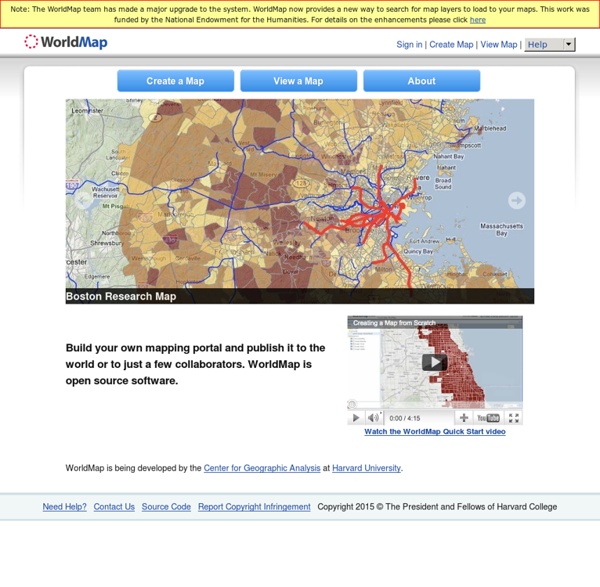
Interview with Suzanne Blier on WorldMap, Easy-to-Use GIS Suzanne Blier is Allen Whitehill Clowes Professor of Fine Arts and of African and African American Studies at Harvard University. She is an historian of African art and architecture in both the History of Art and Architecture and African and African American Studies Departments. She also is a member of the Institute for Quantitative Social Science. She is Co-Chair of an Electronic Geo-Spatial Database AfricaMap, a site that expanded into WorldMap. WorldMap is an open source GIS tool that enables anyone anywhere in the world to create their own maps and overlay them with data for free.
Turabian Style There are two common forms of citation in the Turabian Style bibliography-style (used mainly in humanities and some social sciences) reference list style (used in most social sciences and natual and physical science) The following are examples for the bibliography-style. This style requires footnotes (or endnotes) and a bibliography. The first time a source appears in a footnote, the full citation is given.
Palladio Palladio is a toolset for easy upload and careful investigation of data. It is an intertwined set of visualizations designed for complex, multi-dimensional data. It is a product of the "Networks in History" project that has its roots in another humanities research project based at Stanford: Mapping the Republic of Letters (MRofL). Gridded Population of the World - GPW v3 Introduction Note: "Gridded Population of the World, v4" is now available and supersedes GPWv3. GPWv4 provides gridded population estimates with an output resolution of 30 arc-seconds (approximately 1 km at the equator) for the years 2000, 2005, 2010, 2015, and 2020 based on the results of the 2010 round of censuses, which occurred between 2005 and 2014. For more details about GPWv4 and to access the new data see GPWv3 depicts the distribution of human population across the globe.
20 Good Map Creation Tools for Students A couple of years ago I published a list of 21 online map creation tools. Since then some of those tools have gone offline and new tools have replaced them. Here's my updated list of online map creation tools for students and teachers. Wikia Maps is a map creation tool from Wikia. spatial@ucsb - UCSB Center for Spatial Studies Making our daily environments smart through technologies has been on research and political agendas for more than three decades, with a primary interest in the outdoor environments of cities. Smart city projects are now found worldwide, focusing on sustainability, e-governance, transportation, health, etc. by deploying innovative technologies for sensing, social networking, and knowledge integration. To some extent, campuses can be seen as “small cities,” raising similar concerns for a particular kind of population. Additionally, smart campuses have their own challenges and opportunities, e.g., the support of creativity and interdisciplinary collaboration in science or the involvement of technologically savvy students. Spatial thinking and computing are thought to be key enablers for all these aspects of smart campuses, but this case needs to be made more effectively with university administrators and domain scientists.