
10 Open Source Remote Sensing Software Packages - GIS Geography. What are some open source remote sensing software packages?
There has been a big shift over the years to build software in an open, collaborative manner. This software is made available to the public and is called open source. There is no exception for open source remote sensing software. Satellite and aerial imagery provides answers for environmental change, weather forecasting, disaster management, food security and other remote sensing applications. Remote sensing software processes images and provides solutions to local or global issues. In an open source environment, useful remote sensing techniques can be performed such as filtering data, performing classification and even radar decomposition. A list of open source remote sensing software The choices for commercial remote sensing software has increased over the years.
But what you may not know is the abundance of choice for open source remote sensing software. 1 SAGA GIS: System for Automated Geoscientific Analyses 2 Opticks. 1000 GIS Applications & Uses - How GIS Is Changing the World - GIS Geography. Superpower Your Data with these 1000 GIS Applications & Uses Struggling to find GIS projects for you or your students?
Read the list. Paralyzed when someone asks what GIS can really do? Read the list. Looking to diversify your business and services? One year in the making, these are some of your favorite GIS applications you haven’t heard of yet: 10 Free GIS Data Sources: Best Global Raster and Vector Datasets - GIS Geography. In a perfect world, you’d be able to find all the free GIS data you need in a single website. Of course, it would have to be free, downloadable from an authoritative source. …But well, you know the drill. The world’s not perfect, life’s not fair. So that’s why we’ve put together this list to turbo-charge your search for free GIS data. We provide a list of 10 free, downloadable global GIS datasets from highly reputable sources. You might be interested in these useful resources for GIS data: 1 Natural Earth Data Natural Earth Data is first on the list because it does an amazing job to suit the needs of cartographers. The best part is Natural Earth Data is in public domain.
From a cartography standpoint, it’s a no-brainer. 2 USGS Earth Explorer For Earth observers seeking remotely sensed data, the USGS Earth Explorer is your sole destination. We all know that the USGS’s new Earth Explorer gives you access to one of the largest databases of satellite and aerial imagery. 3 OpenStreetMap. Lista de fontes de dados geográficos. Collaborative Mapping & Crowdsourcing - Map Makerpedia. Collaborative Mapping & Crowdsourcing Edit an articleby Rob Lemmens and The Google Map Makerpedia team In Short Learn the principles of collaborative mapping and crowdsourcing.
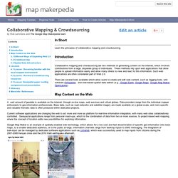
Introduction Collaborative mapping and crowdsourcing are two methods of generating content on the internet, which involves contributions from a large, disparate group of individuals. These methods rely upon web applications that allow people to upload information easily and allow many others to view and react to this information. There are several tools available which allow users to create and edit web content, such as tagging tools, wiki software (Wikipedia), and web-based spatial data editors (e.g., Google Earth, Google Maps, Google Map Maker, OpenLayers). Map Content on the Web A vast amount of geodata is available on the internet, through on-line maps, web services and virtual globes.
. © 2011 Google Different Ways of Exploiting Web 2.0 The means of publishing geo-information may differ across projects. MapGive. HOT Tasking Manager - HOT Tasking Manager About the Tasking Manager OSM Tasking Manager is a mapping tool designed and built for the Humanitarian OSM Team collaborative mapping.
The purpose of the tool is to divide up a mapping job into smaller tasks that can be completed rapidly. It shows which areas need to be mapped and which areas need the mapping validated. This approach facilitates the distribution of tasks to the various mappers in a context of emergency. Sponsorship and Funding OSM Tasking Manager was designed and built for the Humanitarian OpenStreetMap Team. With the invaluable help from: Getting Started Some resources to help you start using the Tasking Manager: Open Source OSM Tasking Manager is an open source software.Feel free to report issues and contribute. The application code is available on github. Lead developer: Pierre GIRAUD (Camptocamp) with the help of other contributors. Home. Welcome To Opticks - Opticks - Opticks Wiki. GRASS GIS - Home. Welcome to the Quantum GIS Project.