
Map Scripting 101 Examples - Map Scripting. Maps & Graphs - Nordregio. GeoCommons. Thematicmapping.org. Traffic signs and signals. About the images We have made available more than 600 traffic-sign images from those in the publication Know your traffic signs.

They are grouped in the same categories. The images are intended mainly for media professionals to reproduce in printed matter, on screen or in other media. The images are not intended for the use of traffic-sign professionals, who should refer to working drawings, chapters of the Traffic signs manual and other relevant sources on GOV.UK. Please use the images responsibly. Terms and conditions Reproducing images of traffic signs Traffic signs are Crown copyright. You may reproduce traffic-sign images free of charge and without having to seek permission, but you must reproduce them accurately and not in a misleading context (eg not on roadside billboards where they could mislead drivers).
Please read the fuller conditions in the Open Government Licence. Image details Traffic signs image details (MS Excel Spreadsheet, 204KB) Images in JPG format Images in EPS format. Mark Easton's UK: Map of the week - how longevity has moved north. Training. This site uses cookies to store information on your computer.

Some cookies on this site are essential, and the site won't work as expected without them. These cookies are set when you submit a form, login or interact with the site by doing something that goes beyond clicking on simple links. We also use some non-essential cookies to anonymously track visitors or enhance your experience of the site. If you're not happy with this, we won't set these cookies but some nice features of the site may be unavailable. The FME Evangelist » FME 2011 Special: The FeatureReader. Hi all, If you’ve used FME2011 – or attended any of our FME World Tour events – then you may have noticed a new transformer called the FeatureReader.

It’s not often a single transformer gets a whole FME Evangelist post to itself, but this remarkable piece of functionality is going to be very popular with power users, besides simple enough for anyone to understand. Ladies and gentlemen, I give you the FeatureReader! What Does it Do? Well, we like to give our FME transformers names that are self-explanatory, and it doesn’t get much simpler than this.
The FME Evangelist » FME2011 Use Case: Joiner vs FeatureMerger. Hi FME’ers, Interacting with FME users I see various points of view on the merits of the Joiner transformer versus the FeatureMerger.
Although both transformers carry out similar actions, it’s not clear to users when you should use each of these – particularly in relation to workspace performance. So this post will indulge in some investigative journalism! I’ll compare and contrast these transformers, to see where you would want to use each of them, and throw other transformers – such as the updated SQLExecutor and the new FeatureReader - into the mix as potential alternatives. Descriptions First a description. In general these transformers are used to merge features together. To do the merge requires some common information; usually a common ID number. FeatureMerger The FeatureMerger is for when both sets of data are being read in a workspace. Joiner The Joiner has only a single input port. FMEpedia - SherbendGeneralizer Examples. SherbendGeneralizer is an FME 2011 transformer for 'smarter' generalization, which preserves original topology of the features.
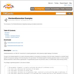
The goal of the Sherbend algorithm is to reduce unnecessary details on a line based on the analysis of the line’s bends. Sherbend is a constraint based algorithm that preserves topology of the lines and points in the input dataset. The Sherbend algorithm iteratively generalizes bends in a line by using the diameter parameter to select bends for generalization. The generalization process may eliminate, reduce, or combine bends, while resolving conflicts. The strategy for generalizing bends in a line looks as follows: * The parameter "diameter" is used to calculate the area of a reference circle. * For each line, determine the locations of the bends. * For each bend, calculate its actual area. * For each bend, calculate its circumference. Software - Products - Search Formats.
FMEpedia Home. FMEpedia - Reading Complex XML or GML using the XMLFlattener. Many users have problems reading complex XML or GML.

In the past you had to make xfMap or XQuery scripts. To address this we recently we added the concept of XML flattening to our XML and GML readers. However, sometimes you have XML elements or attributes that need to be processed within a workspace, such as the result from a URL request. For this you can use the new XMLFlattener transformer. With XMLFlattener, all you have to do is feed it XML on an attribute or from a file, specify the node you want to query, and XMLFlattener transformer will make an FME feature for each occurrence of that node in your XML and flatten all the elements nested within that node into simple FME attributes. Note that the same approach can now be used within the standard FME XML reader by using the reader parameter confguration type = 'Feature Paths' and flatten options set to enable flattening.
Note** This example requires FME 2012+ So, given the following input, xml_string = SAGA - System for Automated Geoscientific Analyses. GRASS GIS - The World Leading Free Software GIS. An ArcGIS Extension for Generating and Updating Ordinary and Multiplicatively Weighted Voronoi Diagrams for Points, Lines, and Polygons. GIS for Elections and Redistricting. Redistricting and Precinct Allocation Redrawing district and precinct lines to ensure balanced representation is a critical yet complex task.

Using GIS mapping technology, Esri data, and the latest available Census data, state and local governments can prototype multiple redistricting scenarios quickly and easily before finalizing new boundaries. Once you have the data you need for redistricting, continue to make the most of it throughout the year. With GIS you can manage and update voter data, including constituent information, and spatially analyze issues for improved decision making. Use GIS to better understand the factors at work in a region, improve collaboration, and provide optimal districts. Success Stories Technology Opens Redistricting Process, CSG Magazine, Jan. Geographic Information Systems.
Open source - Ways to load OS VectorMap data. Current community your communities Sign up or log in to customize your list. more stack exchange communities Stack Exchange sign up log in tour help Geographic Information Systems Ask Question Take the 2-minute tour × Geographic Information Systems Stack Exchange is a question and answer site for cartographers, geographers and GIS professionals.
Ways to load OS VectorMap data 5 Answers. Geospatial Analysis - Web edition. FME User Central.