

OpenLayers 2.10 Beginner's Guide. eBook: $26.99 Formats: $22.94 save 15%! Print + free eBook + free PacktLib access to the book: $71.98 Print cover: $44.99 $44.99 save 37%! Free Shipping! UK, US, Europe and selected countries in Asia. Overview Table of Contents Author Reviews Support Sample Chapters Learn how to use OpenLayers through explanation and exampleCreate dynamic web map mashups using Google Maps and other third-party APIsCustomize your map's functionality and appearanceDeploy your maps and improve page loading timesA practical beginner's guide, which also serves as a reference with the necessary screenshots and exhaustive code explanations Book Details. Comparison of JavaScript mapping libraries? Commercial APIs (Google,Bing, Yahoo) Using any commercial API leaves you at the mercy of whatever changes the provider makes to the API or Terms of Service.
What happens for example if suddenly your local government portal that uses Google Maps suddenly has adverts popping up all over it? Want to reuse your JavaScript Google Maps code for an Intranet site? You'll find yourself having to pay the $10,000 licencing fee. Microsoft often have more defined and fixed terms for their services (if paying) so there may be less of a risk here. The recent backlash against Twitter is a good example of developers having an API that changed beneath them.
IGO FRANCE.
GDAL: GDAL - Geospatial Data Abstraction Library. TileCache, from MetaCarta Labs. GeoTIFF. GeoTIFF represents an effort by over 160 different remote sensing, GIS, cartographic, and surveying related companies and organizations to establish a TIFF based interchange format for georeferenced raster imagery.
Information and Support[edit] ¶ GeoTIFF Revision 1.0 Specification: This is the official release version of the GeoTIFF spec. . : Primary GeoTIFF web site (this page). GeoTIFF-JAI and Extensible-TIFF-JAI: Niles Ritters projects for a Java GeoTIFF API libgeotiff[edit] ¶ Libgeotiff is an open source library normally hosted on top of libtiff for reading, and writing GeoTIFF information tags. Libgeotiff API: Partial documentation. GeoTIFF Mailing List[edit] ¶ A mailing list is currently active to discuss the on-going development of this standard, and the libgeotiff support library. The GeoTIFF mailing list is also available by NNTP at Comments? Bug Tracking[edit] ¶ Tickets can be filed for libgeotiff, the geotiff web pages or problems with the specification.
Geospatial Solutions - Camptocamp. Actuellement, 80% de l’information possède une composante géographique ou spatiale.
GeoTIFF. An alternative to the "inlined" TIFF geospatial metadata is the *.tfw World File sidecar file format which may sit in the same folder as the regular TIFF file to provide very similar functionality to the standard GeoTIFF described here.
History[edit] The GeoTIFF format was originally created by Dr. Niles Ritter while he was working at the NASA Jet Propulsion Laboratory.[2] ReadyMap - web mapping made easy - 3D WebGL globes. MS4W.MapTools.org. Welcome to MS4W, the no fuss installer for setting up MapServer on Microsoft Windows platforms.
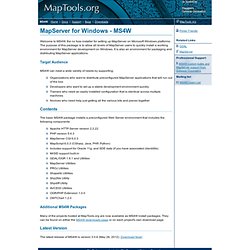
The purpose of this package is to allow all levels of MapServer users to quickly install a working environment for MapServer development on Windows. MVC simple application example called CF (Cartography Framework) Spatial Networks.
OGC Specifications. Esri - GIS Mapping Software, Solutions, Services, Map Apps, and Data. Esri. For the Irish think tank, see Economic and Social Research Institute.
Esri /ˈɛzriː/ is an international supplier of Geographic Information System (GIS) software, web GIS and geodatabase management applications. The company is headquartered in Redlands, California. The company was founded as Environmental Systems Research Institute in 1969 as a land-use consulting firm. Esri products (particularly ArcGIS Desktop) have 40.7% of the global market share.[2] In 2002, Esri had approximately a 30 percent share of the GIS software market worldwide, more than any other vendor.[3] Other sources estimate that about 70 percent of the current GIS users make use of Esri products.[4] The company has 10 regional offices in the U.S. and a network of 80 international distributors, with about a million users in 200 countries.
The company hosts an annual International User's Conference, which was first held on the Redlands campus in 1981 with 16 attendees. ArcGIS. Esri's ArcGIS is a geographic information system (GIS) for working with maps and geographic information.
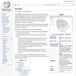
It is used for: creating and using maps; compiling geographic data; analyzing mapped information; sharing and discovering geographic information; using maps and geographic information in a range of applications; and managing geographic information in a database. The system provides an infrastructure for making maps and geographic information available throughout an organization, across a community, and openly on the Web. ArcGIS includes the following Windows desktop software: There are also server-based ArcGIS products, as well as ArcGIS products for PDAs. Extensions can be purchased separately to increase the functionality of ArcGIS. Product history[edit] Prior to the ArcGIS suite, Esri had focused its software development on the command line Arc/INFO workstation program and several Graphical User Interface-based products such as the ArcView GIS 3.x desktop program.