
DM. World-Historical Gazetteer – A project of the World History Center at the University of Pittsburgh. Pleiades.stoa.org. Linking the places of our past. Home - Omeka Classic User Manual. This user manual is for the current version of Omeka Classic.
Getting StartedPlanning your Omeka site, examples and case studies, hosting suggestions, and our Accessibility Statement. Installing Information for installing and upgrading an Omeka Classic installation. Sites – Humanities Commons. Annotating Relations. The Relations tool enables you to draw connections between annotations in a text, and tag the connection in order to make a statement about its type.
How to Use the Relations Tool Switch to Relations annotation mode in the toolbar. To start a connection, click on an annotation once (or click and hold if your prefer). Venice Time Machine. MapAnalyst. EADH - The European Association for Digital Humanities.
Old Maps Online. Palladio. Palladio is a toolset for easy upload and careful investigation of data.
It is an intertwined set of visualizations designed for complex, multi-dimensional data. It is a product of the "Networks in History" project that has its roots in another humanities research project based at Stanford: Mapping the Republic of Letters (MRofL). MRofL produced a number of unique visualizations tied to individual case studies and specific research questions. You can see the tools on this site and read about the case studies at republicofletters.stanford.edu. With "Networks in History" we are taking the insights gained and lessons learned from MRofL and applying them to a set of visualizations that reflect humanistic thinking about data. Akteurszentrierte Darstellung und Analyse sozialer Netzwerke. Gephi - The Open Graph Viz Platform. Historical Network Research.
1) Start with some introductory texts on Social Network Analysis Among the general HNR articles in the Bibliography, Scott Weingart’s blog post series “Networks Demystified” and Claire Lemercier’s article “Formal network methods in history” are particularly useful to get you ideas.
To get a first idea of Social Network Analysis terminology and concepts, you may find this Cheat Sheet helpful. A great resource which will help you understand what you can expect from Social Network Analysis is Valdis Krebs’ Network Discovery Matrix. 2) Find answers to these questions: 1. The “Should I do Social Network Analysis?” If you are already working with network visualisations, take a look at Yannick Rochat’s blog post on best practices: Visualizing Historical Networks. MORE INFORMATION ON HOW TO USE GEPHIThose new to Gephi might consider reviewing the online tutorials.
These provide a brief introduction to the program's capabilities. Information about importing geographic coordinate data can be found here. Our own data is available on .csv files and can be imported to Gephi for use in your own explorations. Instructions on importing can be found here. Welcome! - WorldMap. Exploring Big Historical Data: The Historian's Macroscope. Welcome to the companion site for Exploring Big Historical Data: The Historian’s Macroscope, published by Imperial College Press.
If you want to buy a copy, you can purchase one for $39.00 USD. Feel free to visit our original live-written fully open draft website, which is still online – and if you like what you see, you can always buy the book! On this site you will find code, essays (things we liked from the draft that did not fit), and datafiles that go with our book. The first draft’s interactive visualizations can be found here. HyperCities: Thick mapping in the digital humanities. Debates in the Digital Humanities. What is the Spatial Turn? · Spatial Humanities. “Landscape turns” and “spatial turns” are referred to throughout the academic disciplines, often with reference to GIS and the neogeography revolution that puts mapping within the grasp of every high-school student.
By “turning” we propose a backwards glance at the reasons why travelers from so many disciplines came to be here, fixated upon landscape, together. For the broader questions of landscape – worldview, palimpsest, the commons and community, panopticism and territoriality — are older than GIS, their stories rooted in the foundations of the modern disciplines. These terms have their origin in a historic conversation about land use and agency. Read the Introduction. About the Author. Concepts, Methods, and Tutorials for Students and Instructors. About the Programming Historian. Cheat Sheet: Social Network Analysis for Humanists. Spatial Humanities. This five-year project runs from 2012-16 and is funded by the European Research Council under a Starting Researcher Grant.
Our aim is to create a step-change in how place, space and geography are explored in the Humanities. Building on Lancaster University’s technical expertise in Digital Humanities, Corpus Linguistics and Geospatial Analysis, as well as its applied expertise in the history of the English Lake District, we are developing and applying methodologies for analysing unstructured texts—including large corpora of historical books, periodicals and official reports—within a Geographic Information Systems (or GIS) environment.
YouTube - Broadcast Yourself. The Association for Computers and the Humanities. An EPFL course by Isabella di Lenardo and Frederic Kaplan. Exploring Space-Time in Medieval Literary Texts. Charter Excavator. Home. Digital Medievalist. Hypercities. Forum: The Status Quo of Digital Humanities in Europe. In October and November 2014, H-Soz-Kult publishes a series of essays on "The Status Quo of Digital Humanities in Europe".
Please find the published texts of this essay series here: Editorial Editorial: The Status Quo of Digital Humanities in Europeby Torsten Kahlert and Claudia Prinz, Humboldt-University of Berlin The Status Quo of Digital Humanities in Sweden: Past, Present and Future of Digital Historyby Thomas Nygren, HUMlab, Umeå University, Department of Education, Uppsala University and Department of History, Stanford University; Anna Foka, HUMlab, Umeå University; Philip I. Buckland, Department of Historical, Philosophical & Religious Studies, Umeå University. CITTÀ NOBILISSIMA - Topography and Representation.
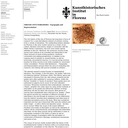
FIRENZE CITTÀ NOBILISSIMA - Topography and Representation Jan Simane, Costanza Caraffa, Laura Cirri, Verena Gebhard, Stephanie Hanke, Lisa Hanstein, Alexander Auf der Heyde, Thomas Frangenberg The rich history of the city of Florence has long been a focus of research for a vast international network of scholars coming from a variety of disciplines.
Visu beta. Open HGIS Lessons and Resources. Home. OpenATLAS is a database application for the work with archeological, historical and spatial data. The developement is currently at an early stage and carried out by a small team from the University of Vienna. Its main features will be: Open source, cost-free, easy to install/use. Centre for Digital Humanities is a collaboration between the University of Amsterdam, the VU University of Amsterdam and the Royal Academy of Arts and Sciences (KNAW) in the area of digital humanities. About the History Data Service. UK Data Archive - HOME. What is the Spatial Turn? · Spatial Humanities. What is a turn? 2013.
Managing 100 Digital Humanities Projects: Digital Scholarship & Archiving in King’s Digital Lab James Smithies, King's College London; Carina Westling, King's College London; Anna-Maria Sichani, King's College London; Pam Mellen, King's College London; Arianna Ciula, King's College London Modelling Medieval Hands: Practical OCR for Caroline Minuscule Brandon W. Hawk, Rhode Island College; Antonia Karaisl, Rescribe Ltd; Nick White, Rescribe Ltd Towards 3D Scholarly Editions: The Battle of Mount Street Bridge Costas Papadopoulos, Maastricht University; Susan Schreibman, Maastricht University Music Scholarship Online (MuSO): A Research Environment for a More Democratic Digital Musicology.
Hypercities Earth. Journal for Early Modern Cultural Studies - DECIMA: The Digitally Encoded Census Information and Mapping Archive, and the Project for a Geo-Spatial and Sensory Digital Map of Renaissance Florence. Find using OpenURL DECIMA: The Digitally Encoded Census Information and Mapping Archive, and the Project for a Geo-Spatial and Sensory Digital Map of Renaissance Florence In lieu of an abstract, here is a brief excerpt of the content: A project at the University of Toronto, with funding from the Social Sciences and Humanities Research Council of Canada (SSHRCC), is developing a mapping tool that will allow for the spatial organization of early modern historical, cultural, and sensory materials. Called the Digitally Encoded Census Information and Mapping Archive (DECIMA), it uses Geographic Information Systems (GIS) software to map, house by house, a 1561-62 Florentine tax census onto one of the best city maps produced in the sixteenth century.
Hypercities. Early medieval mapping.