
Open Geospatial Consortium. OGC Standards. United Nations Initiative on Global Geospatial Information Management. Geospatial Metadata — Federal Geographic Data Committee. An Overview of Spatial Data Protocols for HIV/AIDS Activities: Why and How to Include the “Where” in Your Data. MS-11-41A.pdf — PDF document, 4,558 kB (4,668,266 bytes) Author(s): Year: 2011 Abstract: This guide focuses on data and how to use geography to facilitate linkages among data.
It presents an overview of the ways to structure HIV activities data to take maximum advantage of existing geographic data, or to facilitate future inclusion of the geographic context of data being gathered. This document is not available in print from MEASURE Evaluation. Geoplatform.gov: The National Geospatial Platform Initiative. Health Information Privacy. GeoTools The Open Source Java GIS Toolkit — GeoTools. SAR7.pdf. Ensuring Confidentiality of Geocoded Health Data: Assessing Geographic Masking Strategies for Individual-Level Data. Mapping Health Data: Improved Privacy Protection With Donut Method Geomasking. *Correspondence to Dr.
William C. Miller, The University of North Carolina at Chapel Hill, School of Medicine, Division of Infectious Diseases, CB #7030, Chapel Hill, NC 27599-7030 (e-mail: bill_miller@unc.edu). Received January 29, 2010. Accepted July 6, 2010. A major challenge in mapping health data is protecting patient privacy while maintaining the spatial resolution necessary for spatial surveillance and outbreak identification. American Journal of Epidemiology © The Author 2010. Geomask help.pdf. Pap3012.pdf. About AAG's Initiative for an NIH-wide GIS Infrastructure. By Doug Richardson Below is a column that originally appeared in the AAG Newsletter (Volume 47, Number 3, March 2011).
The author is the Executive Director of the AAG. The AAG has been working with the National Institutes of Health (NIH) for nearly a decade now, and I have discussed some of these collaborations previously in this column. Two years ago, the AAG began building on the foundation of these previous projects* and relationships with a new initiative, called the AAG Initiative for an NIH-Wide GIS Infrastructure. This column describes this AAG Initiative and a significant jointly-sponsored AAG-NIH Workshop held in February, 2011, which has resulted from this work.
The AAG Initiative. GeoPlatform. Federal agencies and their partners collect and manage large amounts of place-based (geospatial) data – but it is often not easily found when needed, and sometimes data is collected or purchased multiple times.
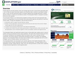
In short, the best government data is not always organized and managed efficiently to support decision making in a timely and cost effective manner. The Geospatial Platform is designed to provide that service and capability. The Geospatial Platform is an Internet-based capability providing shared and trusted geospatial data, services, and applications for use by the public and by government agencies and partners to meet their mission needs. Through the Geoplatform, users will have access to: The Geospatial Platform will significantly expand access to high quality data; enabling users to improve problem solving and streamline mission critical operations. Geospatial Metadata Standards — Federal Geographic Data Committee.
Geospatial Metadata Standards and Guidelines When metadata records are formatted to a common standard, it facilitates the location and readability of the metadata by both humans and machines.
NSDI Stakeholders have long utilized the Content Standard for Digital Geospatial Metadata (CSDGM). However, Circular A-119 Revised directs agencies to use voluntary consensus standards in lieu of government-unique standards. Furthermore, Circular A-16 promotes the use of international standards to advance the building of the Global Spatial Data Infrastructure (GSDI). Several ISO metadata standards are now endorsed by the FGDC and federal agencies and NSDI Stakeholders are encouraged to make the transition to ISO metadata. Spatial-data-standards.pdf. ColorBrewer: Color Advice for Maps.
ISO 3166. Parts[edit] It consists of three parts:[1] ISO 3166-1, Codes for the representation of names of countries and their subdivisions – Part 1: Country codes, defines codes for the names of countries, dependent territories, and special areas of geographical interest.
Editions[edit] The first edition of ISO 3166 was published in 1974, which included only alphabetic country codes. The second edition, published in 1981, also included numeric country codes, with the third and fourth editions published in 1988 and 1993 respectively. ISO 3166 Maintenance Agency[edit] The ISO 3166 standard is maintained by the ISO 3166 Maintenance Agency (ISO 3166/MA), located at the ISO central office in Geneva, Switzerland. Members[edit] There are ten experts with voting rights on the ISO 3166/MA.[4] Five are representatives of national standards organizations:
Competency Model Clearinghouse - Geospatial Technology Industry Competency Model. ArcGIS Help 10.1. Ordnance Survey geospatial standards policy. This policy is concerned with standards that relate to our core business of collecting, maintaining, managing and distributing geospatial data.
It is not concerned with standards that relate to our operation as a business; for example, financial, procurement or health and safety standards. Generally it will be concerned with standards that are specific to our geospatial business but may also, where necessary, include more general standards related to the capture, management, maintenance and dissemination of data. Throughout, definitions from the UK Government Open Standards Principles are used. National Mapping Authority Perspective - International Geospatial Standards.pdf.