Annenberg Media Exhibits: Collapse
Hundreds of years ago in what is now modern Honduras, Copán was a thriving civilization, a center of the cultural life of the Maya. Tens of thousands of people made their home in the Copán Valley. Yet despite its importance, Copán went into decline. Across the vast territory of the ancient Maya, other important sites were sharing a similar fate.
Collapse: Why do civilisations fall?
Hundreds of years ago in what is now modern Honduras, Copán was a thriving civilization, a center of the cultural life of the Maya. Tens of thousands of people made their home in the Copán Valley. Yet despite its importance, Copán went into decline. Across the vast territory of the ancient Maya, other important sites were sharing a similar fate. Classic Maya civilization was collapsing.
Maps and Mapmakers: Seeing What's on the Map - Teachers & Students (myLOC.gov)
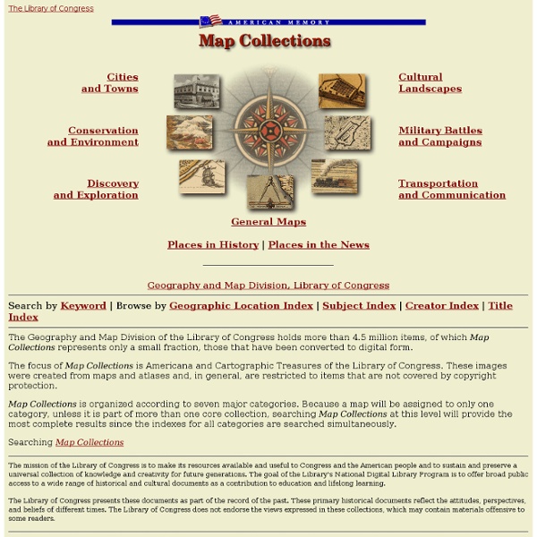
The Library of Congress offers classroom materials and professional development to help teachers effectively use primary sources from the Library's vast digital collections in their teaching. Find Library of Congress lesson plans and more that meet Common Core standards, state content standards, and the standards of national organizations. Discover and discuss ways to bring the power of Library of Congress primary sources into the classroom. Go to the blog Subscribe to the blog via e-mail or RSS. Using Primary Sources
Maps ETC
Welcome to ETC's collection of historic maps. Here you will find over 5,000 maps representing many different time periods. A friendly license allows teachers and students to use up to 25 maps in non-commercial school projects without further permission. All maps are available as GIF or JPEG files for screen display as well as in PDF for printing. Use the GIF or JPEG maps for classroom presentations and student websites.
ChronoZoom
ChronoZoom is an educational tool for teachers and students who want to put historical events in perspective. A great many resources have been created already in ChronoZoom for your enjoyment and enlightenment. Start Exploring
Handy Man - Tools - Early Humans for Kids
Early man did not have sharp claws or strong sharp teeth. He was not larger or stronger than other animals. He could not run like deer or antelope. So how did early man survive? He had to use the things that animals did not have, reason and invention.
Review Game
The Instant Jeopardy Review Game has been designed and dramatically improved to make it the perfect review game for a wide variety of classroom uses. This tool is a fun and interactive way to review content in your classroom, meeting, conference, or other group setting. The new and improved version of the Jeopardy Review Game includes the following features: Simple insertion of pictures on Question and/or Answer slides Full support for symbols, such as exponents and wingdings style fonts Better support for foreign language Question and/or Answer slides Simpler visual editing process Embed anything in your question slides, even Youtube videos, flash objects, etc. Simple scorekeeping system Works on portable devices such as smartphones, iPad, and iPod Touch!
History Map Archive
Browse the Map Archive The art and history of cartography, aka mapmaking, goes back to ancient times. Or at least what they thought it could look like. Our English word map derives from the Latin word mappa, meaning napkin or cloth on which maps were drawn.
Magna Carta: Cornerstone of the U.S. Constitution
At the death of his brother, Richard the Lionhearted, John assumed the throne of England, intent on exercising power to achieve his own selfish ends. To fund military campaigns in France, he extracted exorbitant fees from nobles, who, in turn, raised the rents imposed on their tenants. At the same time, John reduced the lords' customary powers over those tenants, restricting, for example, their power to hold court for those living on their feudal lands. He attempted to influence church elections and confiscated church properties, alienating the powerful ecclesiastical establishment and depriving the poor of the only source of relief available to paupers. He restricted trading privileges traditionally granted to London's merchants and increased their taxes, alienating this constituency as well. King John's tyrannical practices extended to demanding sexual favors from the wives and daughters of his barons and to imposing brutal punishments on individuals who challenged his authority.
Hypogeum of Ħal-Saflieni
The Hypogeum of Paola, Malta, (Ipoġew in Maltese) literally meaning "underground" in Greek, is a subterranean structure dating to the Saflieni phase (3000-2500 BC) in Maltese prehistory. Thought to have been originally a sanctuary, it became a necropolis in prehistoric times and the remains of more than 7,000 individuals have been found. It is the only known prehistoric underground temple in the world. The Hypogeum was depicted on a 2 cents 5 mils stamp issued in the Maltese Islands in 1980 to commemorate the acceptance by UNESCO of this unique structure in the World Heritage Site list. It was closed to visitors between 1992 and 1996 for restoration works; since it reopened only 60 people per day are allowed entry. It was discovered by accident in 1902 when workers cutting cisterns for a new housing development broke through its roof.
Pictogram Graph Creator
x About A simple pictograph creator. Click on the graph to update the values
stle Builder
Image Copyright 1995 by Educational Management Group, Inc. During the Medieval era of history, life was lived by a very different set of political, economic, and social rules. The only form of government was a Monarchy where the king or queen ruled by "divine right." "Divine right" simply meant that God appointed the king or queen to rule with absolute power. The main economic system was Feudalism in which the king appointed a baron or knight to oversee a portion of his land in return for loyalty and protection in case of invasion.
The Other Mystery of Easter Island
Moai statues Easter Island is branded into popular consciousness as the home of the mysterious and towering moai statues, but these are not the only curiosity the South Pacific island holds. Where the moai are fascinating for their unknown purpose and mysterious craftsmen, the island's lost language of Rongorongo is equally perplexing. The unique written language seems to have appeared suddenly in the 1700s, but within just two centuries it was exiled to obscurity.
Socrative
Age Restrictions. You may only use the Site and Services if you are: (i) at least 13 years of age; or (ii) if you are under 13 years of age, with the consent of your teacher or a legal parent or guardian. By using the Site and Services, you hereby represent and warrant that you are at least 13 years of age or, if you are under 13 years of age, that you have the consent of your teacher, legal parent, or guardian to use the Site and Services. Verification of Identity.