

Technical Details. Geospatial Web Services, Open Standards, and Advances in Interoperability: A Selected, Annotated Bibliography</span></p> Abstract: This paper is designed to help GIS librarians and information specialists follow developments in the emerging field of geospatial Web services (GWS).
When built using open standards, GWS permits users to dynamically access, exchange, deliver, and process geospatial data and products on the World Wide Web, no matter what platform or protocol is used. Standards/specifications pertaining to geospatial ontologies, geospatial Web services and interoperability are discussed in this bibliography. Finally, a selected, annotated list of bibliographic references by experts in the field is presented. Keywords:Web services, geospatial data, data processing, spatial data infrastructures, metadata, ontology, interoperability, geoinformatics, grid computing 5. In the last few years, the fields of geospatial visualization of and geoprocessing have grown dramatically because of: Most of the resources selected for this annotated bibliography have been published within the last three years.
Puzzle : GIS Application & Development platform. RosettaCodeData/Task/Haversine-formula/Java/haversine-formula.java at master · acmeism/RosettaCodeData. SECONDO - An Extensible Database System. -Preface. An Introduction to Atmospheric and Oceanographic Datasets The purpose of this NCAR Instructional Aid (IA) is to serve as a ``data-primer'' for students and those in other fields of research who are interested in carrying out research involving the analyses of data in the atmospheric and oceanographic sciences.
This IA will describe, in very general terms, the datasets most commonly used to study the atmosphere-ocean system and the formats used for archival. The datasets include observations from conventional meteorological sources such as stations and ships, from satellites, and analyzed grids produced at operational weather forecast centers. Detailed descriptions of instruments, methodologies and relative quality is not attempted.
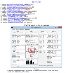
Rather, the focus is upon the broad characteristics of the data sources and the datasets. Atmospheric and oceanographic data are generally archived at data archiving and distribution centers. Acknowledgments Comments, Suggestions, Errors Availability of TN-404. NMEA monitor for windows,WiFFF2ns1,NMEA2KMZ,NMEA Generator,MtkDLut,Geoid correction. NMEA Monitor for windows.
GeoTools The Open Source Java GIS Toolkit — GeoTools. And GIS, Part 1: Intro to GIS. If you've been paying attention to the recent groundswell, chances are that you've heard the terms GIS, geospatial, GPS, and a host of other acronyms being thrown around.
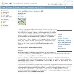
But do you really understand what they mean -- the types of applications that use this stuff, and what it means to the way we look at our development? Naturally, neither of us did at first, but we've been working (well actually, mostly playing) in this space for a couple of years now, and have only recently realized the huge potential it presents us as Java programmers.
This series will serve a couple of purposes: Part 1 will get you up to speed on what all this GIS stuff means, explaining some of the terminology and how it relates to what we build. Part 2 will talk about some of the open source geospatial systems and how the pieces fit together, and Part 3 will be a walkthrough of putting together a Mobile-GIS-enabled application. Sound like fun? GIS Basics Let's start with the basics. Map This! Figure 1. Figure 2.
ESRI. Neo4j - The World's Leading Graph Database. Conservation Gateway. Page Content The Nature Conservancy is committed to making it easy to find current data about our conservation work and tools that help support that work.
Tools: From models, to online databases, to GIS software, our library of conservation tools and resources has something for everyone. There are many different kinds of tools and resources here, but in general they all help users develop, manage, analyze, use, and publish conservation information. Core Data: For information about key conservation data sets. The Atlas of Global Conservation: The Atlas of Global Conservation gives us the most comprehensive look at our planet today. Free OpenSceneGraph Binary Downloads.