

GeoSpatial Training Services – Español -Cursos GIS y Master GIS Algunos de mis blogs de GIS favoritos - Geospatial Training. Tengo aparcado este post desde el primer día que empecé a escribir.
Todos los manuales para blogueros te recomiendan empezar por aquí pero me daba cierta pereza escribirlo En mi caso, los blogs que voy a incluir no tienen por qué ser los más leídos ni tampoco los más visitados pero a mí, para cada uno en particular, se me ocurren varios motivos para mencionarlos. Además, no todos los que menciono están actualmente activos o tienen temática 100 % GIS pero sus autores merecen una especial mención. 1. Lesson: PostGIS Setup — The Free Quantum GIS Training Manual 1.0 documentation. Setting up PostGIS functions will allow you to access spatial functions from within PostgreSQL.
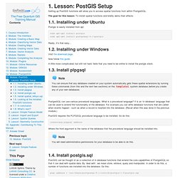
The goal for this lesson: To install spatial functions and briefly demo their effects. 1.1. Installing under Ubuntu Postgis is easily installed from apt. sudo apt-get install postgis sudo apt-get install postgresql-9.1-postgis Really, it’s that easy... Www.giscience.it/it/pdf/DissertationMscComputerScience_CrestazEzio_Supervisors.pdf. EPSG.io: Coordinate Systems Worldwide. 4. Lesson: Spatial Statistics — The Free Quantum GIS Training Manual 1.0 documentation. Note Lesson developed by Linfiniti and S Motala (Cape Peninsula University of Technology) Spatial statistics allow you to analyze and understand what is going on in a given vector dataset.
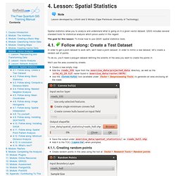
QGIS includes several standard tools for statistical analysis which prove useful in this regard. The goal for this lesson: To know how to use QGIS’ spatial statistics tools. Follow along: Create a Test Dataset In order to get a point dataset to work with, we’ll need a point dataset. To do so, you’ll need a polygon dataset defining the extents of the area you want to create the points in. We’ll use the area covered by streets. Create a new empty map.Add the roads_33S layer from the exercise_data/projected_data directory, as well as the srtm_41_19.tif raster found in exercise_data/raster/SRTM/.Use the Convex hull(s) tool (available under ) to generate an area enclosing all the roads: PyQGIS Programmer's Guide - Locate Press. Manual de ArcGIS 10 en Español PDF. Downloads - Duane Wilkins. Presentado el Informe SIG Libre 2014, de la OSGEO. En la ponencia de clausura de las 8ª Jornadas de SIG Libre, celebradas en Girona (España) del 26 al 28 de marzo de 2014 se presentó el documento Panorama SIG Libre 2014, elaborado por miembros del Capítulo Local de la comunidad hispanohablante de la Open Source Geospatial Foundation, OSGEO.
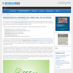
El informe analiza la situación de soluciones SIG basadas en software libre, dividiéndolas en 6 apartados: Servidores (GeoServer, GeoNetwork, 52 North...)Bases de datos (MySQL Spatial, PostGIS, Spatialite, H2GIS)Librerias (GDAL/OGR, GeoTools, Mapnik...)Web Mapping (OpenLayers, Leaflet, GeoExt...)Clientes (gvSIG, QGIS, Udig...)Dispositivos móviles (Mapsforge, OsmAnd, OSMDroid...) Scribd. Installation. Matplotlib compiled fine, but nothing shows up when I use it The first thing to try is a clean install and see if that helps.
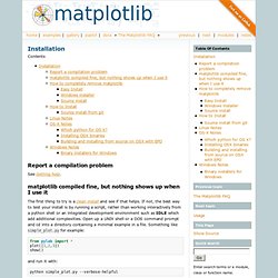
If not, the best way to test your install is by running a script, rather than working interactively from a python shell or an integrated development environment such as IDLE which add additional complexities. Galería de Google Maps. 3.2.3 Retrieving records using an attribute query. Printer-friendly version The previous examples used the SearchCursor object to read through each record in a dataset.
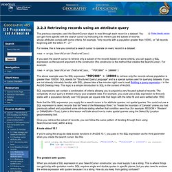
You can get more specific with the search cursor by instructing it to retrieve just the subset of records whose attributes comply with some criteria, for example, "only records with a population greater than 10000,, or "all records beginning with the letters P – Z. " For review, this is how you construct a search cursor to operate on every record in a dataset: rows = arcpy.SearchCursor(featureClass) If you want the search cursor to retrieve only a subset of the records based on some criteria, you can supply a SQL expression as the second argument in the constructor (the constructor is the method that creates the SearchCursor). Rows = arcpy.SearchCursor(featureClass, '"POP2008" > 100000') The above example uses the SQL expression "POP2008" > 100000 to retrieve only the records whose population is greater than 100000.
Oa.upm.es/5816/1/PFC_ELENA_HERRERO_RODRIGUEZ.pdf. Www.ibcperu.org/doc/isis/10515.pdf. Www.uv.es/cuadernosgeo/CG69_70_215_230. Formación Ambiental – Taller SIG – ARCGIS: Corredores ecológicos y conectividad de especies mediante tecnología SIG. Formación online en abierto.
Matricúlate y a partir de la confirmación del alta en el curso tendrás 7 días para realizarlo, sin fechas ni horarios. Infórmese de la posibilidad de impartirlo mediante Formación In Company y Formación a Distancia, a medida del cliente y del alumno. Cualquier licenciatura, ingeniería o diplomatura de la rama ambiental, la conservación y la gestión del medio ambiente. 14 horas (1 semana). En este Taller SIG de ARCGIS: Corredores ecológicos y conectividad de especies mediante tecnología SIG, estudiaremos como la fragmentación del entorno natural y los hábitats que lo componen, son uno de los principales motivos de pérdida de biodiversidad y deterioro del medio ambiente.
El aumento de la superficie y límites de los entornos naturales que utilizan las especies, genera una mayor exposición del hábitat en el que se encuentran, por lo que están sometidos a una mayor diversidad de factores, ya sean naturales o antrópicos. Application - Python Plugin Repositories. Sign in Search: QGIS » QGIS Application Wiki Start pageIndex by titleIndex by date History Python Plugins Repositories¶ QGIS New Official Repository: -> NOTE: always add ?
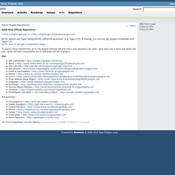
To search these repositories, go to the plugins settings tab and add a new repository for each - give each one a name and paste the URL. Old: Not working? Www.columbia.edu/~cjd11/charles_dimaggio/DIRE/resources/spatialEpiBook.pdf.
Erakundeak.