

GIS Glossary - GIS Wiki. From Wiki.GIS.com abbreviation A shortened form of a word or phrase which represents the whole.
Abbreviations are commonly a letter or group of letters taken from the complete form of the word, such as the usage of St. in place of Street. Abbreviation Dictionary In Maplex for ArcGIS, a file that contains whole words and their abbreviated forms to allow automated shortening of labels. abscissa In a rectangular coordinate system, the distance of the x-coordinate along a horizontal axis from the vertical or y-axis. Absolute accuracy The degree to which the position of an object on a map conforms to its correct location on the earth according to an accepted coordinate system. absolute coordinates Coordinates that are referenced to the origin of a given coordinate system. absolute mode A way of using a digitizing tablet in which locations on the tablet are mapped to specific locations on the screen.
Absolutely constrained adjustment absorption abstract class abstraction access control list access key add-in. A - GIS Dictionary. Map projection. More generally, the surfaces of planetary bodies can be mapped even if they are too irregular to be modeled well with a sphere or ellipsoid; see below.
Even more generally, projections are the subject of several pure mathematical fields, including differential geometry and projective geometry. However "map projection" refers specifically to a cartographic projection. Background[edit] Maps can be more useful than globes in many situations: they are more compact and easier to store; they readily accommodate an enormous range of scales; they are viewed easily on computer displays; they can facilitate measuring properties of the terrain being mapped; they can show larger portions of the Earth's surface at once; and they are cheaper to produce and transport. These useful traits of maps motivate the development of map projections. However, Carl Friedrich Gauss's Theorema Egregium proved that a sphere's surface cannot be represented on a plane without distortion.
Metric properties of maps[edit] Diving Into GIS: A Starter Guide. The premise of a GIS is this: You take a basemap with features to help you visualize the geographic location, then add data layers, called "Feature Layers," that are delivered from a database.

The records in the database include values and labels, as well as fields with X and Y values to geospatially tie the data into the map. More elaborate geospatial tie-ins are created with "Shapefiles. " Hidden fields can be used too. If you were looking at television weather maps during last week's U.S. tornado activity, you were looking at a GIS, or Geographic Information System. Those red and purple splotches racing across the screen represented intensity levels of rotating storm cells.
GIS is a system for capturing, storing, manipulating, analyzing, organizing, and displaying data as it pertains to a geographic area. Feature Layers. Basic Uses of GIS. Guest GIS Contributor Justine Nofal writes about some of the basic types of spatial analysis using GIS.
A GIS (geographic or geospatial information system) allows you to record a base map with a geospatial referencing system such as longitude or latitude and then to add additional layers of other information. Importantly that information is identified using the same geospatial referencing. The GIS then allows the individual layers, or themes as they are called to be linked. Analysis of the information can then be undertaken using the statistical and analytical tools that are provided as part of the GIS.
By providing spatial analysis of suitably coded data it is possible to provide striking, visual representations of data. Visual representations of this type can also be extended further so that more considered and objective means of measurement are applied. GIS - Stack Exchange. If I Were a Small City GIS Manager. By Adam Lodge on January 03, 2012 If I were a small city GIS manager ...I would deploy significant portions of the City's GIS infrastructure using free and Open Source technology.
Why?... Why not? It's free to procure and provides top notch capabilities. Database: The database would be PostgreSQL with PostGIS. Desktop: GPS eXchange Format. GPX, or GPS eXchange Format is an XML schema designed as a common GPS data format for software applications.
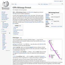
It can be used to describe waypoints, tracks, and routes. The format is open and can be used without the need to pay license fees. Its tags store location, elevation, and time and can in this way be used to interchange data between GPS devices and software packages. Such computer programs allow users, for example, to view their tracks, project their tracks on satellite images or other maps, annotate maps, and tag photographs with the geolocation in the Exif metadata. Data types[edit] This is the essential data contained in GPX files. WpType: lat="DD.thm... " lon="DDD.thm... " plus other data: is the WGS 84 (GPS) coordinates of a point and other description. <wpt> wptType </wpt> is an individual waypoint among a collection of points with no sequential relationship, despite the name (the county towns of England, say, or all Skyscrapers in New York).
<trk><trkseg><trkpt wpType />...