Banaue Rice Terraces. Banaue Rice Terraces Locals to this day still plant rice and vegetables on the terraces, although more and more younger Ifugaos do not find farming appealing, often opting for the more lucrative hospitality industry generated by the terraces[citation needed].
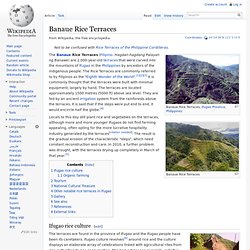
The result is the gradual erosion of the characteristic "steps", which need constant reconstruction and care. In 2010, a further problem was drought, with the terraces drying up completely in March of that year.[5] Ifugao rice culture[edit] Chocolate Hills. The Chocolate Hills is a geological formation in Bohol Province, Philippines.[1] There are at least 1,260 hills but there may be as many as 1,776 hills spread over an area of more than 50 square kilometres (20 sq mi).[2] They are covered in green grass that turns brown (like chocolate) during the dry season, hence the name.
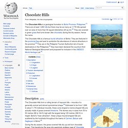
The Chocolate Hills is a famous tourist attraction of Bohol. Hundred Islands National Park. The Hundred Islands National Park (Pangasinan: Kapulo-puloan or Taytay-Bakes) is a national park in the Republic of the Philippines.
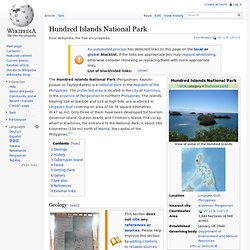
The protected area is located in the city of Alaminos, in the province of Pangasinan in northern Philippines. The islands, totaling 124 at low tide and 123 at high tide, are scattered in Lingayen Gulf covering an area of 16.76 square kilometres (6.47 sq mi). Only three of them have been developed for tourism: Governor Island, Quezon Island, and Children's Island. Sinking cemetery: Camiguin. Camiguin (Tagalog pronunciation: [kamiˈɡin], (Cebuano: Lalawigan sa Camiguin), (Tagalog: Lalawigan ng Camiguin) is an island province of the Philippines located in the Bohol Sea, about 10 kilometres (6.2 mi) off the northern coast of Mindanao.
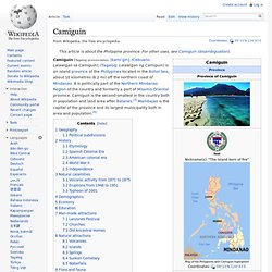
It is politically part of the Northern Mindanao Region of the country and formerly a part of Misamis Oriental province. Camiguin is the second-smallest in the country both in population and land area after Batanes.[3] Mambajao is the capital of the province and its largest municipality both in area and population.[4] Geography[edit] The province consists primarily of Camiguin Island, as well as a few other surrounding minor islets including: Camiguin Island is a pearl-shaped island with an area of approximately 238 km2 (92 sq mi).[3] The island measures about 23 kilometres (14 mi) at its longest and 14.5 kilometres (9.0 mi) at its widest breadth.[5] The island is mountainous with the highest elevation reaching over 5,000 ft (1,500 m).
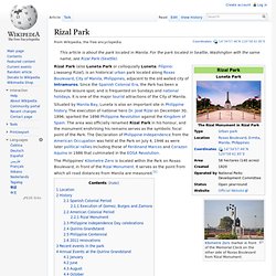
History[edit] Maria Cristina Falls. Rizal Park. Kilometre Zero marker in front of the Memorial Clock on the other side of Roxas Boulevard from Rizal Monument.
Mayon Volcano. Local Philippine folklore refers to the volcano as Bulkang Mayon (Bikol: "Mayon volcano"), after the legendary heroine Daragang Magayon (Bikol: "Beautiful Lady").[4] Location[edit] The location of Mayon in Albay province and the eight cities and municipalities that share the volcano Mayon Volcano is the main landmark of Albay Province, Philippines, rising 2,462 metres (8,077 ft) from the shores of the Gulf of Albay about 10 kilometres (6.2 mi) away.[5][6] The volcano is geographically shared by the eight cities and municipalities of Legazpi, Daraga, Camalig, Guinobatan, Ligao, Tabaco, Malilipot, and Santo Domingo (clockwise from Legazpi), which divide the cone like slices of a pie when viewed from above.
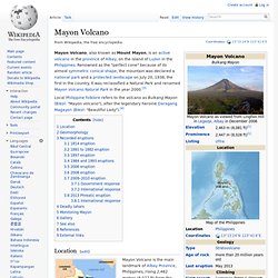
Geomorphology[edit] Mayon is a classic stratovolcano type of volcano capped by a small central summit crater. Kennon Road. Kennon Road is a roadway in Benguet province in the Philippines connecting the mountain city of Baguio to the lowland town of Rosario in La Union province.
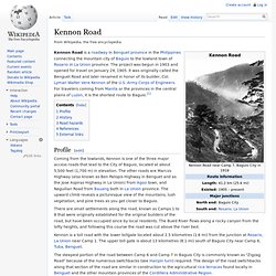
The project was begun in 1903 and opened for travel on January 29, 1905. It was originally called the Benguet Road and later renamed in honor of its builder, Col. Lyman Walter Vere Kennon of the U.S. Army Corps of Engineers. Mount Apo. Mount Apo is a large solfataric, potentially-active stratovolcano in the island of Mindanao, Philippines.
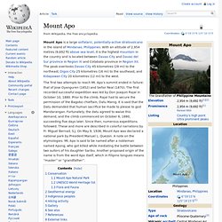
With an altitude of 2,954 metres (9,692 ft) above sea level, it is the highest mountain in the country and is located between Davao City and Davao del Sur province in Region XI and Cotabato province in Region XII. The peak overlooks Davao City 45 kilometres (28 mi) to the northeast, Digos City 25 kilometres (16 mi) to the southeast, and Kidapawan City 20 kilometres (12 mi) to the west. The first two attempts to reach Mt. Apo’s summit ended in failure: that of Jose Oyanguren (1852) and Señor Real (1870). The first recorded successful expedition was led by Don Joaquin Rajal in October 10, 1880. Conservation Mount Apo Natural Park On May 9, 1936, Mount Apo was declared a national park with Proclamation no. 59 by President Manuel L. UNESCO World Heritage list. El Nido, Palawan.