
Vpfview (v2.1) Download. Map Resources, Mapping Info, Overlay Mapping, SVG Maps. Vector map. The Vector Map (VMAP), also called Vector Smart Map, is a vector-based collection of Geographic information system (GIS) data about Earth at various levels of detail.
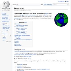
Level 0 (low resolution) coverage is global and entirely in the public domain. Level 1 (global coverage at medium resolution) is only partly in the public domain. WikiMiniAtlas. WikiMiniAtlas is a JavaScript plugin to display a draggable, zoomable, and clickable worldmap (as well as Moon, Mars, Venus, Mercury, Io and Titan imagery) in geocoded Wikipedia articles.
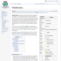
The map contains links to all other geocoded articles in Wikipedia and can be magnified down to streetlevel. 3D building models are displayed in modern browsers. While it looks similar to Google Maps it is our own software and free data.