
RACE: The Power of an Illusion. RACE - Human Variation. Langscape. Go West Across America with Lewis and Clark Game. Picturing America Home Page. 7 Wonders Panoramas - The New 7 Wonders -Travel Great Wall, Taj Mahal, Machu Picchu - 360 degree Panoramas. Downton Abbey - Highclere Castle. The expedition which led to the awesome discovery of King Tut's tomb - in November, 1922 - was funded by George Herbert.
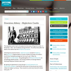
His official title (after the death of his father) was the 5th Earl of Carnarvon. Inheriting his ancestral home - Highclere Castle, located in Newbury, West Berkshire, England (which is south of Oxford and west of London) - the 5th Earl had great prestige but not much cash. When he married Almina Wombwell - the goddaughter of Alfred de Rothschild, an exceedingly wealthy banker - the money problems of George Edward Stanhope Molyneux Herbert were over. By signing an agreement to mary the girl actually believed to be Rothschild's daughter, the 5th Earl had access to the annual sum of £6.5 million (in today's currency). That converts to a bit more than $10 million every year Even with income like that, however, it took a great deal of money to fund Howard Carter's Egyptian excavations. At last have made wonderful discovery in the Valley.
See, also: 15 Amazing Places You Can Tour Virtually. If you can’t check out these places in person, you can at least visit them virtually—no flights or road trips required. 1.
The National Museum of Natural History Learn where we’ve been by taking a look around the stunning exhibits at this Smithsonian museum in the nation’s capital. 2. Taj Mahal. Sistine Chapel - Virtual Tour. Walk through the Continents - Print Maps Large and Small - Free. Print free maps large or small; from 1 page to almost 7 feet across; PC or Mac.
For classroom and student use. MegaMaps requires Adobe Flash. Free online software—no downloading or installation. Print out maps in a variety of sizes, from a single sheet of paper to a map almost 7 feet across, using an ordinary printer. You can print single page maps, or maps 2 pages by 2 pages, 3 pages by 3 pages, etc. up to 8 pages by 8 pages (64 sheets of paper; over six feet across!). Walk Through The Continents Trace car trips; where grandparents and aunts and uncles and cousins live; the Oregon Trail and the Cumberland Gap; Huck Finn's journey; the Rocky Mountains, the Appalachians, the Mississippi River, the Columbia River and the Colorado, label states… There are any number of ways to use these maps.
My Culture Quest. China Game. SS 1Geography and History. Classwork-Homework Earth from Space Terms to Learn Landforms: mountains, hills, plateaus, and plains Elevation: height above or below sea level Mantle: surrounds the core mostly hot, solid rock Crust: a thin layer of rock, sand, and soil that floats on the melted outer part of the mantle Tectonic Plates: separate sections of the crust Continental Drift: movement of plates Volcanoes: cone shaped mountains created by lava Earthquakes: sudden shifts in the Earth's crust The Layers of the Earth 5:59 The Earth's Layers Scan Section 2 Land, Water, and Climate pages 9-18 Wobbler Allow boiled and raw eggs to stand at room temperature for about 20 minutes.
The hard boiled egg spins easily and continues to spin for a few seconds. Interactive maps and visualizations. Map Skills For Today Grade 2. Geographia - World Travel Destinations, Culture and History Guide. Mapping History. ZIPskinny - Get the Skinny on that ZIP (demographics by ZIP Code) Old Maps Online. Time Zone Map.
World Wonders Project. Bible Maps, Timelines, Charts, Lineages. The Lost Tribes of Israel Locations where Israel taken captive View Migration after captivity View Israel's first settlement in Europe View.
TimeMaps - World History Atlas. Test Your Geography Knowledge at Lizardpoint.com. Country Guides to Culture, Etiquette, Customs & more! MIT Visualizing Cultures. The map as history : a multimedia atlas of world history with animated historical maps. China. The Inca Trail and Machu Picchu. 6 Sites To Get Kids Excited About Google Maps. I can remember three distinct occasions in my life where I have been blown away by technology.
I will save the first two for another day, but I will say that the amazing experience of walking the streets of New York, from my computer on the other side of the world in Australia is definitely one of them. That feeling of disbelief where you wonder if it is another April 1st prank… What, they actually drove a little car all around the city taking photos??? But they did… And they continue to do so. Google Maps started as a downloadable C++ program designed by two Danish brothers Lars and Jens Rasmussen. Since being acquired by Google in 2004, the program turned web app, has seen massive innovation and is now a tool used in nearly ever industry imaginable.
Here are six brilliant sites that use Google Maps to make fascinating, interesting, fun and thought provoking things happen. Google Sightseeing. IfItWereMyHome.com. Canada A land of vast distances and rich natural resources, Canada became a self-governing dominion in 1867 while retaining ties to the British crown.
Economically and technologically the nation has developed in parallel with the US, its neighbor to the south across an unfortified border. Canada faces the political challenges of meeting public demands for quality improvements in health care and education services, as well as responding to the particular concerns of predominantly francophone Quebec. Canada also aims to develop its diverse energy resources while maintaining its commitment to the environment. The land now occupied by Canada was first inhabited approximately 16,000 years ago by aboriginal peoples. Desert Biomes by DesertUSA.
Geocube - The world of Geography at your fingertips. Classroom Antarctica — Classroom Antarctica. GEOGRAPHY-MAP-GAMES online free geography flash games. Geosense: an online world geography game. Smithsonian: Beauty Surrounds Us. OneWorld Classrooms.