
Visualization: Geomap - Google Chart Tools. Overview A geomap is a map of a country, continent, or region map, with colors and values assigned to specific regions.
Values are displayed as a color scale, and you can specify optional hovertext for regions. The map is rendered in the browser using an embedded Flash player. Note that the map is not scrollable or draggable, but can be configured to allow zooming. Gallery – Street View – Google Maps. Map Your Twitter Followers. DAWC - WxCam - Google Maps Home Page. International Flight Tracker, World Airline Flights and Airport Status. MapBox. Cartografare il presente. The World Bank - Mapping for Results, World. We build tools to help teams communicate. Convention concerning international carriage by Rail of 9 may 1980 - COTIF. Protectedplanet.net - Explore Protected Areas. This free photo software enables you to manage and to GPS geo tag your photos and videos. Forest Atlas of the Democratic Republic of Congo.
Global map - Annex I. Mapping the Arabic Blogosphere: Politics, Culture and Dissent. Participatory Avenues, Gateway to Community Mapping, P3DM, PGIS & PPGIS. Geographically based Economic data (G-Econ) Google Map Reverse Geocoding Tutorial with Example.Google Map Reverse Geocode. Map Overlays - Google Maps API - Google Code. Version 2 of the JavaScript API has been turned down Warning: Version 2 of the Google Maps JavaScript API is no longer available.
Please follow the guide to migrate your code to version 3 of the Google Maps JavaScript API. As of November 19, 2013, all applications requesting v2 are served a special, wrapped version of the v3 API instead. We expect this wrapped version of the API to work for most simple maps, but we strongly encourage you to migrate to the v3 API immediately. Overlays are objects on the map that are tied to latitude/longitude coordinates, so they move when you drag or zoom the map. The Maps API has several types of overlays: AJAX APIs Playground. Live Ships Map - AIS - Vessel Traffic and Positions. Latitude and Longitude of a Point.
Shr.aaas.org/geotech/libya/AAAS_Libya.pdf. TTC GPS Streetcar Tracking Beta? Now Live! The TTC, GPS, and mobile devices appear to finally be united!
Using the satellite-based services of a company called NextBus, the TTC now has what appears to be (LIVE!) Mobile-friendly, GPS-enabled tracking on our streetcar routes. It's really easy to use. You simply visit the NextBus TTC web page, choose your route, then direction, then your starting point, and voila! The Official Global GPS Cache Hunt Site. GEO-Portal - GEOPortal Home. Maps: see where a language is spoken. "Where on Earth do they speak...
" [Map] Check an alphabetical list of world's languages and see where the language is spoken. Languages of the World [Map] Zoom and pan an interactive map. See at glance the areas with the highest language diversity. Global health, local information. Disease Categories Twelve disease categories are used to help you quickly find what you're looking for within your local area.

Most of the categories refer to where the disease affects your body, such as Gastrointestinal for cholera or Respiratory for pneumonia. We also keep track of environmental risks (i.e. beach closures due to sewage) and animal diseases (i.e. foxes found with rabies) to provide you a broader picture of diseases in your area. The number of alerts in each category determines the order in which they appear in the Outbreaks Near Me section. The category with the greatest number of alerts appears first. Animal Diseases affecting domestic animals, livestock, and wildlife. Environmental Changes in the environment that may impact human health (natural/man-made disaster, heat wave, volcanic eruption). Go-Geo! - Homepage. 1911 Census website.
Google Earth Community - Forums powered by UBB.threads™ Top - International Steering Committee for Global Mapping. Old Maps. Environmental interactive maps — EEA. Foodspotting. Revolver Maps - Free 3D Visitor Maps. Description RevolverMaps are a collection of real-time visitor statistics widgets for your website or blog.
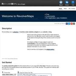
Have a look at the sample on the left: Every visitor leaves an eternal dot on the 3D globe, recent visitor locations are tagged by the labels showing the flag of the country as well as city and state. All widgets are free of charge, easy to install and customizable in size and appearance. Every widget is connected to the public live statistics page providing more detailed information on your visitors. Get an overview of all widgets in the widget gallery.
Get Started To quickly embed the globe from the sample above in your page follow two steps: Choose a size and copy the code from the textarea below to the desired position in your HTML structure. 1. More options 2. More Widgets, More Configuration Options → Get the Standard Version, the globe as shown above → Get the Mini Globe, a globe optimized for small sizes. CGMap - CGIAR MTP Analysis Program. United Nations Initiative on Global Geospatial Information Management. Street View : la Snowmobile pour couvrir les pistes. Avec Google Art Project, le dispositif photographique Street View arnaché à une sorte de déambulateur a réussi à pénétrer dans 17 musées à travers la planète pour capturer des vues panoramiques à 360°.
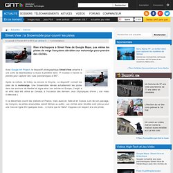
Après la voiture, le trolley ou encore le tricycle, ce dispositif connaît les joies de la motoneige. Une Snowmobile dévale actuellement les pistes dans les environs de Méribel et signe ainsi son arrivée en Europe. L'engin a en effet déjà été utilisé au Canada, à l'occasion des derniers Jeux Olympiques d'hiver ( voir vidéo ci-dessous ). Il va désormais couvrir les stations en France, mais aussi en Italie et en Suisse. Lors de son passage, les tronçons de pistes empruntées seront fermés au public. NASA Earth Observatory : Home. Road Traffic Reports, Travel Information and Traffic News. Twittervision. Live Piracy Map. Forums.