
Phyllite. Phyllite is a foliated metamorphic rock primarily composed of quartz, sericite mica, and chlorite.
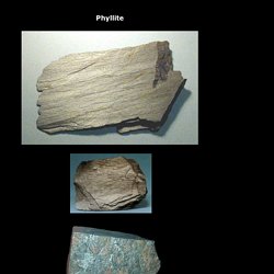
It represents a gradiation in the degree of metamorphism between slate and mica schist. Minute crystals of graphite, sericite, or chlorite impart a silky, sometimes golden sheen to the surfaces of cleavage (or schistosity). Phyllite is formed from the advanced metamorphism of slate. The protolith (or parent rock) for a phyllite is a slate. Its constituent platy minerals are larger than those in slate but are not visible with the naked eye.
State geology and mineral maps – Geological Survey of India Miscellaneous Publication Series. EsriNcgmp Online Geologic Mapping Template (v.10 SP1) National Geologic Lexicon Database - homepage. Mars Geology. Montana geologic map data. Section Sketch - About. Loess: Face of the Earth. Geological Survey of India(GSI),Ministry of Mines,Government of India - Misc. Publication No. 30 Maps. Geologic Time Clock. Energy Data Finder. Woods Hole Coastal and Marine Science Center Software. The mapping of hydrothermal alteration zones on the island of Lesvos, Greece using an integrated remote sensing dataset - International Journal of Remote Sensing - Volume 23, Issue 2. The mapping of hydrothermal alteration zones associated with epithermal gold deposits on the island of Lesvos in Greece has been carried out using Landsat Thematic Mapper (TM) satellite and ground remote sensing data.

The initial analysis of the satellite data using the minimum noise fraction, matched filter and spectral unmixing techniques identified the altered rock outcrops clearly. The identified pixels were almost completely contained within the highest grade alteration zones mapped by the field geologists. The analysis of the field spectroscopy data using two quantitative techniques, spectral angle mapper and cross-correlogram spectral matching, identified clearly the presence of high grade kaolinite and alunite outcrops. 1.5 Million Years of Climate History Revealed After Scientists Solve Mystery of the Deep.
This is because the isotope record shows the combined effects of both deep sea temperature changes, and changes in the amount of ice volume.
Separating these has in the past proven difficult or impossible, so researchers have been unable to tell whether changes in Earth's orbit were affecting the temperature of the ocean more than the amount of ice at the Poles, or vice-versa. The new study, which was carried out by researchers in the University of Cambridge Department of Earth Sciences, appears to have resolved this problem by introducing a new set of temperature-sensitive data. This allowed them to identify changes in ocean temperatures alone, subtract that from the original isotopic data set, and then build what they describe as an unprecedented picture of climatic change over the last 1.5 million years -- a record of changes in both oceanic temperature and global ice volume. Note : The above story is reprinted from materials provided by University of Cambridge, via EurekAlert! OpenStereo. OpenStereo is an open source, cross-platform software for structural geology analysis.

The software is written in Python, a high-level, cross-platform programming language and the GUI is designed with wxPython, which provide a consistent look regardless the OS. Numeric operations (like matrix and linear algebra) are performed with the Numpy module and all graphic capabilities are provided by the Matplolib library, including on-screen plotting and graphic exporting to common desktop formats (emf, eps, ps, pdf, png, svg). OpenStereo is released under the GNU General Public License v.3. An abstract about the software was presented at the AGU 2010 Fall Meeting.
A ful paper is being prepared for publication. Screenshots Download : Windows binaries (version 0.1.2f) Click Here Python source code (version 0.1.2f) Geology. Earth Sciences. Lifornia Geological Survey - Hazardous Minerals. Lifornia Geological Survey - Asbestos. Chrysotile and amphibole asbestos (such as tremolite) occur naturally in certain geologic settings in California, most commonly in association with ultramafic rocks and along associated faults.
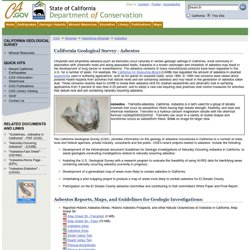
Asbestos is a known carcinogen and inhalation of asbestos may result in the development of lung cancer or mesothelioma. The asbestos contents of many manufactured products have been regulated in the U.S. for a number of years. For example, the California Air Resources Board (CARB) has regulated the amount of asbestos in crushed serpentinite used in surfacing applications, such as for gravel on unpaved roads, since 1990. In 1998 new concerns were raised about possible health hazards from activities that disturb rocks and soil containing asbestos and may result in the generation of asbestos laden dust. Asbestos Reports, Maps, and Guidelines for Geologic Investigations: For Additional Asbestos Information See These Related Links: Lifornia Geological Survey - Mercury.
Mercury Mercury is present in the environment as a result of both natural processes and human activities.
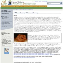
Natural sources of mercury include volcanoes, hot springs, and natural mercury deposits. Sources related to human activities include coal combustion, waste incineration, certain industrial activities and some mining activities. California environmental mercury issues relate to historical mining operations in two ways. The first is to mercury mining activity that occurred between 1846 and 1981, during which time about 100 million kilograms of mercury were produced within the state. Mercury is a human neurotoxin with developing fetuses and small children being at greatest risk. Tyrell.