
Dwight D. Eisenhower High School - Geography Files. Current Events Archive. GIS/GPS Resources. The Geography and Literacy Connection. What do you think of when you hear the word literacy?
Depending on what you teach, chances are geography is not the first thought that comes to mind. But believe it or not, geography and literacy naturally share many similarities. And you can deepen students’ learning in both geography and literacy when they are integrated in the curriculum. The Common Core State Standards in English Language Arts represent a significant change in literacy requirements, including a new emphasis on teaching literacy skills in and through history/social studies, science, and technical content areas. The end goal of the Common Core State Standards is to make students stronger critical thinkers who are better prepared for college and career success in the 21st century.
AISD: Social Studies - High School. Geography Alive! Enrichment Resources. The Longitude Problem. Geography USA : A Free Online Textbook. Nat Geo Education Blog. Following the launch of our brand new program, the Geo-Educator Community, we reached out to the eight outstanding educators that make up our community’s Steering Committee to hear their thoughts on […] Read Article → This blog was written by Livia Mazur, a Mapping Specialist at National Geographic’s Center for Geo-Education.
Have you ever seen a map and marveled over all of the information […] Read Article → This month, National Geographic’s Pristine Seas team has set off once again to explore one of the last “wild” places in the ocean, and they’re inviting classrooms to come along […] Read Article → Creating Content With MapMaker Interactive. A new feature on the MapMaker Interactive lets you create your own set of links, or geotour, that you can save and share with the world.
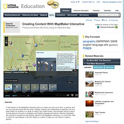
Creating, sharing, and collaborating on geotours can be a great project for students in a range of subject and content areas—the examples linked to above include geotours focused on geography and English language arts themes. National Geographic will continue to develop the new geotour feature of the MapMaker Interactive, so come back often to check for new releases of the tool. Below is a series of steps you can follow to create a geotour. 1. Organize the information for your geotour. First, you need to write and organize your geotour—the locations on the map you want to mark and the information or images you want to use for each location. For the links, you can include a URL to a website or to an image saved on the web. 2.
Explore Taylor & Francis Online. GTI - 2011. Mapping History. Oakland Schools Middle School World Geography (New Configuration)* (M) / Grade 6 (Oakland Scope Middle School) Activities for Kids « GeoBeats - Guided video tours of your next international destination. Lewis and Clark : Cartography. View/au8dyxvvb.html. GIS Education Community.
Web maps, web apps, story maps … these and other new terms are frequently used in the new world of cloud based GIS.
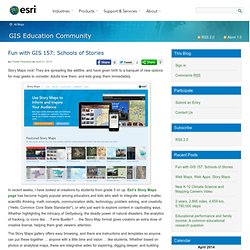
Sorting through the lexicon of any field is critical to understanding it and to teach it. What are the similarities and differences between these terms, and how does one decide when to use each of them? All three of these terms refer to a web map dynamically stored in the cloud, or a remote server, so that the map user can interact with it in various ways. By “interact”, I mean change the scale, extent, classification, or symbology, add or subtract data, filter data, analyze spatial relationships, and more. Depending on your goals, you may want to create and use one or all three of these types of maps. Bicycle Route, New York City to New Jersey, shown in ArcGIS Online. Users of your ArcGIS Online maps will not only be able to access your map as you have created it, but they can also save it into their own ArcGIS Online account and make changes to it. Geography Printables, Lessons, & Quizzes for Teachers (K-12. Geography Lessons.
A Terrifying, Fascinating Timelapse of 30 Years of Human Impact on Earth - Emily Badger. A new interactive project from Google, NASA and the US Geological Survey.
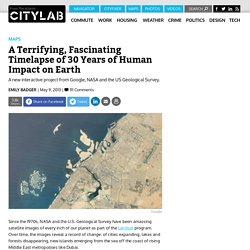
Since the 1970s, NASA and the U.S. Geological Survey have been amassing satellite images of every inch of our planet as part of the Landsat program. Why You May Not Be Seeing Many 17-Year Brood II Cicadas - John Metcalfe. Wasn't the East Coast supposed to be up to their soft palates in 17-year Brood II cicadas by now? It would seem that way, given the alarm bells that have been clanging as far back as early April . Cicadas bursting from the ground like little clawed zombies, cicadas transforming trees into randy pillars of six-legged sex, cicadas carpeting the streets like squishy shag carpet, cicadas flying into our mouths and hair – in many big cities, it hasn't happened yet. What's up with that? I asked a few distinguished experts on cicada biology and lifestyle, and got back several explanations. The first is the unusually cold weather that's descended over the East Coast. (May 24, 2013. Google Earth Tour Creation.
AP Geography. The Daily Rundown: Schools downplaying geography lessons. National Geographic Photography. Weather and climate.