
Mapping Toolbox: 10+ Tools Worth Checking Out. MapStack: Making maps beautiful.
Maps are one of the most popular ways to visualize data and are an easy way to add context to geographically-based datasets. They can also be beautiful and offer a different view of our world. Learning to make appealing and informative maps to support stories is a great skill to learn. Over the past few years I’ve experimented with dozens of mapping tools and libraries. Here’s my shortlist based on the tools I find myself using most often. Some of these tools are easy to use: add some data, choose your preferred settings and you create your map. 1 — My Maps Ease of use: Easy This is a great place to start if you’re new to mapping.
71 mil mapas antigos em alta resolução para download gratuito. Google Crisis Map. MapHub · Create interactive maps. OpenHeatMap. Story Map Cascade. VIS. Visual Investigative Scenarios platform: About. Tour Builder. 3 tools for finding geolocated posts on social media. Credit: Image from Thinkstock Eyewitness media has become a valuable resource in journalism and news organisations are increasingly using it as a basis for producing multimedia coverage and telling stories in more powerful ways. However, with an average of 500,000 million tweets posted per day and 40 million photos uploaded daily to Instagram, finding relevant information quickly and accurately can be a challenging and lengthy process. Geolocation can be very valuable in the newsgathering process, especially in the event of an ongoing breaking news situation, such as the current refugee crisis developing in Europe.
Here are three location-based free tools for finding eyewitness media footage on social media. EchoSEC Launched in 2014, echoSEC is a web platform that allows you to discover and monitor posts from specific areas in a given timeframe. The tool displays an earth view of Google Maps and a search filter. Mind42: Free online mind mapping software. Create amazing maps with your data — CartoDB.
Modest Maps. Polymaps. Crowdmap. TileMill. Mapas de Vista. OpenStreetMap. Wikimapia. House Street City Country World 30624872 places Distance Measure About Wikimapia, All countries, USA, Canada, UK, Australia, New Zealand, Germany, Switzerland, Italy, France, Spain, Russia, India, Brazil ...
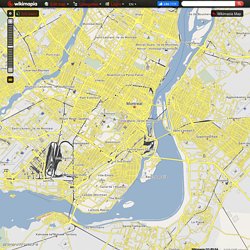
Tags directory, Last adds, Tags page 2, Tags page 3, Tags page 4, Tags page 5, Tags page 6, Tags page 7, Tags page 8, Tags page 9, Tags page 10 ... Wikimapia is an online editable map - you can describe any place on Earth. Loading map... <br />We recommend to use a new browser, Firefox is preferrable. Mapbox. StoryMap JS. 8 herramientas para crear mapas. Los mapas conceptuales son excelentes herramientas de apoyo para reunir conceptos y realizar explicaciones detalladas.
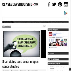
Estas gráficas favorecen la mejora de la productividad en el trabajo y el desarrollo de ideas junto a colegas. Te presentamos una serie de herramientas en línea para la creación de este tipo de diagramas: 1. Creately Dentro de este servicio están disponibles más de 40 tipos de diagramas, entre ellos mapas conceptuales sencillos pero con bastantes beneficios.
Entre sus características resalta la colaboración en tiempo real de diferentes usuarios en un mismo mapa. Puedes probar el servicio siguiendo este enlace. 2. Esta aplicación tiene un interfaz sencillo que consiste en arrastrar y soltar el material que necesites hacia la plataforma. Los mapas creados pueden guardarse, compartirse y también ser insertados en paginas web, gracias a que pueden exportarse en una gran variedad de formatos (XML , HTML , PNG y JPG).