
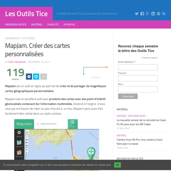
http://outilstice.com/2014/12/mapjam-creer-des-cartes-personnalisees/
Related: Outils pour la classe • Outils-images • Cartographie • Veille techno-methodo-carto • Cartes géo : création, consultation5 tools to leverage augmented reality - Page 2 of 2 - eCampus News The University of Maryland also is home to the Virtual and Augmented Reality Laboratory, also known as the Augmentarium. The Augmentarium’s main technology is the highly popular Oculus Rift. Augmented reality’s applications within learning could be limitless, because any concept with a special or physical component can be better understood through a student’s firsthand use of the technology, and would likely make learning even more interesting and exciting for most students, university representatives said.
Forensically, free online photo forensics tools - 29a.ch Forensically is a set of free tools for digital image forensics. It includes clone detection, error level analysis, meta data extraction and more. It is made by Jonas Wagner. How to draw a map This tutorial covers my entire process for how to draw a map – from start to finish. In this case I’m illustrating a simple town map, but the steps apply to any map. Tools and Software I used Photoshop for this map, but all of this can be done in Gimp (for free).
Map of literary road trips Ever wanted to follow in the footsteps of a famous writer or literary character in their journey across the country? Well now you can. Richard Kreitner for Atlas Obscura hand-cataloged the road trips — more than 1,500 entries — from twelve works of literature and Steven Melendez mapped the paths. The above map is the result of a painstaking and admittedly quixotic effort to catalog the country as it has been described in the American road-tripping literature. The Obsessively Detailed Map of American Literature's Most Epic Road Trips The above map is the result of a painstaking and admittedly quixotic effort to catalog the country as it has been described in the American road-tripping literature. It includes every place-name reference in 12 books about cross-country travel, from Mark Twain’s Roughing It (1872) to Cheryl Strayed’s Wild (2012), and maps the authors’ routes on top of one another. You can track an individual writer’s descriptions of the landscape as they traveled across it, or you can zoom in to see how different authors have written about the same place at different times. Most interestingly of all, for me at least, you can ruminate about what those differences say about American travel, American writing, American history. A word to close readers: I hand-typed most of these 1,500-plus entries and located their coordinates as best I could.