
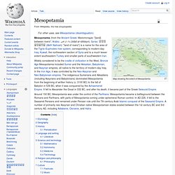
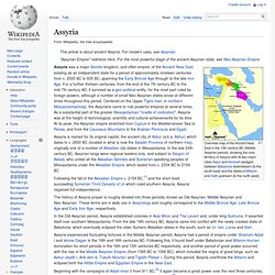
Mesopotamia. Map showing the extent of Mesopotamia Mesopotamia (from the Ancient Greek: Μεσοποταμία: "[land] between rivers"; Arabic: بلاد الرافدين (bilād al-rāfidayn); Syriac: ܒܝܬ ܢܗܪܝܢ (Beth Nahrain): "land of rivers") is a name for the area of the Tigris–Euphrates river system, corresponding to modern-day Iraq, Kuwait, the northeastern section of Syria and to a much lesser extent southeastern Turkey and smaller parts of southwestern Iran.
Widely considered to be the cradle of civilization in the West, Bronze Age Mesopotamia included Sumer and the Akkadian, Babylonian, and Assyrian empires, all native to the territory of modern-day Iraq. In the Iron Age, it was controlled by the Neo-Assyrian and Neo-Babylonian empires. The indigenous Sumerians and Akkadians (including Assyrians and Babylonians) dominated Mesopotamia from the beginning of written history (c. 3100 BC) to the fall of Babylon in 539 BC, when it was conquered by the Achaemenid Empire.
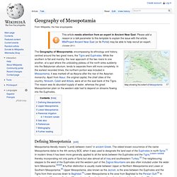
Etymology Geography History Periodization Literature. Ancient Near East. Geography of Mesopotamia. The Geography of Mesopotamia, encompassing its ethnology and history, centred around the two great rivers, the Tigris and Euphrates.
While the southern is flat and marshy; the near approach of the two rivers to one another, at a spot where the undulating plateau of the north sinks suddenly into the Babylonian alluvium, tends to separate them still more completely. In the earliest recorded times, the northern portion was included in Mesopotamia; it was marked off as Assyria after the rise of the Assyrian monarchy. Apart from Assur, the original capital, the chief cities of the country, Nineveh, Calah and Arbela, were all on the east bank of the Tigris. The reason was its abundant supply of water, whereas the great Mesopotamian plain on the western side had to depend on streams flowing into the Euphrates. Defining Mesopotamia[edit] Mesopotamia literally means "(Land) between rivers" in ancient Greek. Upper Mesopotamia[edit] Lower Mesopotamia[edit] Perennial irrigation[edit] See also[edit] Cities of the ancient Near East.
The largest cities in the Bronze Age ancient Near East housed several tens of thousands.
Memphis in the Early Bronze Age with some 30,000 inhabitants was the largest city of the time by far. Ur in the Middle Bronze Age is estimated to have had some 65,000 inhabitants; Babylon in the Late Bronze Age similarly had a population of some 50–60,000, while Niniveh had some 20–30,000, reaching 100,000 only in the Iron Age (ca. 700 BC). The KI 𒆠 determinative was the Sumerian term for a city or city state.[1] In Akkadian and Hittite orthography, URU𒌷 became a determinative sign denoting a city, or combined with KUR𒆳 "land" the kingdom or territory controlled by a city, e.g.
Sumer. The irrigated farming together with annual replenishment of soil fertility and the surplus of storable food in temple granaries created by this economy allowed the population of this region to rise to levels never before seen, unlike those found in earlier cultures of shifting cultivators.
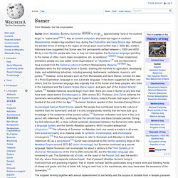
This much greater population density in turn created and required an extensive labour force and division of labour with many specialised arts and crafts. At the same time, historic overuse of the irrigated soils led to progressive salinisation, and a Malthusian crisis which led to depopulation of the Sumerian region over time, leading to its progressive eclipse by the Akkadians of middle Mesopotamia. Sumer was also the site of early development of writing, progressing from a stage of proto-writing in the mid 4th millennium BC to writing proper in the 3rd millennium BC (see Jemdet Nasr period).
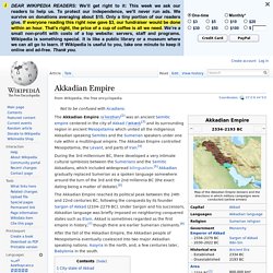
Origin of name[edit] City-states in Mesopotamia[edit] Map of Sumer Other principal cities: Assyria. Overview map of the Ancient Near East in the 15th century BC (Middle Assyrian period), showing the core territory of Assyria with its two major cities Assur and Nineveh wedged between Babylonia downstream (to the south-east) and the states of Mitanni and Hatti upstream (to the north-west).
Assyria was a major Semitic kingdom, and often empire, of the Ancient Near East, existing as an independent state for a period of approximately nineteen centuries from c. 2500 BC to 605 BC, spanning the Early Bronze Age through to the late Iron Age. For a further thirteen centuries, from the end of the 7th century BC to the mid-7th century AD, it survived as a geo-political entity, for the most part ruled by foreign powers, although a number of small Neo-Assyrian states arose at different times throughout this period. Centered on the Upper Tigris river, in northern Mesopotamia(Iraq), the Assyrians came to rule powerful empires at several times.
Names[edit] Akkadian Empire. Coordinates: During the 3rd millennium BC, there developed a very intimate cultural symbiosis between the Sumerians and the Semitic Akkadians, which included widespread bilingualism.[5] Akkadian gradually replaced Sumerian as a spoken language somewhere around the turn of the 3rd and the 2nd millennia BC (the exact dating being a matter of debate).[6] The Akkadian Empire reached its political peak between the 24th and 22nd centuries BC, following the conquests by its founder Sargon of Akkad (2334–2279 BC).
Under Sargon and his successors, Akkadian language was briefly imposed on neighboring conquered states such as Elam. Akkad is sometimes regarded as the first empire in history,[7] though there are earlier Sumerian claimants.[8] Babylonia. Babylonia was an ancient Akkadian-speaking Semitic nation state and cultural region based in central-southern Mesopotamia (present-day Iraq).

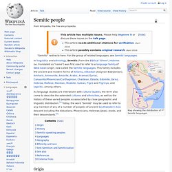
It emerged as an independent state c. 1894 BC, with the city of Babylon as its capital. It was often involved in rivalry with its fellow Akkadian state of Assyria in northern Mesopotamia. Semitic people. Map showing the distribution of Semitic languages In linguistics and ethnology, Semitic (from the Biblical "Shem", Hebrew: שם, translated as "name") was first used to refer to a language family of West Asian origin, now called the Semitic languages.
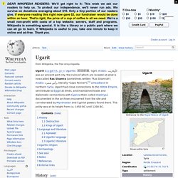
Ugarit. Excavated ruins at Ras Shamra Ugarit (/ˌuːɡəˈriːt, ˌjuː-/; Ugaritic: 𐎜𐎂𐎗𐎚, ʼUgrt; Arabic: أوغاريت) was an ancient port city, the ruins of which are located at what is now called Ras Shamra (sometimes written "Ras Shamrah"; Arabic: رأس شمرة, literally "Cape Fennel"),[1] a headland in northern Syria.
Ugarit had close connections to the Hittite Empire, sent tribute to Egypt at times, and maintained trade and diplomatic connections with Cyprus (then called Alashiya), documented in the archives recovered from the site and corroborated by Mycenaean and Cypriot pottery found there. The polity was at its height from ca. 1450 BC until 1200 BC. History[edit] Ras Shamra lies on the Mediterranean coast, some 11 kilometres (7 mi) north of Latakia, near modern Burj al-Qasab. Though the site is thought to have been inhabited earlier, Neolithic Ugarit was already important enough to be fortified with a wall early on, perhaps by 6000 BC. Destruction[edit] Baal Cycle. The Baal Cycle is a Ugaritic cycle of stories about the Canaanite god Baal, also known as Hadad the god of rain, storm and fertility.
They are written in Ugaritic, a language written in a cuneiform alphabet, on a series of clay tablets found in the 1920s in the Tell of Ugarit (modern Ras Shamra), situated on the Mediterranean coast of northern Syria, a few kilometers north of the modern city of Latakia, far ahead of the now known coast. Basic Synopsis[edit] The Baal Cycle series of stories are summarized thus: Baal and Yam[edit] Hurrian songs. A drawing of one side of the tablet on which the Hymn to Nikkal is inscribed[1] The Hurrian songs are a collection of music inscribed in cuneiform on clay tablets excavated from the ancient Amorite[2][3] city of Ugarit which date to approximately 1400 BC. One of these tablets, which is nearly complete, contains the Hurrian hymn to Nikkal (also known as the Hurrian cult hymn or A Zaluzi to the Gods, or simply h.6), making it the oldest surviving substantially complete work of notated music in the world.
While the composers' names of some of the fragmentary pieces are known, h.6 is an anonymous work. History[edit] Ugarit, where the Hurrian songs were found The tablet h.6 contains the lyrics for a hymn to Nikkal, a Semitic goddess of orchards, and instructions for a singer accompanied by a nine-stringed sammûm, a type of harp or, much more likely, a lyre.[9] One or more of the tablets also contains instructions for tuning the harp.[10] Notation[edit] 7–5 šērum (song?)
1–6 šalšatum (third) A Hurrian Cult Song from Ancient Ugarit. Ebla. Ebla (Arabic: إبلا, modern Tell Mardikh, Idlib Governorate, Syria) was one of the earliest kingdoms in Syria, located about 55 km (34 mi) southwest of Aleppo. It was an important center throughout the Third millennium BC to the end of the first half of the Second millennium BC Started as a small settlement in the early Bronze Age, it developed into a trading empire and later turned into an expansionist power that imposed its hegemony over much of northern and eastern Syria, its language, the Eblaite language is now considered the earliest attested Semitic language,[1] after Akkadian, the site is most famous for the Ebla tablets, an archive of about 20,000 cuneiform tablets found there,[2] dated from around 2350 BC, written in both Sumerian and Eblaite languages and using the Sumerian Cuneiform which allowed a better understanding of Sumerian.
History[edit] The first kingdom[edit] Early period[edit] Archive period[edit] Royal palace G First destruction[edit] Mari revenge: prof. Palace Q. Short chronology timeline. The short chronology is one of the chronologies of the Near Eastern Bronze and Early Iron Age, which fixes the reign of Hammurabi to 1728–1686 BC and the sack of Babylon to 1531 BC. The absolute 2nd millennium BC dates resulting from this decision have very little support in academia, particularly after more recent research. The middle chronology (reign of Hammurabi 1792–1750 BC) is still commonly encountered in literature and the most recent work has essentially disproved this short chronology.[1] Use of short chronology dates, however, is currently the standard practice in the English Wikipedia articles on the Ancient Near East (as discussed on the Ancient Near East project page).
In general, middle chronology dates can be calculated by adding 64 years to the corresponding short chronology date (e.g. 1728 BC in short chronology corresponds to 1792 in middle chronology). Early Bronze Age[edit]