
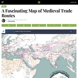
Photo Sharing. Your Photos Look Better Here. Why all world maps are wrong. Maps as Media – Fall 2018. 30 Unusual, Perspective-Changing Maps People Shared On This Reddit Group – Earth Wonders. To its devotees, Reddit feels proudly untamed, one of the last Internet giants to resist homogeneity.
Most Reddit pages have a throwback aesthetic, with a few crudely designed graphics and a tangle of text: an original post, comments on the post, responses to the comments, responses to the responses. That’s pretty much it. Reddit is made up of more than a million individual communities, or subreddits, some of which have three subscribers, some twenty million. If you want to stay updated with the latest trends and what the internet is talking about, then Reddit is the place to be. It’s a site where the registered community members submit text posts, images, and direct links to funny and interesting content. Maps And Mapping. Old maps of Seven Seas (Open Ocean) How does it work?

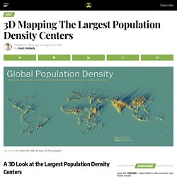
These instructions will show you how to find historical maps online. Getting started Type the place name in the search box to find the exact location. You can further adjust the search by zooming in and out. Zoom Zoom in and out with the buttons or use your mouse or touchpad natively. Exact Area tool. 3D Mapping The Largest Population Density Centers. Since their invention, automobiles have been a driving force of the global economy.
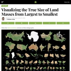
Used by millions of people to get to work, transport goods, and travel, the modern automobile has become ubiquitous in our daily lives. So much so, that a whopping 92 million cars were produced in just 2019. Visualizing the True Size of Land Masses from Largest to Smallest. Since the U.S.
Constitution was first instituted, there have been 48 vice presidents. They’ve supported presidents in seeing the country through wars, economic expansions and contractions, a global pandemic—and much more. A president’s success depends on the strength of their team, so it’s only natural that as second-in-command, the pick for a VP carries significant weight. In some cases, they can even make or break the race to secure a spot in the White House. Mercator Misconceptions: Clever Map Shows the True Size of Countries. Since their invention, automobiles have been a driving force of the global economy. Used by millions of people to get to work, transport goods, and travel, the modern automobile has become ubiquitous in our daily lives. So much so, that a whopping 92 million cars were produced in just 2019. The Inverted World Map - Variations on a Blue Marble - 3Develop image blog. It probably happens to everyone who likes to look at maps.
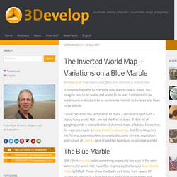
You imagine land to be water and water to be land. Continents to be oceans and and oceans to be continents. Islands to be lakes and lakes to be islands. A Fascinating Map of Medieval Trade Routes. Since their invention, automobiles have been a driving force of the global economy.
Used by millions of people to get to work, transport goods, and travel, the modern automobile has become ubiquitous in our daily lives. So much so, that a whopping 92 million cars were produced in just 2019. Map Maker: Show off where you've been or where you're going. Cool cartography: the art of mapmaking. (11) Pinterest. Piri Reis (Turkish, 1465-1555). 'Leaf from Book… Geography: Exploring cartography and mapmaking. This course has now passed – but we update our programme all the time.
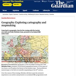
For information on our full range of masterclasses, sign up to our newsletter, follow us on Twitter, or keep an eye on our calendar. Reawaken your interest in geography at this incredible evening class with Nicholas Crane, president of the Royal Geographical Society. Cool cartography: the art of mapmaking. The octopuses of war: WW1 propaganda maps in pictures. Discover Fascinating Vintage Maps From National Geographic's Archives. Cartography has been close to National Geographic’s heart from the beginning.
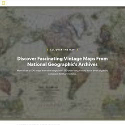
And over the magazine’s 130-year history, maps have been an integral part of its mission. Now, for the first time, National Geographic has compiled a digital archive of its entire editorial cartography collection — every map ever published in the magazine since the first issue in October 1888. The collection is brimming with more than 6,000 maps (and counting), and you’ll have a chance to see some of the highlights as the magazine’s cartographers explore the trove and share one of their favorite maps each day. Follow @NatGeoMaps on Twitter, Instagram, and Facebook to see what they discover.
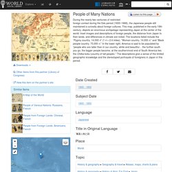
Population Mountains. The Map is not the territory. This map shows the European regions fighting to achieve independence. Antipodes Map - Tunnel to the other side of the world. Ingeniously Redesigned World Map Looks Unusual, But Is Highly Accurate. Modern Pangea Map Showing Today's Countries on the Supercontinent. Atlasobscura. A World of Circles. Interactive Maps. Interactive Maps. People of Many Nations. During the nearly two centuries of restricted foreign contact during the Edo period (1600–1868), the Japanese people still maintained a curiosity about foreign cultures.
A Wonderfully Stereotypical 1970s Map of New York. How might a person who’s never left New York City view the rest of the world?
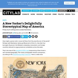
Perhaps with Manhattan taking up 80 percent of the U.S., the other four boroughs 10 percent, the Midwest completely nonexistent, and foreign countries reduced to vague presences somewhere across the water. That’s the view of this wonderful 1970s map lampooning a New Yorker’s self-centered geography. Digital Atlas of the Roman Empire. The octopuses of war: WW1 propaganda maps in pictures. Strange maps - Cartographies et arts. Incredible Map Reveals Just How Long It Will Take To Reach A City From ANY Place On Earth. The Big Data Institute at the University of Oxford has published a map revealing how long it will take you to travel to the nearest urban area from anywhere in the world. The end result is a psychedelic masterpiece.
But it doesn’t just look stunning. It serves a very serious purpose. As the researchers point out, cities serve as a hub for all sorts of institutions and services, including education, healthcare, and banking. They hope the project will help inform future endeavors to improve transportation links and accessibility to urban centers without endangering the surrounding environment and local wildlife. Mapping Tools. Maps. Historic Maps. Map of Billionaires - 2013. 38 Maps You Never Knew You Needed. Mapporn - najlepsze znaleziska i wpisy - archiwum z października 2015 o #mapporn w Wykop.pl.
The AuthaGraph World Map Isn't Perfect, But It's Pretty Close. Creating a proportional map of the world is tricky because the world is a sphere and a map is flat. That creates visual distortions, which explains why Mercator projections shrink Africa and super-size Greenland. Designer Hajime Narukawa found a clever solution to this problem: triangles. Narukawa's AuthaGraph World Map, which recently won the grand prize in Japan’s biggest design competition, retains the proportions of the continents and oceans—so much so that you can fold it into a three-dimensional globe.
Like magic! Old Maps Online. Maps and GPS. Map Porn, for interesting maps.