
Moyen-âge : vocabulaire augmenté - Ti'loustics - Explorer le monde. Cette période, il est prévu que je travaille sur le Moyen-âge avec mes élèves de maternelle.
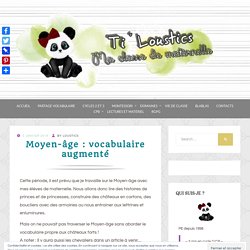
Nous allons donc lire des histoires de princes et de princesses, construire des châteaux en cartons, des boucliers avec des armoiries ou nous entrainer aux lettrines et enluminures. Mais on ne pouvait pas traverser le Moyen-âge sans aborder le vocabulaire propre aux châteaux forts ! A noter : Il y aura aussi les chevaliers dans un article à venir… Alors, voici des affiches en réalité augmentée qui vont permettre aux enfants d’apprendre le vocabulaire nécessaire en écoutant, regardant ou en s’entrainant à replacer les mots proposés. Pour élèves lecteurs ou non lecteurs ! Le matériel : J’ai prévu différentes affiches selon le niveau et le besoin des enfants. Affiche 1 Cette première affiche permet aux élèves de lire les Codes qui proposent le nom des éléments pointés + une image réelle. Par exemple : la herse. Atlante Storico Mondiale Interattivo dal 3000 aC.
CNICE - Ciencias, Geografía e Historia. Schools - Primary History. L'Histoire à la carte : un atlas historique multimédia constitué de cartes animées pour mieux comprendre l'Histoire. Struthof, l'ancien camp de concentration de Natzweiler en Alsace. Geonef. Tesori d'archivio: decine di migliaia di mappe da scaricare gratuitamente - Frizzifrizzi.
InkleWriter. Créer des histoires interactives – Les Outils Tice. InkleWriter est un outil en ligne qui permet d’écrire des histoires interactives où le lecteur choisit régulièrement la suite de l’intrigue entre plusieurs options.
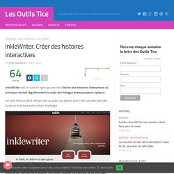
Un outil très simple à utiliser seul ou avec vos élèves pour créer par exemple des livres où le lecteur est le héros. Nostalgie. 100 Diagrams That Changed the World. Since the dawn of recorded history, we’ve been using visual depictions to map the Earth, order the heavens, make sense of time, dissect the human body, organize the natural world, perform music, and even concretize abstract concepts like consciousness and love. 100 Diagrams That Changed the World (public library) by investigative journalist and documentarian Scott Christianson chronicles the history of our evolving understanding of the world through humanity’s most groundbreaking sketches, illustrations, and drawings, ranging from cave paintings to The Rosetta Stone to Moses Harris’s color wheel to Tim Berners-Lee’s flowchart for a “mesh” information management system, the original blueprint for the world wide web.
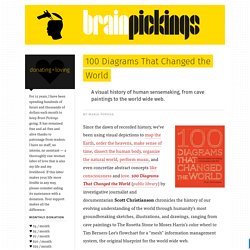
It appears that no great diagram is solely authored by its creator. Most of those described here were the culmination of centuries of accumulated knowledge. Most arose from collaboration (and oftentimes in competition) with others. 3 Very Good Resources of Historical Maps for Teachers. April 12, 2016 Yesterday we reviewed an excellent tool teachers can use to create animated multimedia scenarios on a map.
Through this tool we discovered some very good resources where history teachers or anyone else interested in past cartography can access a plethora of historical maps. Some of these maps are copyright friendly and you can download and use them with your students in class. We invite you to check them out and share with us if you have other suggestions to add to this list. Engineering an Empire - Egypt.
Alla scoperta dell'antica Roma. Athenian Vase Painting: Black- and Red-Figure Techniques. The Ancient Greek World. 5 TED-Ed Lessons about awesome women in history. If it’s true that well-behaved women seldom make history, then we’d like to introduce you to a few of our favorite troublemakers.
Here are 5 TED-Ed Lessons about remarkable women: 1. The pharaoh that wouldn’t be forgotten Hatshepsut was a female pharaoh during the New Kingdom in Egypt. The Histomap. Experience Ancient Egypt. Images pour la classe nos photos, gravures et cartes à usage pédagogique. Images d’Art. Acropolis. An `acropolis’ is any citadel or complex built on a high hill.
The name derives from the Greek Akro, high or extreme/extremity or edge, and Polis, city, translated as 'High City’, 'City on the Edge’ or 'City in the Air’, the most famous being the Acropolis of Athens, Greece, built in the 5th century BCE. Though the word is Greek in origin, it has come to designate any such structure built on a high elevation anywhere in the world. Mycenae. Mycenae The Lions GateThe palace of Mycenae is surrounded by a fortification wall.
The main entrance of this fortification wall is the “Lions Gate”. Timeglider: web-based timeline software. MapStory : Welcome! Histography- A Wonderful Interactive Timeline for History Teachers. October , 2015 Histography is an excellent interactive timeline that spans the history of humankind from the Big Bang to 2015.
Mesopotamia - The Sumerians. Christophe Colomb (1451-1506) Christophe Colomb, navigateur « espagnol d’origine italienne » est célèbre pour avoir découvert le Nouveau Monde en 1492 alors qu’il cherchait la route des Indes.
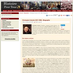
Pourtant, c’est lui que les historiens ont encore du mal à découvrir. La scoperta dell`America. Ulisse - America, storia di un continente. Le verdure importate dall'America da Cristoforo Colombo. Cristoforo Colombo e Magellano cosa mangiavano i grandi esploratori HD. YouTube - La scoperta dell'America. Europe 1923. Europe 1919-1923. Europe 1914 Régimes. Europe_1939_4_copy.png (1088×915) Lexicity. Rebuilding Ancient Egyptian Temples in 3D.
Resources for Primary Source Documents. Primary sources are resources that were first-hand created in a given period of time and never undergone any kind of editing or distortion.
These sources are multimodal and they come in different forms. They can be artifacts, documents, pictures, recordings, essays, photographs, maps...etc. Now with the globalization of knowledge and the pervasive use of digital media, primary sources become accessible to everybody with an internet connection. However, the search for these materials is akin to a scavenger hunt and hence the importance of having a handy list such as the one below to keep for rainy days. Timelines.tv - History, documentary and video online. TimeRime.com - Homepage. The Other Mystery of Easter Island. Moai statues Easter Island is branded into popular consciousness as the home of the mysterious and towering moai statues, but these are not the only curiosity the South Pacific island holds.
Time line of art history. Ancient Greece - The British Museum. Ancient Greece. Citations latines, expressions, locutions, aide au latin, traduction, theme, version. AncientEgyptMap.jpg (JPEG Image, 841x1474 pixels) Early Byzantine Art. Early Byzantine Art As you know, Rome was the capitol of the Roman Empire until the era of Constantine. In 324, Constantine moved the capital from Rome to the Greek City of Byzantium and renamed it Constantinople.
Things were fine for awhile, but by the 5th century of the common era, things began to change.The West was under attack by the barbarians and ultimately fell apart. The cities that were part of the Roman empire declined in population or simply died. Documentari storia superquark. Timescape. MapStory : Bienvenue! Moduli di Storia.