
Reality Solutions Webinars - ReCap Product News. If you want to learn more about Reality Capture, 3D laser scanning, UAVs, photogrammetry, 3D printing, new technologies...

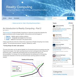
You are in the right place! Newly scheduled sessions will follow, so we advise you to come back and check our latest updates. Topics will vary. We'll be covering everything from the 3D laser scanning industry to photogrammetry (photos to 3D), and new technology previews like Project Memento. To get started with ReCap, please visit the ReCap website. Next sessions: Upcoming topics: "Using Reality Data in Fusion 360" "Stockpile Estimation with ReCap" Previous sessions: An Introduction to Reality Computing - Part 2 - Reality Computing.
The last blog post introduced Reality Computing as a high-level concept that integrates the digital and physical worlds, bringing together many products and technologies to: Capture -- digitally capture existing conditions,Compute -- manipulate and analyze that information,Create -- realize the result back in the physical world.
Today’s post will look at the first of these three components of Reality Computing more closely: 'capture'. The next posts will examine ‘compute’, followed by ‘create’. “Turning things into data” (aka capture) The ways information can be captured digitally from the physical world are increasing every day.
The first commercial 3D laser scanning systems for the AEC industry were complicated and expensive, limiting their market penetration. However, the systems were complicated and very expensive, limiting their market penetration, whereas today laser scanning is a staple of infrastructure and land development projects. Google's secretive 3D-mapping project now has a tablet: here it is. Comprehending the world around us is something we humans take for granted, but it's not so easy for our technology.
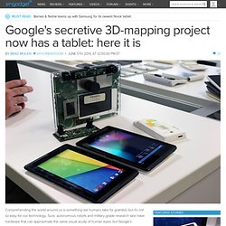
Sure, autonomous robots and military-grade research labs have hardware that can approximate the same visual acuity of human eyes, but Google's Advanced Technologies and Projects (ATAP) division started Project Tango to bring that sort of tech to the masses. Its mission is to make mobile devices capable of using depth sensors and high-spec cameras to craft three-dimensional maps more cheaply and easily than other current efforts.
ATAP announced its first piece of hardware in February, a prototype smartphone equipped with Kinect-like 3D sensors and other components, but the team is now expanding the project to a new form factor: a seven-inch tablet that's packed with a lot more power. This is Project Tango's 3D-mapping tablet See all photos 30 Photos The Tango tablet sees the world through the two cameras and a depth sensor on the back. Comments Share. Kickstarter. Looking Glass is the world's first volumetric printing service.
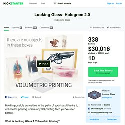
We developed volumetric printing over the past year so that we could bring any 3D scene from digital space into the real world in magazine-resolution color. A bioluminescent jellyfish. An amoeba magnified 100X. A boa constrictor consuming an elephant. This isn't likely something you've seen in 3D object printing or holography before. If you can dream it, now you can hold it in a Looking Glass. Take this translucent frog, for instance (available as one of the Rewards for this Kickstarter). Full Video of Prototype LIDAR Lite on 3D Robotics Drone. LIDAR-Lite by PulsedLight. The founders of PulsedLight, Bob Lewis and Dennis Corey, recognized that there was an unmet need for an optical distance measurement sensor technology that addressed applications where a very small, low-power, high performance, reduced cost optical ranging sensor was required, such as robotics and UAVs.
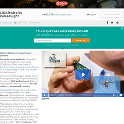
So in 2011 they co-founded PulsedLight, LLC in Bend, Oregon to bring their vision for a new optical ranging sensor technology to market. After more than two years of work, we are ready to introduce our technology in the form of the LIDAR-Lite, a very small form factor, optical distance measurement sensor capable of measuring out to 40 meters using inexpensive, off-the-shelf, electro-optical components. First, a Little Science All optical ranging sensors use the principle of “Time-of-Flight” (ToF) to calculate distance to a target. Autodesk ReCap. Details Published: 27 May 2014 In 2012 Autodesk launched ReCap, a platform for the growing reality capture market.
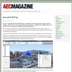
Since then, the company has expanded its capabilities, added a layer of cloud services and recruited third party developers. The manual survey market was revolutionised by the widespread adoption of laser scanners, which can measure millions of 3D points in seconds, building dense point clouds of surfaces. But there remain a number of downsides to the technology. Laser scanners are typically hard to use, expensive and generate huge, unintelligent, process-intensive, files. Autodesk has recognised that the laser scanning software market was ripe for a wider audience, and that it could offer a competitive product and provide tools to enable the conversion of ‘dumb’ scan data to intelligent Building Information Modelling (BIM) models with its ReCap software.
Autodesk’s core AEC products have the ability to handle point cloud data, in addition to BIM geometry. Dotproduct3d.com. Google's Project Tango. Say hello to Project Tango! ATAP Project Tango – Google. Collaborative 3D Scanning with Paracosm and Project Tango. Forge - Abound Labs.