
Policies 2.0
Official Twitter of Policies 2.0 a Global Professional Police Social Network. Changing Police organizations through the social media.
What tutorials are available for Fusion Tables? - Google Fusion Tables Help. Create with Fusion Tables These tutorials step you through using Fusion Tables’ features to accomplish neat things with your data.
See what others have done in the Example Gallery. Basic tutorials Get started using Fusion Tables: Create a map Turn a table of locations into a map. Extending your knowledge. Interesting Web. Google products. Google maps. Maps. Cartography & gps online utilities. 12 Ways To Learn In 2012 (Source : The eLearning Coach) Mapping. Mapping. VARIOUS TOOL. Google Map tools. GPS and Google Maps. GPS and Google Maps. Maps, Missouri Compromise, Slave Act. Data Mapping. Maps, Geolocation. Open Data Kit » Use.
To use ODK, you need to do three things -- design a form, setup a server, and connect the device to that server.
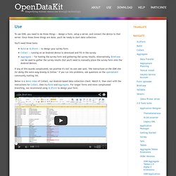
Once those three things are done, you'll be ready to start data collection. You'll need three tools: Build or XLSForm -- to design your survey form.Collect -- running on an Android device to download and fill-in the survey.Aggregate -- for hosting the survey form and gathering the survey results. Alternatively, Briefcase can be used to gather the survey results (but you'll need to manually place the survey form onto the Android device). If any of this sounds complicated, we promise it's not! Below is a demo video of Collect, our Android-based data collection client. Gapminder: Unveiling the beauty of statistics for a fact based world view. Hans Rosling's 200 Countries, 200 Years, 4 Minutes - The Joy of Stats - BBC Four - YouTube.
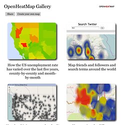
Hans Rosling: Stats that reshape your worldview. Gephi, an open source graph visualization and manipulation software. NodeXL: Network Overview, Discovery and Exploration for Excel - Home. OpenHeatMap Gallery. How the US unemployment rate has varied over the last five years, county-by-county and month-by-month Map friends and followers and search terms around the world House prices for different neighborhoods in Boulder, Colorado A view of over 1,000 data sets from the World Bank, covering health, economic and social statistics for the last fifty years on countries around the world The US Presidential election results by state, starting in 1868.
Create beautiful dynamic data driven maps. Information Is Beautiful. Стилизованные карты - JavaScript API Google Карт (версия 3) Using a styled map, you can customize the presentation of the Google base maps, changing the visual display of such elements as roads, parks, and built-up areas.
Hint: You can use styling to prevent businesses, points of interest and other features from appearing on the map. See the sample for hiding map features with styling. Example The following example styles the map in night mode, using colors that are useful for situations such as giving directions in the dark. For a list of all available values for featureType, elementType and stylers, see the JSON style reference. Info windows - JavaScript API Google Карт (версия 3) Google Maps marker grouping. How to Show/Hide Google Maps Markers by group , and trigger the event from un HTML checkbox? Google Maps JavaScript API Example. Simple icons - JavaScript API Google Карт (версия 3) Too Many Markers! - API Google Карт. Luke Mahe and Chris Broadfoot, Google Geo APIs TeamDecember 2010 Introduction Some applications are required to display a large number of locations or markers.
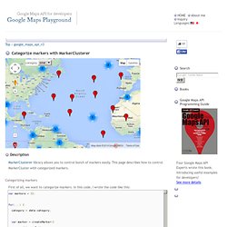
Despite the v3 JavaScript API's significant improvement to performance, naively plotting thousands of markers on a map can quickly lead to a degraded user experience. Too many markers on the map cause both visual overload and sluggish interaction with the map. To overcome this poor performance, the information displayed on the map needs to be simplified. One approach at simplification is to render markers on the server. Categorize markers with MarkerClusterer - Google Maps Playground. Map Data Map data ©2014 Google, INEGI category:
Google map marker sprite image position. Data Visualization. Visual Complexity. Ville Vivante. Le portail des territoires et des citoyens. Your Open Source Compass. Flightradar24.com - Live Flight Tracker! In order to save data consumption Flightradar24 web page times out after 30 minutes.
Please reload the web page to get another 30 minutes. or get a Flightradar24 Premium subscription and Flightradar24.com will not time-out again! GeoCommons. Free Geography Tools. GeoNames. GPS Visualizer. Earth Dashboard. U.S. Geological Survey Earthquake Hazards Program.
Earthquake visualization. Emergency and Disaster Information Service. OpenStreetMap. Thematicmapping.org. Earth Atlas. Maps API Premier - Visualisez vos données. Google Maps API Premier permet aux entreprises d'intégrer facilement des cartes interactives Google Maps à leur site Web public ou interne. Cette API permet à vos clients et à vos équipes de prendre des décisions adaptées, en visualisant des informations importantes sur une carte. Aidez vos clients à vous trouver plus facilement grâce à un outil de localisation.Prenez en compte la dimension géographique lors de vos décisions d'achat, notamment pour des voyages ou des projets d'achats immobiliers.Consultez les actualités et les tendances associées à un lieu.Affichez instantanément des informations sur vos clients, le chiffre d'affaires, les données de veille économique, et évaluez les performances pour un lieu défini.Effectuez le suivi des actifs, des expéditions et des chaînes d'approvisionnement grâce à des représentations visuelles, simples d'utilisation.
Google Map Maker. Google Map Maker officially closed on March 31, 2017, and many of its features are being integrated into Google Maps.
Since 2008, the Google Map Maker community has edited and moderated millions of features to improve the Google Maps experience. To make it easier for all Google Maps users to contribute changes to the map, we’ve started to graduate functionality from Map Maker to Google Maps on both desktop and mobile. 10 Dumbest Google Maps Fails. Image via Googlesystem Google is as essential and ubiquitous in our lives today as mammoths were to our early ancestors.

Hopefully our childrens childrens children will not find Google employees frozen in the Siberian ice. If they do, however, it will be because Google Maps led them there on the way to Rio. And if they do ever manage to unthaw one of these people-sicles, you can bet the newly unfrozen former employee of the big G will gasp out: Walking directions are in Beta!
10 Dumbest Google Maps Fails. How to Create a Google Map with Addresses of your Google Contacts. Learn how to create a Google Map using postal addresses of your contacts that are available inside Google Contacts.
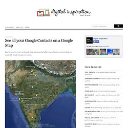
Create a Map of your Google Contacts If you have been using Google Contacts (or any other address book*) to store the postal addresses of your friends and colleagues, you can easily create an online Google Map with all these address or even view them inside Google Earth. Here are the steps: Make a copy of this Google Sheet in your own Google Docs account. From the Google Contacts menu in the sheet, choose Initialize and authorize the script (see source code) to access your Google Contacts. Google Cube: Because you’re dying to play a game about Google Maps. Ever wanted to lead a ball through a maze and learn about Google Maps at the same time?
Me too. Google has released its Google Cube game, to be played once and forgotten. It’s fun to play for novice gamers (see: me) or someone looking to kill some time, but at its core, it’s a promotional vehicle. Snazzy Maps - Color Schemes for Google Maps. Who Made Google's Map Pin? Maps Gallery. Maps Engine. Datos y estadísticas gratis, recopilación de datos, análisis, visualización y opciones para compartir - knoema.com.
World Data Finder. Interactive Colored Maps / Choropleth charts. NatGeo Mapmaker Interactive. Create and view beautifully informative animated maps, for free! StatPlanet - Interactive Maps of World Development. TargetMap - Create & share customized data maps on OpenStreetMap. Free Online Mapping tool. Maps - Casey Trees. Heat maps reveal where you feel emotions in your body. Open Source GIS. MapGuide Open Source. Free and Open Source GIS Software. Which software is for me? Even though most open-source software is freely distributed, your time is limited. So which software should you try first? That depends on what you want to accomplish, the kind of free software you want to deploy and the environment in which you work. The Free GIS FAQ listed below can help you identify the characteristics that are important to you.
If you have more questions you want to see there, another opinion to offer, etc. let meThis e-mail address is being protected from spam bots, you need JavaScript enabled to view it know. The FAQ is followed by an annotated list of free, open-source software. FreeGIS.org. GIS Links. Community Maps Program. Create and share heatmaps using geospatial data. Data visualization and custom maps. Sign up. Custom GIS Mapping Services - Subscriptions, API & Widgets. Community indicator mapping software from InstantAtlas.
InstantAtlas sites use some unobtrusive cookies to store information on your computer. Some cookies on this site are essential, and the site won't work as expected without them. These cookies are set when you submit a form, login or interact with the site by doing something that goes beyond clicking on simple links. We also use some non-essential cookies to anonymously track visitors or enhance your experience of the site. If you're not happy with this, we won't set these cookies but some nice features of the site may be unavailable. To control third party cookies, you can also adjust your browser settings. By using our site you accept the terms of our Cookie Policy. Free World Maps - Regional Maps - Physical maps.
Sponsors <-- Return to Main Free Maps Download Page Exceptionally nice collection of high quality map images from the CIA World Factbook 2008. Below are some low resolution sample images. Click on the links below to access the high resolution maps in jpg and pdf format. Here's a low resolution sample of the Middle-East map with a zoomed in portion below it that was captured from the PDF format map.
Here are a few more zoomed in views. Creating Heat Maps with Bing Maps and Dynamics CRM - Microsoft Dynamics CRM Team Blog. Using the Bing Maps API. Getting started with Bing Maps AJAX Control 7.0. All that is needed to complete the page is a Div with the correct ID and something to call the GetMap function and make everything happen: Getting started with Bing Maps AJAX Control 7.0. How do I set a version 7.0 bing map center to a location. Geocoding a Location.
Geocoding using the Search Manager Class To geocode and reverse-geocode locations, you can use the geocode and reversegeocode methods in the SearchManager Class class. The class reference page provides sample code to show you how. Polymaps. Kartograph.org. ColorBrewer. GeoCommons. Create beautiful dynamic data driven maps. Earth. Scribble Maps : Draw On Maps and Make Them Easily. Wikimapia. House Street City Country. Mapbox. Maps And Mapping. Source Code & Tutorials. Recently, I have released source code for a number of projects. In most cases these projects are released as they were published – while the code is reasonably well-commented, the projects weren’t build specifically to be released and thus may not be shining examples of standards and software architecture.
That said, I hope that these releases will serve as inspiration for you to make some things of your own. If you do end up building something interesting, please let me know.