
Instruments de navigation. Weather Vanes Weather vanes were found on every ship.
They showed the wind direction so the coxswain paid close attention to which direction it pointed after they lost sight of land. But it was easy to be fooled. The wind could change direction and the current could send the ship off course. It was therefore necessary for the skipper to have navigation instruments. Bearing Circle Sunboard Semi-Wheel Seafarers made many observations of the sun all year round and they knew the sun's path through the heavens for all the seasons. They often had to find their way back to previously discovered sights by mere chance, places like Iceland and America. Hadley_octant.htm octant Instruments: Instruments de navigation Période. The Sun compass is essentially a sundial used in "reverse".
Imagine a circular wooden disk about 4 or 4 inches in diameter set level to the ground. From the center rises a thin post or gnomon. When the sun is out, the gnomon casts a shadow on the disk. Were you to mark the position of the tip of the shadow each half an hour, and then connect the points, you would generate an arc. That arc is a recording of the sun's height during the day, at that time of year, at that latitude. [Home | Cross Staff | Back Staff | Chip Log | Altitude Rings | Sandglasses | Quadrants | Hadley Octants | Nocturnals | Traverse Board | Set for USS Constitution | ] Cadrans de navigation ou compas solaires. Navigation terrestre. Instruments de magie - instrument de magie. Navigation Viking. Marlys Henke developed the following multicultural activity for her mathematics class: Background Information: The Vikings were the first of the European seafaring explorers.
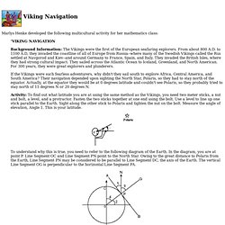
From about 800 A.D. to 1100 A.D, they invaded the coastline of all of Europe from Russia--where many of the Swedish Vikings called the Rus settled at Navgorod and Kiev--and around Germany to France, Spain, and Italy. They invaded the British Isles, where they had strong cultural impact. They sailed across the Atlantic Ocean to Iceland, Greenland, and North American. For 300 years, they were great explorers and plunderers. If the Vikings were such fearless adventurers, why didn't they sail south to explore Africa, Central America, and South America? Activity: To find out what latitude you are at using the same method as the Vikings, you need two meter sticks, a nut and bolt, a level, and a protractor. To understand why this is true, you need to refer to the following diagram of the Earth. Developed by Marlys Henke. The secret of ancient Viking navigation was transparent crystals.
This could also be basis for one hell of a socio-linguistic research.
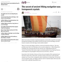
That, what we now call "transparent calcite crystal known as Iceland spar" they called "sunstone". After newer technology outdated the old one, it's use and name steadily vanished. So what else knowledge was known, rationally explained and used - totally common in these days, that, due to different factors, is now forgotten?