
U.S. and World Maps and Puzzles - Free Maps That Teach. US Geography Mega Quiz 1100 varied and interesting questions about the United States.
The questions encourage the player to think and make connections using a map. Printable U.S. State Maps Maps of all of the 50 U.S. states, labeled and unlabeled, for classroom and student use. Online Atlas Maps of the countries of every continent and of every continent. Walk through the Continents - Print Maps Large and Small - Free. Print free maps large or small; from 1 page to almost 7 feet across; PC or Mac.
For classroom and student use. MegaMaps requires Adobe Flash. Free online software—no downloading or installation. Print out maps in a variety of sizes, from a single sheet of paper to a map almost 7 feet across, using an ordinary printer. You can print single page maps, or maps 2 pages by 2 pages, 3 pages by 3 pages, etc. up to 8 pages by 8 pages (64 sheets of paper; over six feet across!). Walk Through The Continents Trace car trips; where grandparents and aunts and uncles and cousins live; the Oregon Trail and the Cumberland Gap; Huck Finn's journey; the Rocky Mountains, the Appalachians, the Mississippi River, the Columbia River and the Colorado, label states… There are any number of ways to use these maps.
. • Print out a multi-page map of the US or the world, and have groups of students assemble it together, like a puzzle. By coloring and writing on the map, students make it “their own”. World History Maps & Timelines. Arizona Geographic Alliance. Skip to Main Content Area n/a Home GeoLiteracy These are lessons from the GeoLiteracy project.
For all the materials you'll need to use a lesson, click on the lesson's name. Right menu AzGA on Facebook Become a Member Donate Arizona Geographic AllianceSchool of Geographical Sciences and Urban Planning | Lattie F. MapMaker Page Maps. ProjectBritain.com - A resource of British Life and Culture in the UK by Woodlands Junior. Knowledge Quest 2013 - Globalmania. Master World Geography in 7 Months or Less Looking for an Easy and Effective way for your students to learn world geography?
Look no further... In an effort to rid the world of geographaphobia, we are pleased to offer our very popular ebook titled GLOBALMANIA: Master World Geography in 7 Months or Less - retail value $14.95 - free of charge. We hope that you take us up on our challenge and enjoy your learning moments together. Grade Level: 3-12 grades To speed up download times, we've broken the Globalmania ebook into two parts for easier download. For best results, especially with the continent maps, use Adobe Reader to open, view and print files.
Geography. Undefined MacBeth's Opinion ...a small shelf in a big world (updated 1-24-05) New!
Click here to Play Geography Games! New! India China (coming soon) Korea (coming soon) Russia (coming soon) Festival Special: Holi. The winter leaves are making way for spring buds.
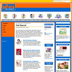
Even the gods are charmed by the friendly mischief of the changing season that the festival of Holi signifies. A children's special on Holi in India and its popularity among children. Articles on Holi customs and myths, cities famous for Holi revelry, e-cards, a Holi quiz and a craft activity on making natural Holi colours. This year Holi falls on March 9-10. Holi- The Colours of Spring. Trailer: My Passport to India. TimeMaps - World History TimeMap. Geography/Cultures. (See Around the World in 80 Days on the “Books to Read” page) (See Junior Classics, Fairy and Wonder Tales on the “Books to Read” page) (See The Book of Missionary Heroes on the “Books to Read” page.
Stories from Africa and the Pacific mostly) World Find maps to print out on the Social Studies/History Page Here are more maps that have more specific areas Create a map M/U show socio/economic data on a map Map Maker Interactive L/M/U National Geographic It’s a map with some cities labeled and then you add the symbols.
Mapmaking vocabulary L Longitude and latitude game L/M Map skills flash M/U Mapmaking Online Game Drag the countries/states to their right place. Games MapStats map concepts and statistics, I haven’t used this, but it looks really cute Games, music, map interactives, quizzes National Geographic Map Puzzles Travel Quizzes Geography Quizzes can choose from specific areas Seterra quizzes — countries, capitals, flags. Country Facts, Photos, Videos, Ecards, Maps, Geography. GeoBee Challenge Game, Geographic Bee Practice, Geography Trivia -
The Difference between the United Kingdom, Great Britain and England Explained. My Wonderful World. My Great Maps. Ictmagic.sharedby.co/share/QPx1Gf. The Traveler IQ Challenge® - USA Challenge.