
Tectonic plates make me genius. What is a flood? Introduction to Flooding Many of us have this idea that floods (or flooding) is simply, too much water around your house.
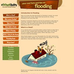
People think that can be fun. Wrong. Flooding is a lot more than that. Flooding is extremely dangerous and has the potential to wipe away an entire city, coastline or area, and cause extensive damage to life and property. What is a flood? It is a natural event or occurrence where a piece of land (or area) that is usually dry land, suddenly gets submerged under water. When floods happen in an area that people live, the water carries along objects like houses, bridges, cars, furniture and even people.
Floods occur at irregular intervals and vary in size, duration and the affected area. It is important to note that water naturally flows from high areas to low lying areas. In this lesson, we shall see more about what causes flooding, the types of flooding, some effects of floods and what we can do before, during and after floods occur. Weather Wiz Kids weather information for kids. Earthquakes(Earthquakes are not associated with weather, but instead are natural disasters.)
What is an earthquake? Earthquakes are the shaking, rolling or sudden shock of the earth’s surface. They are the Earth's natural means of releasing stress. More than a million earthquakes rattle the world each year. The West Coast is most at risk of having an earthquake, but earthquakes can happen in the Midwest and along the East Coast. Click Here to learn more about earthquakes from USGS. What causes an earthquake? Click Here to see an animation of an earthquake. What are plate tectonics? What is a seismograph? Earth's Changing Surface by Alison Peternell on Prezi. World Landforms of the Earth, List of Landforms around the World. Earth's Changing Surface. Timelapse: Landsat Satellite Images of Climate Change, via Google Earth Engine.
TIME and Space | By Jeffrey Kluger Editors note:On Nov. 29, 2016, Google released a major update expanding the data from 2012 to 2016.
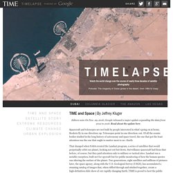
Read about the update here. Spacecraft and telescopes are not built by people interested in what’s going on at home. Rockets fly in one direction: up. Telescopes point in one direction: out. That changed when NASA created the Landsat program, a series of satellites that would perpetually orbit our planet, looking not out but down. Over here is Dubai, growing from sparse desert metropolis to modern, sprawling megalopolis. It took the folks at Google to upgrade these choppy visual sequences from crude flip-book quality to true video footage. These Timelapse pictures tell the pretty and not-so-pretty story of a finite planet and how its residents are treating it — razing even as we build, destroying even as we preserve. Chapter 1: Satellite Story | By Jeffrey Kluger But in 1966, Udall and his staff had an idea. 1 of 20 Aaron Vincent Elkaim / Boreal Collective. Changes on the Earth's Surface. Vibrant Volcanoes ~ Video Segments.
San Francisco Earthquake 1989 PowerPoint. Landforms. Earth's Changing Face Reading A-Z. 433A648F-0257-49A7-AAD7-FA62CC880CDA.