
Maps That Teach: Free U.S. and World Maps and Puzzles. US Geography Mega Quiz 1100 varied and interesting questions about the United States.
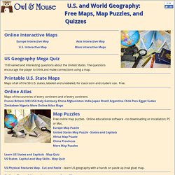
The questions encourage the player to think and make connections using a map. Printable U.S. State Maps Maps of all of the 50 U.S. states, labeled and unlabeled, for classroom and student use. Online Atlas Maps of the countries of every continent and of every continent. Print Free Maps Large or Small Free online software to print outline maps - one page to 7 feet wide. Megamaps - free maps large and small Great for classroom maps. Maps by Place: World: Print World Maps Online Atlas Continents and Regions Maps Continents Map Puzzle World Features Map Puzzle World Monuments Map Puzzle Europe: Online Map of Europe Online Atlas Maps of the Countries of Europe Europe Map Puzzle Print Maps of Europe and European Countries United States: Online Atlas maps of the United States Make Your Own USA Online Map of the United States Printable U.S.
Asia: Africa: North America: Central America and the Caribbean: Mexico: Deciduous Forest Biome. Deciduous forests can be found in the eastern half of North America, and the middle of Europe.
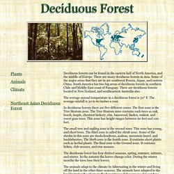
There are many deciduous forests in Asia. Some of the major areas that they are in are southwest Russia, Japan, and eastern China. South America has two big areas of deciduous forests in southern Chile and Middle East coast of Paraguay. There are deciduous forests located in New Zealand, and southeastern Australia also. The average annual temperature in a deciduous forest is 50° F.
In deciduous forests there are five different zones. The small tree and sapling zone is the second zone. The deciduous forest has four distinct seasons, spring, summer, autumn, and winter. The animals adapt to the climate by hibernating in the winter and living off the land in the other three seasons. The plants have adapted to the forests by leaning toward the sun.
A lot of deciduous forests have lost land to farms and towns. By Connie T. 2001 bibliography: nbsp; Bibliography: "World Biomes", 5/1/01" Research: Flash Earth. Research: Islands - National Geographic. An island is a land area completely surrounded by water.
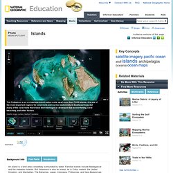
Familiar islands include Madagascar and the Hawaiian Islands. But Greenland is also an island, as is Cuba, Ireland, the United Kingdom, and Manhattan. The Bahamas, Japan, Indonesia, Philippines, and New Zealand are nations made up of islands. A group of related islands, such as the Philippines, is called an archipelago.
There are two types of islands: continental and oceanic. Because of their isolation, many islands are home to unique species. Climate change is also a growing threat to islands. Research: MapMaker Interactive - National Geographic. Welcome to the MapMaker Interactive This tutorial explains how to explore National Geographic Education's interactive GIS mapping tool and tools for customizing outline maps for print.

Use the zoom bar to go from a world view to a local view (or in cartographic terms, from a large scale to a small scale). If you zoom out to a world view, you will see that the map is in a Mercator projection. Use the location menus at the top to zoom from a world view to a continent, country, or other region. Identify your geographic position on the map using the latitude and longitude display at the bottom left. Switch between different styles of base maps including a custom layer from National Geographic, satellite, terrain, and topographic views. Using the 1-Page base map, click on a continent, country, or state to load the corresponding MapMaker 1-Page map.
You can customize and download your 1-Page map, or go back to the interactive map to explore more. Final Project: Glogster EDU. Final Project: Storybird. Final Project: Photo Peach.