
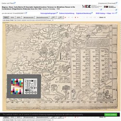
Miasto Darłowo - System Informacji Przestrzennej - e-mapa.net. Geoportal.gov.pl. 25.10.2018 Dane Narodowego Instytutu Dziedzictwa dostępne w geoportalu - Aktualności - Geoportal Krajowy. W serwisie geoportal.gov.pl w sekcji „Dane innych instytucji” została podłączona nowa grupa usług „Narodowy Instytut Dziedzictwa”, w której można zobaczyć: Archeologiczne Zdjęcie Polski – usługa umożliwiająca przeglądanie sekcji arkuszy Archeologicznego Zdjęcia Polski Pomniki Historii (INSPIRE) - usługa umożliwiająca przeglądanie danych dotyczących „Pomników Historii” Rejestrowe zabytki archeologiczne (INSPIRE) - usługa umożliwiająca przeglądanie danych dotyczących „Rejestrowych Zabytków Archeologicznych” Rejestrowe zabytki nieruchome (INSPIRE) - usługa umożliwiająca przeglądanie danych dotyczących „Rejestrowych Zabytków Nieruchomych” Obiekty na liście UNESCO (INSPIRE) - usługa umożliwiająca przeglądanie danych dotyczących „Światowego Dziedzictwa UNESCO” Usługi publikowane są przez Narodowy Instytut Dziedzictwa i oprócz prezentacji graficznej pozwalają na identyfikację obiektów, dzięki czemu można zobaczyć również szersze informacje opisujące poszczególne obiekty.
CRFOP - Wyszukiwanie. Geoserwis GDOŚ. Digital Archive @ McMaster University Library. FBC - Wyniki wyszukiwania. Rügenwalde (Derłów) Pas 31 Słup 23 : skala 1:100 000. Kujawsko-Pomorska Digital Library - Einheitsblatt Nr. 11 [Lanzig-Stolpmünde-Rügenwalde-Stolp] Dzierzłów (Rügenwalde) : podziałka 1:100 000. Rügenwalde. Meßtischblatt 317 (Neue Nr. 1564) - Baltic Digital Library. Title: Subject and Keywords: Publisher: Preuβische Landesaufnahme ; Reichsamt für Landesaufnahme place of the extradition: Berlin.
Index of /m/City_plans/Central_Europe. GaiaLight3. File:Mahdia Crusade 01.jpg. Tableau l'historie de Danemarck et de Suede. Category:Koninklijk Nederlands Aardrijkskundig Genootschap. Polar expedition KNAG, 1882-1883.
The Royal Dutch Geographical Society, or Koninklijk Nederlands Aardrijkskundig Genootschap (KNAG) in Dutch, was founded in 1873 in the Netherlands. The aim of the institute was to increase interest in geography among a general audience. Part of their programme was to gather more geographical knowledge. In 1873 they started building a collection among which were a library and collection of maps and atlases. In those early years the institute had a reputation for organizing expeditions into unknown territories. History of the KNAG collection[edit] Map of Nova Zembla. The library and map collection of the KNAG increased rapidly in size since the founding of the organisation in 1873. Maps of the Netherlands were kept separately and used for research concerning the geography of the Netherlands. Polona. Wikidata:WikiProject Maps/list of maps.
The table lists the current Wikidata items that are instance of (P31) map (Q4006) or its subclasses.
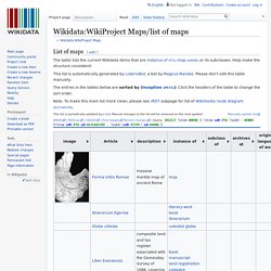
Help make the structure consistent! This list is automatically generated by ListeriaBot, a bot by Magnus Manske. Please don't edit this table manually. The entries in the tables below are sorted by (inception (P571)). FBC - Wyniki wyszukiwania. N:o 20. Ruigenwalde. A: 1638. - Riksarkivet - Sök i arkiven. Projekt CMS. Category:Atlas Ortelius 1571. Category:Old maps of Scandinavia. Category:Old maps of Denmark. File:Tabula hydrographica - no-nb krt 00479.jpg. Category:Maps of the history of Europe by country. Category:Europe in the 15th century. CancelEditDeletePreviewrevert Text of the note (may include Wiki markup) Could not save your note (edit conflict or other problem).
File:Ausbreitung der Hanse um das Jahr 1400-Droysens 28.jpg - Wikipedia.
Das ist der Rom-Weg von meylen zu meylen mit puncten verzeychnet von eyner stat zu der andern durch deutzsche lantt. - Digitale samlinger. Nykiøbing efter Resen [1675?] - Digitale samlinger. Category:Old maps by country. CancelEditDeletePreviewrevert Text of the note (may include Wiki markup) Could not save your note (edit conflict or other problem).
File:Europa 1400.jpg. Category:Maps by year. CancelEditDeletePreviewrevert Text of the note (may include Wiki markup) Could not save your note (edit conflict or other problem).
Please copy the text in the edit box below and insert it manually by editing this page. Category:1529 maps. CancelEditDeletePreviewrevert Text of the note (may include Wiki markup) Could not save your note (edit conflict or other problem).
Please copy the text in the edit box below and insert it manually by editing this page. Upon submitting the note will be published multi-licensed under the terms of the CC-BY-SA-3.0 license and of the GFDL, versions 1.2, 1.3, or any later version. See our terms of use for more details. Dawne Mapy - stare mapy, antyki, kolekcja map, historia kartografii. Digitale Bibliothek - Münchener Digitalisierungszentrum. Cookie barclose This website makes use of cookies to enhance browsing experience and provide additional functionality.
None of this data can or will be used to identify or contact you. This website makes use of third party cookies, see the details in the privacy policy. This website makes use of tracking cookies, see the details in the privacy policy. To learn more about how this website uses cookies or localStorage, please read our PRIVACY POLICY. By clicking Allow cookies you give your permission to this website to store small bits of data on your device.
By clicking Disallow cookies, or by scrolling the page, you deny your consent to store any cookies and localStorage data for this website, eventually deleting already stored cookies (some parts of the site may stop working properly). To learn more about cookies and localStorage, visit Information Commissioner's Office. To disable all cookies through the browser, click on the corresponding icon and follow the instructions: Drogi handlowe w Polsce w wiekach średnich i w. XVI. UMedia Viewer. Category:Cosmographia Claudii Ptolomaei Alexandrini. CancelEditDeletePreviewrevert Text of the note (may include Wiki markup) Could not save your note (edit conflict or other problem).
Please copy the text in the edit box below and insert it manually by editing this page. Category:Insularium Illustratum. Cancel Edit Delete Preview revert Text of the note (may include Wiki markup) Could not save your note (edit conflict or other problem). Please copy the text in the edit box below and insert it manually by editing this page.
Upon submitting the note will be published multi-licensed under the terms of the CC-BY-SA-3.0 license and of the GFDL, versions 1.2, 1.3, or any later version. See our terms of use for more details. Brbl-dl.library.yale. Alvin - IIPMooViewer 2.0 - 6964.jp2. File:Kunyu Wanguo Quantu (坤輿萬國全圖).jpg. File:Carta Marina by Antony Lafreri, 1572.jpg. Carta Marina - A Map of Scandinavia drawn in 1539 by Olaus Magnus, Featuring Sea Monsters and Magnificent Ships[1800x1232] : MapPorn. Ciekawe mapy z różnych epok - Dziwowisko. Mapy archiwalne Polski i Europy Środkowej. [Europa]. Europa w 1360 r. - Wirtualny Atlas Historyczny - Historia. Euratlas Periodis Web - Map of Europe in Year 1400. Kroniki Historyczne: Mapy.
Polska na mapie z 1300 roku - Mapa z Hereford - Eloblog. EasyZoom. Mapa średniowiecznych szlaków handlowych - Eloblog. Tak rok po roku zmieniały się granice państw w Europie - Eloblog. Dokładna stara mapa Europy z 1644 roku - Eloblog. Dokładna stara mapa Europy z 1644 roku. Szczegółowa mapa Polski z 1771 roku - Eloblog. Szczegółowa mapa Polski z 1771 roku Bardzo szczegółowa mapa Polski z 1771 roku autorstwa Jana Babireckiego. Granice i terytorium Rzeczypospolitej Obojga Narodów tuż przed przeprowadzeniem I rozbioru Polski, który miał miejsce w roku 1772. Niezwykła portugalska mapa świata z 1502 roku - Eloblog. Niezwykła portugalska mapa świata z 1502 roku Zobacz niezwykłą mapę świata pochodzącą z początków XVI wieku, sporządzoną przez Portugalczyków w erze wielkich odkryć geograficznych. Portugalska mapa świata, przedstawiająca Europę, Afrykę i szczątkowo obie Ameryki.
Mapa pochodzi z 1502 roku i wykradziona została z Portugalii przez włoskiego szpiega Alberta Cantino. Portugalska mapa świata i włoski szpieg. DMMapp - Digitized Medieval Manuscripts App. What is the DMMapp? The DMMapp is an open source app that links to digital repositories containing digitized western medieval manuscripts from all over the world. Finding digitized repositories can be difficult, and we want to create a central hub that can help medievalists, codicologists, and enthusiasts to find the medieval manuscripts they are searching for. Who made the DMMapp? The DMMapp is a project by Giulio Menna, MA, and Marjolein de Vos, MA. We are the Sexy Codicology Team. Kartografia morska i krain nadmorskich. Kartografia morska i krain nadmorskich / - Katalog publikacji pracowników Uniwersytetu Szczecińskiego - BAZA PUBLIKACJI PRACOWNIKÓW US - UNIWERSYTET SZCZECIŃSKI.
Wyszukane mapy. Archiwum Map Zachodniej Polski. Gmina Darłowo. FREE&FUN. Niezwykła stara mapa Polski z 1570 roku - Eloblog. Gmina Darłowo. Kort & Atlas. Maps and views - The British Library. Erik af Pommern og Viborg.