
CartoMundi - Accueil. La participation à l'annuaire de CartoMundi est ouverte à tous les établissements qui conservent, commercialisent ou produisent des documents cartographiques.
Ses données sont publiques, elles sont accessibles en ligne à travers le portail des cartothèques. Cette participation est gratuite, les partenaires peuvent se retirer de l'annuaire à n’importe quel moment. Pour devenir partenaire, la procédure est la suivante : 1. Demander la création d’un compte * Cocher les cases « Accepter ces conditions » et « Demande d’inscription », en bas de cet écran. * Remplir le formulaire « Demande de partenariat » puis l’envoyer en cliquant le bouton « Soumettre » Cette étape prend seulement quelques minutes. Maps for the world. Maps for the world. Le Souk Vrac OneDrive. Scanned maps, scales 1:50,000 to 1:125,000. RED. Scanned maps, scales 1:200,000 to 1:253,440. RED. Army Map Service. Army Map Service Topographic Map Series Index to U.S.
Army Map Service Topographic Maps in Google Earth [KMZ] Africa, 1:1:000,000, Great Britain. War Office. General Staff. Includes Parts of Pakistan, Nepal, Bhutan and all of East Pakistan [Bangladesh]. Indochina and Thailand, Series L509, 1:250,000, U.S. Includes Algeria, Egypt, Libya, Morocco and Tunisia. Aeronautical Charts. These maps are for historical and reference use and are not for navigational use.

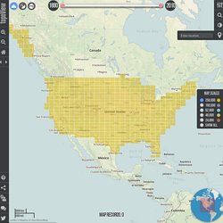
Topographic Maps. U.S.
Topographic Maps - 1:250,000 Scale Africa, Americas, Asia, Europe, Pacific and United States. Russia Joint Operations Graphic. Russia, Joint Operations Graphic 1:250,000 [Not for navigational use] U.S.
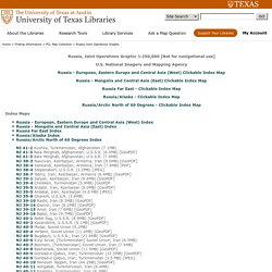
National Imagery and Mapping Agency Russia - European, Eastern Europe and Central Asia (West) Clickable Index Map Russia - Mongolia and Central Asia (East) Clickable Index Map Russia Far East - Clickable Index Map Russia/Alaska - Clickable Index Map Russia/Arctic North of 60 Degrees - Clickable Index Map. Asia 1:1,500,000. WIG Map Archive (English) - German maps 1919-1945. This page shows German maps, mostly of Poland and other Central and Eastern European Countries.
The main mapping organization in Germany was Reichsamt für Landesaufnahme (1921– 1945) which took over from the Königlich Preußischen Landesaufnahme, disbanded with the end of World War 1. Please Note: some files can be quite large, up to 90 Mb; try NOT to open the scans by clicking on the link (usually map name) with left button of your mouse. Unless you have plenty of RAM and a fast processor, you can expect your Internet Explorer or Firefox to “hang” and a browser is not a good program for viewing maps anyway. We recommend that you download the file(s) on the computer first: click on the file with the RIGHT mouse button and you will see a list of options - then choose “save link as..”, or “Save target as…”.
This will open a window to show where on your computer to download the file. The scans below also include maps created or co-made by the following German bodies: • OKH/Gen St d. Mapy archiwalne Polski i Europy Środkowej. USGS Viewer. Ready to explore topoView features in more detail?
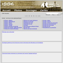
Check out our detailed help guides or our quick start video. Have a question? If you can't find an answer email us. We're here to help. – Click to zoom in or hold shift key and click-drag the mouse (shortcut +). – Click to zoom out (shortcut -). – Click to zoom to the initial full extent of the viewer. – Toggle between previous and current map extents. – Share your maps with others (URL link opens to current map extent). – Shows your current position based on Geolocation API. – Visit our twitter page. – Instantly zoom to a location by entering a city, zip code, address, or lat/long pair. – Use the slider to adjust the opacity of the map boundaries. UCT Libraries Digital Collections. UWM Libraries Digital Collections. 1886 - Collections patrimoniales numérisées de Bordeaux Montaigne.
2336 résultats Cartes : accès par aires géographiques [Portulan de la Gironde] Sondages généraux de la Garonne et de la Gironde entre Bordeaux et St-Estèphe Carte des dunes anciennes ou primaires de l'ancien Captalat de Buch Carte du Bassin d'Arcachon Dignes Mapa de la Republica Argentina [échelles hydro] Date d'édition : 1909 Emplacement : Amérique du sud Mapa de la Republica Argentina [stations météo] Mapa de la Republica Argentina [relief et hydro] Mapa de los ferro-carriles de la Republica Argentina Mapa de la republica Argentina Date d'édition : 1932.
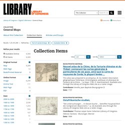
Library of Congress General Maps. Map Theatrum orbis terrarum.
Theatrvm orbis terrarvm Relief shown pictorially. Colophon: 20 Mai 1570. Catalogus auctorum includes 87 names.