
Collection: CIA Cartography. National Geographic. Maps of Africa. Chronicling America. LoC: Maps of America List v.2. Harvard Map Collection. The Harvard Map Collection is one of the oldest and largest collections of cartographic materials in the United States with over 500,000 items.
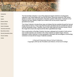
Resources range from 16th century globes to modern maps and geographic information systems (GIS) layers. A selection of our materials has been digitally imaged and is offered both as true picture images and georeferenced copies. This Virtual Collection includes those maps and atlases that are available through the Harvard Image Delivery Service. Those maps that have been georeferenced are available through the Harvard Geospatial Library. Therefore, many of the maps listed will have two records, one for the image that is true to the original and the other a georeferenced image.
Only a small portion of the Map Collection has been cataloged and included in Hollis and an even smaller selection are included in this virtual collection as digital images. NYPL: Maps. Archaeological Sites. Atlas of the Historical Geography of the United States. A spectacular historical atlas refashioned for the 21st century Here you will find one of the greatest historical atlases: Charles O.
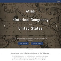
Paullin and John K. Wright's Atlas of the Historical Geography of the United States, first published in 1932. This digital edition reproduces all of the atlas's nearly 700 maps. Many of these beautiful maps are enhanced here in ways impossible in print, animated to show change over time or made clickable to view the underlying data—remarkable maps produced eight decades ago with the functionality of the twenty-first century. hide introductory video next Old Atlas, New Functionality Georectified Maps Most maps in the atlas have been georectified, warped so that they can be placed consistently on top of a digital map.
Navigating the Atlas For most maps in the atlas click on georectified ⇆ plate to toggle back and forth between views of the georectified maps and how they look in the printed atlas. GLOBAL MIDDLE AGES. Coast Survey's Historical Map & Chart Collection. About this Collection - Civil War Maps. Brings together materials from three premier collections: the Library of Congress Geography and Map Division, the Virginia Historical Society, and the Library of Virginia.
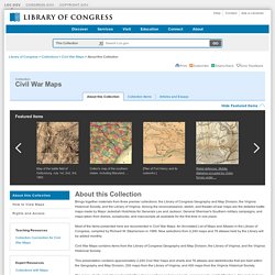
Among the reconnaissance, sketch, and theater-of-war maps are the detailed battle maps made by Major Jedediah Hotchkiss for Generals Lee and Jackson, General Sherman's Southern military campaigns, and maps taken from diaries, scrapbooks, and manuscripts all available for the first time in one place. Most of the items presented here are documented in Civil War Maps: An Annotated List of Maps and Atlases in the Library of Congress, compiled by Richard W. Stephenson in 1989. New selections from 2,240 maps and 76 atlases held by the Library will be added monthly. History of Cartography: Volumes One, Two, and Three. Historypin. DMMapp - Digitized Medieval Manuscripts App. What is the DMMapp?

The DMMapp is an open source app that links to digital repositories containing digitized western medieval manuscripts from all over the world. Finding digitized repositories can be difficult, and we want to create a central hub that can help medievalists, codicologists, and enthusiasts to find the medieval manuscripts they are searching for. Who made the DMMapp? The DMMapp is a project by Giulio Menna, MA, and Marjolein de Vos, MA.
We are the Sexy Codicology Team. Digital Atlas of the Roman Empire. USGS Historical Topographic Map Explorer. Herodotus Timemap. Book 1, Ch. 1 This is the display of the inquiry of Herodotus of Halicarnassus, so that things done by man not be forgotten in time, and that great and marvelous deeds, some displayed by the Hellenes, some by the barbarians, not lose their glory, including among others what was the cause of their waging war on each other.The Persian learned men say that the Phoenicians were the cause of the dispute.
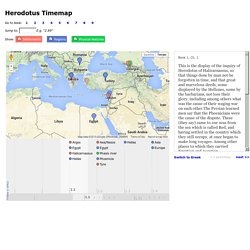
These (they say) came to our seas from the sea which is called Red, and having settled in the country which they still occupy, at once began to make long voyages. Among other places to which they carried Egyptian and Assyrian merchandise, they came to Argos,which was at that time preeminent in every way among the people of what is now called Hellas. PELAGIOS. Historic Map Works, Residential Genealogy ™ Old Maps Online. David Rumsey Historical Map Collection.