
Planetary. Astronomy. SCIENCE. Earth from Space. Earth From Space. Earth From Space PBS Airdate: February 13, 2013 NARRATOR: Our planet: Earth—you may think you know it well, but a startling new picture is emerging of a world shaped by forces more dynamic and intertwined than we ever imagined, raising possibilities that defy common sense.

How can sandstorms in the Sahara Desert transform the Amazon rainforest, over 5,000 miles away? In the frigid ocean beneath Antarctica, how can a vast undersea waterfall, 500 times bigger than Niagara Falls, lead to a gigantic feeding frenzy near the equator? And how can warm water, streaming past the coast of Africa, trigger a weather catastrophe, half a world away, in the southern United States? Scientists have begun to find surprising answers to these and other profound questions, thanks to a network of satellites, orbiting high above the earth.
EMILY SHUCKBURGH ( British Antarctic Survey): It’s really the last bastion of human discovery. Smithsonian Institution. S Earth Observing System. NASA Visible Earth: Home. Visible Earth: Browse by Sensor. View from Satellite. NASA Earth Observatory : Home. Images of Earth. My List Addition Date Target Mission Instrument Size TIFF (2.051 MB) JPEG (118.7 kB) TIFF (10.32 MB) JPEG (442.7 kB) TIFF (2.905 MB) JPEG (93.08 kB)
MODIS Website. MODIS Website. MODIS Website. Moon View. Lunar Eclipse Pictures: See Last Weekend's Red Moon. Total Lunar Eclipse This Weekend—Last One Until 2014. This weekend sky-watchers across most of the globe will have the chance to watch at least some of the last total lunar eclipse until 2014.
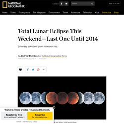
The entire lunar eclipse will be visible in East Asia, Australia, and the far western portion of North America that includes Alaska and Canada's Yukon and Northwest Territories. The spectacle will last nearly three and a half hours, starting on Saturday at 4:45 a.m. Pacific Time. Totality—when the full moon will be completely blocked from direct sunlight—will start at 6:05 a.m. PT and last until 6:57 a.m. Part of the eclipse will be visible in Europe and Africa at moonrise, in the evening, said Raminder Singh Samra, an astronomer at the H.R.
"Meanwhile, observers across the Pacific region of North America will get to see the sky show low in the western horizon at moonset, in the early morning," he said. Craters Screen Saver for Windows. By John Walker What better way to protect your monitor's phosphor than by smashing rocks into it at dozens of kilometres per second?
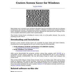
This directory contains a Windows screen saver named “Craters” which simulates cratering of initially flat terrain, obeying the same power-law relating crater size to number observed on airless solar system bodies. The Craters Screen Saver, including its source code, is in the public domain. You can do anything you like with it. Downloading and Installation Versions of the Craters Screen Saver are available for both 16-bit and 32-bit windows. After you've downloaded the program archive, extract the contents with Info-ZIP or a compatible archive extract program, and copy the CRATERS.SCR file to your Windows directory (usually C:\WINDOWS). . Lunar Reconnaissance Orbiter . Calendar Dates. Global Maps.
Earth. GLOBAL CLIMATE CHANGE from JPL Your planet is changing.
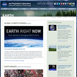
We're on it. Our planet is changing. Through the gradual build-up of more greenhouse gases in the atmosphere, Earth is warming. As Earth warms, ocean waters expand and ice melts to make sea levels rise. Click here to see how your planet is changing. EARTH IMAGES from the JPL Photojournal NASA Spacecraft Sees Stark Effects of California Drought on Agriculture Stark effects of a California drought on agriculture can be seen clearly in these two February images acquired by NASA's Landsat 8 in 2014 (left) and NASA's Terra spacecraft in 2003 (right). Read more | | More Earth images Explore Earth satellites in 3D "Eyes on the Earth" is a 3-D visualization experience that lets users "fly along" with NASA's fleet of Earth science missions and observe climate data from a global perspective in an immersive, real-time environment. View interactive. An Ancient Universe - Earth.
Earth Now. Orbiting Earth 101: What You’d See / What You’d Do. “I saw for the first time the earth’s shape.
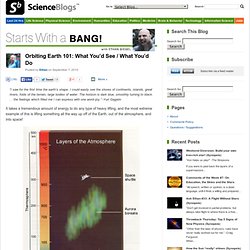
I could easily see the shores of continents, islands, great rivers, folds of the terrain, large bodies of water. The horizon is dark blue, smoothly turning to black. . . the feelings which filled me I can express with one word–joy.” -Yuri Gagarin. Earth Day from Space. There are many ways to celebrate Earth Day, from sustainability efforts (and check out our new blog, Guilty Planet) to simply appreciating nature.
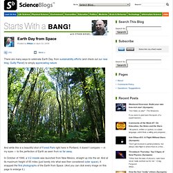
And while this is a beautiful shot of Forest Park right here in Portland, it doesn’t compare — in my eyes — to the perfection of Earth as seen from so far away. In October of 1946, a V-2 missile was launched from New Mexico, straight up into the air. And at its maximum height of 65 miles (just barely into what was then considered outer space), it snapped the first photographs of the Earth from Space.
(And you can click every image on this page to enlarge it.) It wasn’t until Apollo 8, 22 years later, that the first color photograph of Earth was taken. And now, in the 21st Century, we’ve got a myriad of satellites, shuttles, spacecraft and rockets to choose from if we want to photograph the Earth. While, on the other side of the Earth, the United States’ Space Shuttle photographed this shot of the Aurora Borealis in 2007. That’s us, folks.
Astronaut's View. The Gateway to Astronaut Photography of Earth. Lunaria. Calendrica. Almanacs.