
Untitled. GIS (Geographic Information System) can capture and store information, and allows the display of different types of information in one map.
GIS is the technology behind Google Maps. GPS stands for Global Positioning System, a navigation system that uses satellites to look at location, weather, traffic and more. In May 2014, the White House announced through its ConnectEd initiative that ArcGIS Online mapping software, one of the most popular, would be available free to K-12 schools. Through this program you can see how teachers in Virginia are using crowdsource data to learn about birds and environmental connections, how Oklahoma students are measuring and mapping a community walking path, and how students in New Hampshire are measuring the depth of a local lake to calculate volume and look at different conditions and their impact on the watershed.
Dataset Gallery. PowerKnowledge Earth & Space Science. Hunger & Poverty in the United States. StudyJams! Science Activities. Games & Simulations - Weather, Climate, Atmosphere. Skip to main content Games & Simulations - Weather, Climate, Atmosphere You are here Home This page is a directory of educational games, simulations, and virtual labs related to Weather, Climate, Atmospheric Science, and the Sun and Space Weather.
This list is a subset of a collection of links to games, simulations, and virtual labs that span a larger range of STEM (Science, Technology, Engineering & Math) education topics. Lesson Plan Six. Hand out the Student Data Sheet: World Climates (Frost-Free Days).
Have students locate the approximate latitudes of the six continents. Explain the physical relationship between latitude and climate. Generally speaking, the farther one travels both north or south of the Equator, the cooler the climate will become. Hand out the blank Student Information Sheet: Origin of the Modern Summer Games and have students fill in the "Physical Geography" column for each country, using the world climate map and a topographical map of the world's countries. GraphicMaps. Teaching with Maps. By Phil Nast, retired middle school teacher and freelance writer Found In: language arts & literature, math, science, social studies, preK-2, 3-5, 6-8, 9-12 Lessons & Activities Lesson Plans Introduction to Latitude and Longitude Students in grades K-2 look at lines of latitude and longitude on a map of the U.S. and discuss why the lines are helpful.
Hurricane Harvey: What’s in the path? - Washington Post. Endonym Map: World Map of Country Names in Their Local Languages. As the World Turns- A Lesson on Maps for Kids - Kids Discover. RTimages/Shutterstock How we view the world helps shape the view we have of others and ourselves.
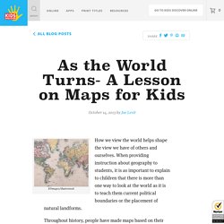
When providing instruction about geography to students, it is as important to explain to children that there is more than one way to look at the world as it is to teach them current political boundaries or the placement of natural landforms. Throughout history, people have made maps based on their limited knowledge and their own preferences. For Students Grades 5-8: NASA Knows. Teacher Packet - What do Maps Show? - Home/Index Page. What Is Topography? United Nations Geospatial Information Section Web Site.
LINKS TO OTHER WEB SITES: This is the United Nations Geospatial Information Section web site.
Links to other sites are provided for information only. The inclusion of these links and their content does not imply official endorsement or approval whatsoever by the United Nations. DESIGNATIONS USED: The depiction and use of boundaries, geographic names and related data shown on maps and included in lists, tables, documents, and databases on this web site are not warranted to be error free nor do they necessarily imply official endorsement or acceptance by the United Nations. COPYRIGHT NOTICE: Unless otherwise noted, the maps included on this web site are produced by the Geospatial Information Section and are copyrighted by the United Nations. Reproduction of any part without the permission of the copyright owner is unlawful.
Middle Eastern Map. The World Factbook. The Office of Public Affairs (OPA) is the single point of contact for all inquiries about the Central Intelligence Agency (CIA).
We read every letter, fax, or e-mail we receive, and we will convey your comments to CIA officials outside OPA as appropriate. However, with limited staff and resources, we simply cannot respond to all who write to us. Contact Information. Maps of political trends & election results. Europe Maps. Europe Maps The PCL Map Collection includes more than 250,000 maps, yet less than 30% of the collection is currently online.
A $5, $15, or $25 contribution will help us fund the cost of acquiring and digitizing more maps for free online access. The True Size. All maps are wrong. I cut open a globe to show why. Decadal Change in Groundwater Quality : NAWQA. NAWQA Annual Reports. 5 Types of Stories Students Can Tell With Digital Maps. When most teachers hear or read about Google Maps, Google Earth, ESRI, and other digital mapping tools they tend to think about social studies topics.
While digital mapping tools are perfectly suited to social studies lessons, they can also be used in other subject areas including math, language arts, and science. Here are five types of stories that students can tell with digital mapping tools. Teacher and the Rockbots - Cities, States, Countries & Continents. Song online and lyrics. Lyrics to world geography and social studies songs. Teacher and the RockbotsWORLD Lyrics Switch to lyrics with without answers Continents - Song Sample - © 2006 Smart Kid Publishing, ASCAP Seven continents connect the People of the World Seven continents connect the People of the World.
Continents and Oceans. Interactive map. USA: states quiz. Reach the World's GeoGames: The New Way to Teach GeoGraphy. Pokemon GO: What Education Should Be - TechNotes Blog - TCEA. This blog was updated on August 6, 2016 to include new resources. I admit it. I’m addicted to Pokemon GO. It’s not something that I expected to happen. (After all, I’m not really their prime demographic audience!) Six maps that will make you rethink the world. We don’t often question the typical world map that hangs on the walls of classrooms — a patchwork of yellow, pink and green that separates the world into more than 200 nations. But Parag Khanna, a global strategist, says that this map is, essentially, obsolete. Khanna is the author of the new book “Connectography: Mapping the Future of Global Civilization,” in which he argues that the arc of global history is undeniably bending toward integration. Instead of the boundaries that separate sovereign nations, the lines that we should put on our maps are the high-speed railways, broadband cables and shipping routes that connect us, he says.
Schools around the world. Old Maps Online. Middle East Interactive Map. Interactive Map-Rethinking Schools. Maps-Slideshare. Map that Named America. Primary Source Map Set-Library of Congress. Globe Game LP-Education World. Subjects Social Studies --Geography Grade K-23-56-89-12 [facebookbadge] Brief Description Map game challenges students to develop geography skills.
Mapping Landforms. 1. Discuss different kinds of landforms. Project the Landforms map and invite volunteers to point to the different landforms, name them, and read the descriptions. Show the photo gallery with examples of these landforms around the world. Ask students to describe experiences they have had of being near any of these landforms, or seeing them in a movie, in photos, or on a map. 40 Maps That Will Help You Make Sense of the World. If you’re a visual learner like myself, then you know maps, charts and info graphics can really help bring data and information to life. Maps can make a point resonate with readers and this collection aims to do just that. Hopefully some of these maps will surprise you and you’ll learn something new. A few are important to know, some interpret and display data in a beautiful or creative way, and a few may even make you chuckle or shake your head. If you enjoy this collection of maps, the Sifter highly recommends the r/MapPorn sub reddit.
You should also check out ChartsBin.com. MapCarte 289/365: The Molucca Islands by Petrus Plancius, 1594. The Babylonian map of the world sheds light on ancient perspectives. Make a Contour Map.