
Tour Builder. TargetMap - Create & share customized data maps on OpenStreetMap. Free Online Mapping tool. Ancient Earth globe. This visualization is created and maintained by Ian Webster.

See more of my work at ianww.com or email me at ian@dinosaurpictures.org. Click here to subscribe to occassional email updates when we add something interesting to this visualization such as new dinosaur or plate tectonic data. Plate tectonic and paleogeographic maps by C.R. Scotese, PALEOMAP Project. For more information visit: & www.globalgeology.com. Some elements of this visualization are not adjusted for time (eg. cloud and star positions). Quizzity - a geography game. Cube. METRO MAP CREATOR. If you have the code for a map please paste it into the box below, then click "LOAD"LOAD CODE Alternatively you can chose a sample route.DefaultPoo Land Here is the code for your map.

Copy this code to a text file on your computer if you want to carry on with your map at a latter date. SAVE AS IMAGE (low res)Quickly save the map at a low resolutionQUICK SAVEWhen the image appears, right click it and chose save SAVE AS IMAGE (high res)To save at a high resolution follow these steps...Firstly before doing anything else, copy the code above into the clipboard.Once you have done this THEN click here. Catálogo Colectivo de la Red de Bibliotecas de los Archivos Estatales > Mapas, Planos y Dibujos. OmnesViae: Roman Route Planner- Tabula Peutingeriana and Itinerarium Antonini. Harvard Map Collection. The Harvard Map Collection is one of the oldest and largest collections of cartographic materials in the United States with over 500,000 items.
Resources range from 16th century globes to modern maps and geographic information systems (GIS) layers. A selection of our materials has been digitally imaged and is offered both as true picture images and georeferenced copies. This Virtual Collection includes those maps and atlases that are available through the Harvard Image Delivery Service. Those maps that have been georeferenced are available through the Harvard Geospatial Library. Therefore, many of the maps listed will have two records, one for the image that is true to the original and the other a georeferenced image.
Only a small portion of the Map Collection has been cataloged and included in Hollis and an even smaller selection are included in this virtual collection as digital images. National Geographic. Collection: CIA Cartography. Coast Survey's Historical Map & Chart Collection. NYPL: Maps. Old Maps Online. David Rumsey Historical Map Collection. David Rumsey Historical Map Collection. Old Maps Online. Historical Maps. OpenStreetMap.
El mundo de 1000 años en Europa mapa 1000-2000. World History Maps & Timelines. Blank map of the world country. - Blank map speciality shop. Walk through the Continents - Print Maps Large and Small - Free. Print free maps large or small; from 1 page to almost 7 feet across; PC or Mac.
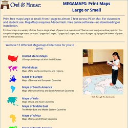
For classroom and student use. MegaMaps requires Adobe Flash. Free online software—no downloading or installation. Print out maps in a variety of sizes, from a single sheet of paper to a map almost 7 feet across, using an ordinary printer. You can print single page maps, or maps 2 pages by 2 pages, 3 pages by 3 pages, etc. up to 8 pages by 8 pages (64 sheets of paper; over six feet across!). Walk Through The Continents Trace car trips; where grandparents and aunts and uncles and cousins live; the Oregon Trail and the Cumberland Gap; Huck Finn's journey; the Rocky Mountains, the Appalachians, the Mississippi River, the Columbia River and the Colorado, label states… There are any number of ways to use these maps. . • Print out a multi-page map of the US or the world, and have groups of students assemble it together, like a puzzle. By coloring and writing on the map, students make it “their own”. CartaBCN. Direcció: La carta Històrica de Barcelona es un projecte ideat i desenvolupat pel MUHBA Direcció del científica: Joan Roca Albert Direcció d’aixecaments cartogràfics: Manel Guàrdia Bassols i Joan Roca Albert Supervisió de cartografies: Ramon Pujades Bataller Gestió d’imatges i documentació: Carme García Soler, Marta Iglesias Urbano.
La Evolución de los mapas a través de la historia. Historia con Mapas - Atlas & Maps. Rediscover the world as you've never seen it before. Carta Arqueològica de Barcelona. Diccionaris cartogràfics. A-Train, n m constel·lació de la tarda, n f sin. compl.
Tren de la tarda, n m sin. compl. Es A-Train es constelación de la tarde sin. compl. Es tren de la tarde sin. compl. En A-Train en Afternoon constellation sin. compl. En Afternoon Train sin. compl. <Teledetecció > Sèries i constel·lacions> Constel·lació formada pels satèl·lits Aqua, CloudSat, CALIPSO, Aura, GCOM-W1 i OCO-2, que orbiten molt pròxims els uns als altres, destinada a proveir dades de les propietats dels aerosols i dels fluxos radiatius dels núvols i l'estat atmosfèric general per a quantificar, de manera acurada, aquestes propietats. Fem pública la cartografia secreta de Catalunya – gencat blog. Com ha canviat el territori català en els darrers 70 anys, com s’ha urbanitzat el territori, com han avançat les ciutats i s’han multiplicat els ports?
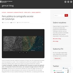
Ara ho podrem saber més enllà de la memòria dels nostres avis («quan jo era jove, tot això eren camps»). L’Institut Cartogràfic i Geològic de Catalunya (ICGC) ha posat en marxa una aplicació web, el Comparador històric del territori, per comparar imatges aèries de 1945 amb l’actualitat i extreure-les en format GIF. Pixelis Maps · Buscador de coordenadas GPS. GeaMap. ICGC - Vissir3. 20 km VISSIR v3.17 Veure i comparar Comparar amb...
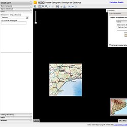
Capes addicionals Cerca. Com realitzar un mapa amb Mymaps de Google? InstaMaps. Catalunya: l'ull del temps. Galeria de mapes InstaMaps. Rediscover the world as you've never seen it before. Story Maps. PINTAMAPS MÓN. Sign up. Old Maps Online.