

US State Names. Britain from Above. Online Interactive Maps - Maps of all continents and U. S. Maps: Interactive Atlases, Continent and Country Maps, Print Maps, Resources. MapMaker Interactive. Old-Maps - the online repository of historic maps - home page.
Earth. World Map. Geography. Geography. Beach Destinations in the Philippines. “Don’t you get tired of beaches?”
It’s a question that foreign friends have asked me more than a few times upon learning that I come from an archipelago of 7107 islands. “No, not really” is what I usually answer. Beach fatigue is possible especially if you’re constantly traveling around the Philippines, hopping from one island to another. Yes, most beaches look similar — white or gray sand beach gently sloping down into turquoise water. Sometimes there’s a mountain towering in the background. But sometimes, you find beaches that feature a little something — natural or manmade — that makes it more captivating and sets it apart from the rest. 1. Yes, pink! In the pink! World Factbook. People from nearly every country share information with CIA, and new individuals contact us daily.
If you have information you think might interest CIA due to our foreign intelligence collection mission, there are many ways to reach us. If you know of an imminent threat to a location inside the U.S., immediately contact your local law enforcement or FBI Field Office. For threats outside the U.S., contact CIA or go to a U.S. Embassy or Consulate and ask for the information to be passed to a U.S. official. Please know, CIA does not engage in law enforcement. In addition to the options below, individuals contact CIA in a variety of creative ways. If you feel it is safe, consider providing these details with your submission: Your full name Biographic details, such as a photograph of yourself, and a copy of the biographic page of your passport How you got the information you want to share with CIA How to contact you, including your home address and phone number.
African Countries. Go Somewhere. Beautiful Places. Life By rosey | What most of us living in the U.S. don’t know is that this country is actually a great place to travel around, because it offers tons of stunning scenery.

The United States is one of the most visited countries in the world for good reasons. NationMaster - World Statistics, Country Comparisons. Maps Of War. Ancient Maps Cover Page. Fantastic Maps. I’ve been asked a few times recently about how I draw isometric buildings.
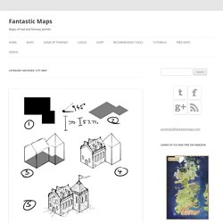
Here’s the run down. Continue reading One of the wonderful side effects of living in New York is the chance to run into great people from Tor.com. I’m now part of a semi-regular D&D game, and I draw the party dungeon maps. Continue reading City maps are complex beasts. Continue reading It’s good to hand over final pieces. The featured locations were all drawn at many times their final size. Washington. If you’re planning for a memorable Washington adventure this summer, here’s 15 jaw dropping views around the state to add to your itinerary: Beaver Falls – This charming waterfall can be found on the Olympic Peninsula Waterfall Trail!
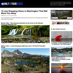
Alpine Lakes – A stunning large wilderness area in the North Cascades Range. North Cascades Highway, also known as Washington State Route 20 – A great scenic route if you’re looking for a wondrous view! GeographyIQ - World Atlas - Home Page. Explorer. Make new discoveries about your neighborhood with Census Explorer, the U.S.
Census Bureau’s interactive map series. Census Explorer: Young Adults: Then and Now Edition Do more young adults today in your area live with their parents than in previous decades? Do more own their own homes? This edition looks at multiple characteristics of the population age 18-34 in 1980, 1990, 2000 and today (using 2013 American Community Survey 5-year data). Census Explorer: Population Estimates Edition Explore the latest population estimates for states and counties by age, race, and Hispanic origin.
Census Explorer: Retail Edition County Business Patterns includes statistics on retail trade in America, including the growing online market. Census Explorer: People, Education and Income Census Explorer: Commuting Edition How have our commutes changed since 1990? Q&As Which boundaries does Census Explorer use for the maps? How do you define the “tech” jobs in the People, Education and Income Edition? Map Collections. The Library of Congress Search by Keyword | Browse by Geographic Location Index | Subject Index | Creator Index | Title Index The Geography and Map Division of the Library of Congress holds more than 4.5 million items, of which Map Collections represents only a small fraction, those that have been converted to digital form.

The focus of Map Collections is Americana and Cartographic Treasures of the Library of Congress. These images were created from maps and atlases and, in general, are restricted to items that are not covered by copyright protection. Map Collections is organized according to seven major categories. Searching Map Collections The mission of the Library of Congress is to make its resources available and useful to Congress and the American people and to sustain and preserve a universal collection of knowledge and creativity for future generations. GeoCommons. World History Maps. TimeMaps - World History TimeMap.