
What3words /// The simplest way to talk about location. Radar - Karten - Foreca.com. Interactive Weather Map and Radar. Maps - MSN Weather. Netherlands Weather - AccuWeather.com. Weather forecasts, maps, news and videos. World Map / World Atlas / Atlas of the World Including Geography Facts and Flags. Maps. Steam Charts - Tracking What's Played. GSMA - Network Coverage Maps. GSMA Members continously update their network coverage and submit their latest coverage data to the GSMA.
All of our members' latest network can be seen here. Simply select the country you are visiting and the operators in that country will be listed. Our coverage maps are produced in partnership with Collins Bartholomew, a division of HarperCollins Publishers. If you would like to include network coverage maps on your own website or are interested in coverage data, please contact collinscoverage@harpercollins.co.uk If you are a mobile network operator and member of the GSMA, please read our submissions guide to find out how to display your coverage on this service. The Opte Project. This is the first major release of the Internet map since 2010.
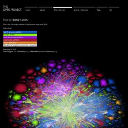
Color Chart: Date: July 11 2015 Graph Engine: LGL 1000×800 px (png) 10000×8000 px (non-antialiased) (png) This image was never released publicly prior to 2014. It has only been viewable at the Museum of Modern Art (MoMA) in New York, and in an edition of Discover Magazine. It is the first version of the image rendered using BGP as the data points rather than raw traceroutes. THREAT MAP by LookingGlass. Bitdefender Threat Map. Digital Attack Map. Kaspersky Cyberthreat-Echtzeitkarte. Live Cyber Threat Map. Antipodes Map - Tunnel to the other side of the world. Pixel Map Generator. Maps - Fon: The global WiFi network. Maps. Live CO₂ emissions of electricity consumption.
9 minutes ago arrow_drop_down Climate Impact by Area Ranked by carbon intensity of electricity consumed (gCO₂eq/kWh) South Island New Zealand. A global map of wind, weather, and ocean conditions. World Sites Atlas (Sitesatlas.com): maps, hotels, information, and more. 100,000 Stars. What would happen if a nuclear bomb went off in your backyard? Worldometer - real time world statistics. Submarine Cable Map. Index. Live World Map of Satellite Positions - In-The-Sky.org. Finde Fahrradstrecken, nimm Fahrten auf, Fahrradroutenplaner, GPS. Interactive Map of Active Volcanoes and recent Earthquakes world-wide.
Draw On Maps and Make Them Easily. Freies AIS Tracking von Schiffsbewegungen. My Ship Tracking Free Realtime AIS Vessel Tracking Vessels Finder Map - ship tracker. MarineTraffic: Global Ship Tracking Intelligence. We and our store and/or access information on a device, such as cookies and process personal data, such as unique identifiers and standard information sent by a device for personalised ads and content, ad and content measurement, and audience insights, as well as to develop and improve products.
With your permission we and our partners may use precise geolocation data and identification through device scanning. You may click to consent to our and our partners’ processing as described above. Railroad Webcams, Railcams & Live Train Videos. This page provides a directory of 419 railcams (railroad web cams) offering live trackside images and live webcam train video of freight railroads, passenger trains, and transit systems worldwide. See also: YouTube Railfan Channels, Train Videos & DVDs, Railroad Photo Websites, Steam Train Photos North American Railroad Webcams (RailCams) Ashland Railcam - Three cameras provide live video and audio of CSX freight trains and Amtrak Northeast Regional & Atlantic Coast Service passenger trains in Ashland, Virginia Bailey Yard Railcam - Live video day and night of the world's largest railroad classification yard from the top of Union Pacific's Golden Spike Tower in North Platte, Nebraska.
Live Flug-Tracker - FlightAware. Train Map. Flightradar24: Live Flight Tracker - Real-Time Flight Tracker Map. AfricaMap. Powered by WorldMap AfricaMap Sign in | Create Map | View Map | Help Rectify Images Use WorldMap WARP to upload and rectify scanned maps for use in WorldMap.
Maps rectified using this tool can be brought into WorldMap by following the instructions under Section 4.5 in WorldMap Help. Countries. WwiTV - Watch live TV channels broadcasting on the Internet for free. Listen to live Beijing radio on Radio Garden. Radiooooo. #onemilliontweetmap. Welcome to Accessibility World Map! - Accessibility World. World Time Zone and current time around the World and standard world time zones map of the world- 12 format. Ventusky - Wind, Rain and Temperature Maps. RainViewer: Live Weather Radar Map. Real Time Lightning Map. Wind map & weather forecast. Sygic Maps - Worldwide Travel Maps and City Guides.
Worldwide Travel Maps and City Guides for your next Holiday An ultimate tool for every traveler.
Sygic Maps combines detailed worldwide travel maps with information from in-house editors, Wikipedia and other sources. Discover the best tourist attractions, things to do, restaurants, shops, hotels or tours. Build your Travel Itinerary with Sygic Maps. Maldingen - 百度地图. LIVE weather, storm tracker, wind & radar map. OpenStreetMap. Satellite map — all countries, cities, streets and buildings. Official MapQuest - Maps, Driving Directions, Live Traffic. Google Maps. Bing.