
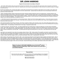
Sir John Hawkins biography. England’s first slave trader who was Mayor of Plymouth But these were dangerous times; merchant ships trading in coastal waters around Europe had to be prepared to repel borders by force as pirates of many nations were active.
In those times Kings & Queens licensed pirates who were then called privateers. Captured ships were called prizes the crew and passengers butchered, their possessions shared among the crew. William commanded privateers to Brazil at least three times and then continued to develop the trade from home to his immense profit. He became infamous to the Spanish and Portuguese colonies where his violent piracy was feared. In 1544 William received the Kings Commission to ‘annoy the King’s enemies’. The Board of Longitude : Maritime history features : Sea & ships. Martin Frobisher's expeditions, 1576–78 : Exploration, adventure and tragedy : Search for the North-West Passage : Maritime history features : Sea & ships. Frobisher's first voyage - click to enlarge The English search for the North-West Passage began in earnest with a voyage captained by Martin Frobisher in 1576.
After reaching Resolution Island Frobisher thought he may have found the entrance to the passage but had instead found a bay on the south of Baffin Island (a bay which now bears his name). On this trip he ran into trouble with native Inuits who kidnapped five of his men (they were never seen again). Second and third voyages Sir Martin Frobisher. PU2378Frobisher didn’t return to England empty-handed. Sir John Hawkins. Sir John Hawkins Sir John Hawkins (1532-1595) English mariner (sailor) who ranks with Sir Francis Drake as a leader of the Elixabethan "sea dogs.
" Hawkins created a new type of warship. Empire of the Bay: Sir Martin Frobisher. One of many explorers looking for a Northwest Passage to the Orient, Sir Martin Frobisher was one of the first English explorers to sail the northeast North American coast.
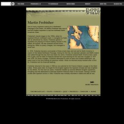
Frobisher's travels began in the 1550s, when he explored Africa's northwest coast. A navigator by trade and an adventurer by nature, Frobisher gained a reputation for preying on French trading vessels in the waters off Guinea. He was arrested several times during the 1560s on piracy charges, but managed to avoid trial. In 1576, Frobisher became commander of three small ships and set sail for North America in search of the fabled Northwest Passage.
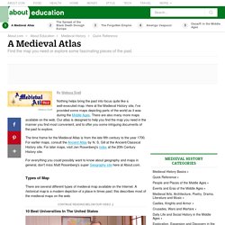
Mapping The Newest Old Map Of The World. Under circumstances shrouded by mystery, two brothers painted this on a wall by the railway tracks at Paddington on Christmas Eve of 1974.
Until the wall was knocked down, ten years later, passengers would cruise past it as their trains slowed in and out of London. It was anonymous, 45 centimeters tall, and not very colorful, but a lot of people remember it. “Far away is close at hand in images of elsewhere.” Mappa mundi. A mappa mundi (Latin [ˈmappa ˈmʊndiː]; plural = mappae mundi) is any medieval European map of the world.
Such maps range in size and complexity from simple schematic maps an inch or less across to elaborate wall maps, the largest of which was 11 ft. (3.5 m.) in diameter. The term derives from the Medieval Latin words mappa (cloth or chart) and mundi (of the world). Approximately 1,100 mappae mundi are known to have survived from the Middle Ages. Of these some 900 are found illustrating manuscripts and the remainder exist as stand-alone documents.[1] Types of mappae mundi[edit]
Cosmographia. - Medieval and Renaissance Manuscripts. Atlas sive Cosmographicæ Meditationes de Fabrica Mundi. - Medieval and Renaissance Manuscripts. A Medieval Atlas. By Melissa Snell Nothing helps bring the past into focus quite like a well-executed map.
Here at the Medieval History site, I've provided some maps depicting parts of the world as it was during the Middle Ages. Amazing satellite images from around the world. American Indians Tribes Map. 40 Maps That Will Help You Make Sense of the World. If you’re a visual learner like myself, then you know maps, charts and infographics can really help bring data and information to life. Maps can make a point resonate with readers and this collection aims to do just that. Hopefully some of these maps will surprise you and you’ll learn something new. A few are important to know, some interpret and display data in a beautiful or creative way, and a few may even make you chuckle or shake your head.
If you enjoy this collection of maps, the Sifter highly recommends the r/MapPorn sub reddit. You should also check out ChartsBin.com. 1. 2. 3. 4. Pangea was a supercontinent that existed during the late Paleozoic and early Mesozoic eras, forming about 300 million years ago. 5. 6. 7. 8. 9. 10. 11. 12. 13. 14. 15. 40 maps that explain the world. By Max Fisher By Max Fisher August 12, 2013 Maps can be a remarkably powerful tool for understanding the world and how it works, but they show only what you ask them to.
So when we saw a post sweeping the Web titled "40 maps they didn't teach you in school," one of which happens to be a WorldViews original, I thought we might be able to contribute our own collection. Some of these are pretty nerdy, but I think they're no less fascinating and easily understandable. A majority are original to this blog, with others from a variety of sources. I've included a link for further reading on close to every one. [Additional read: How Ukraine became Ukraine and 40 more maps that explain the world] Click to enlarge. Alternate North America. Maps Of War: Visual History Of War, Religion, & Govt.
Let's explore the world! Watch 1000 Years of European Borders Change In 3 Minutes. Cartographies of Time: A Visual History of the Timeline. By Maria Popova A chronology of one of our most inescapable metaphors, or what Macbeth has to do with Galileo.
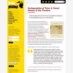
I was recently asked to select my all-time favorite books for the lovely Ideal Bookshelf project by The Paris Review’s Thessaly la Force and artist Jane Mount. Despite the near-impossible task of shrinking my boundless bibliophilia to a modest list of dozen or so titles, I was eventually able to do it, and the selection included Cartographies of Time: A History of the Timeline (public library | IndieBound) by Daniel Rosenberg and Anthony Grafton — among both my 7 favorite books on maps and my 7 favorite books on time, this lavish collection of illustrated timelines traces the history of graphic representations of time in Europe and the United States from 1450 to the present, featuring everything from medieval manuscripts to websites to a chronological board game developed by Mark Twain.
The first chapter, Time in Print, begins with a context for these images: 40 more maps that explain the world. Maps seemed to be everywhere in 2013, a trend I like to think we encouraged along with August's 40 maps that explain the world.
Maps can be a remarkably powerful tool for understanding the world and how it works, but they show only what you ask them to. You might consider this, then, a collection of maps meant to inspire your inner map nerd. Old Maps Online. Heritage Route. The son of Charlemagne, Louis the Pious, and his successors, the rulers of Francia Media, visited Nijmegen regularly.