
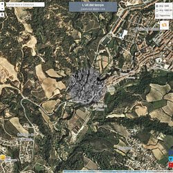
Géoportail - version simple/tablette. Catalunya: l'ull del temps. L'ull del temps Catalunya abans i ara BETAPORTAL:Veure més prototips | Font:Institut Cartogràfic i Geològic de Catalunya CC-BY 4.0, Font:Ministerio de Defensa Canvia ordre del fons.
Ruta CAMINADA POPULAR DE L'ANOIA A PIERA 2012 - Piera, Catalunya (España) - GPS track. Darrera Mirada - Els Quarterons Garriga i Roca - 1860. Barcelona, Darrera Mirada - Els Quarterons Garriga i Roca - 1860. The True Size Of ... Municipis amb Mapa del Patrimoni cultural en línia - Patrimoni cultural. Pat.mapa - Mapa. United States (Contiguous 48) vs. Australia: Comparea Area Comparison. Maps & Graphs - Nordregio. Lionel Pincus and Princess Firyal Map Division - NYPL Digital Collections. Department of History - Our Atlases. About Our Atlases In 1938 the predecessors of today's Department of History at the United States Military Academy began developing a series of campaign atlases to aid in teaching cadets a course entitled, "History of the Military Art.

" Since then, the Department has produced over six atlases and more than one thousand maps, encompassing not only America’s wars but global conflicts as well. In keeping abreast with today's technology, the Department of History is providing these maps on the internet as part of the department's outreach program. The maps were created by the United States Military Academy’s Department of History and are the digital versions from the atlases printed by the United States Defense Printing Agency. We gratefully acknowledge the accomplishments of the department's former cartographers, Mr. Polona. Videos, articles, and tips to help you succeed, from the world's leading experts. Draw On Maps and Make Them Easily. Vissir3. FORO OFICIAL ELGPS.COM. Com era Catalunya? (des de 1945) The Internet map. How to Make a Map in Illustrator. Every time I start thinking of a tutorial to write, I try to show techniques that I use in my job as a designer.
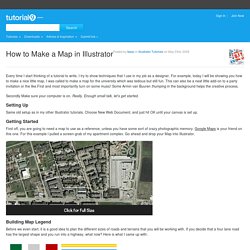
For example, today I will be showing you how to make a nice little map. I was called to make a map for the university which was tedious but still fun. This can also be a neat little add-on to a party invitation or the like.First and most importantly turn on some music! Some Armin van Buuren thumping in the background helps the creative process. Secondly Make sure your computer is on. Setting Up Same old setup as in my other Illustrator tutorials. Getting Started First off, you are going to need a map to use as a reference, unless you have some sort of crazy photographic memory. Building Map Legend Before we even start, it is a good idea to plan the different sizes of roads and terrains that you will be working with. I am going to go pretty simple for this example, but it can be as complex or simple as you want. Making the Brushes Drawing the Roads. Scribble Maps - Draw on google maps with scribblings and more! Bienvenue sur le projet QGIS !
Create amazing maps with your data — CartoDB. Pat.mapa - Mapa. Watch 1000 Years of European Borders Change In 3 Minutes. 40 more maps that explain the world. Maps seemed to be everywhere in 2013, a trend I like to think we encouraged along with August's 40 maps that explain the world.
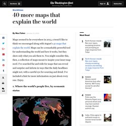
Maps can be a remarkably powerful tool for understanding the world and how it works, but they show only what you ask them to. You might consider this, then, a collection of maps meant to inspire your inner map nerd. I've searched far and wide for maps that can reveal and surprise and inform in ways that the daily headlines might not, with a careful eye for sourcing and detail.
I've included a link for more information on just about every one. Enjoy. 1. Data source: Oak Ridge National Laboratory, World Bank. Those dots represent people: the brighter the dot, the more people. 2. Click to enlarge. Human beings first left Africa about 60,000 years ago in a series of waves that peopled the globe. 3. (Wikimedia commons) The Mongol conquests are difficult to fathom. 4. Click to enlarge. This map shows the Spanish and Portuguese empires at their height. 40 maps that explain the world. By Max Fisher By Max Fisher August 12, 2013 Maps can be a remarkably powerful tool for understanding the world and how it works, but they show only what you ask them to.
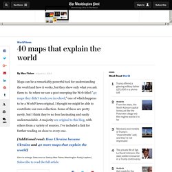
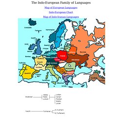
So when we saw a post sweeping the Web titled "40 maps they didn't teach you in school," one of which happens to be a WorldViews original, I thought we might be able to contribute our own collection. Some of these are pretty nerdy, but I think they're no less fascinating and easily understandable. A majority are original to this blog, with others from a variety of sources. I've included a link for further reading on close to every one. [Additional read: How Ukraine became Ukraine and 40 more maps that explain the world] The one million tweet map #onemilliontweetmap. Old Maps Online. Sistema de Información Territorial Municipal (SITMUN) ICGC - Vissir3. Indoeuropean.html. The Indo-European Family of Languages Map of European Languages.
Arxiu Cerdà - Any Cerdà.