
Monitoring air quality using lichens - field guide and app. Lichen-app A new mobile app (download in the sidebar) using lichens to assess atmospheric nitrogen pollution effects has been developed by the Centre for Ecology & Hydrology (CEH).
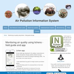
The app includes some simple elements: - Lichen identification key guide for nitrogen sensitive and tolerant species.- Simple Recording system for surveying lichens on tree trunks and branches - Field guide with instructions on carrying out the survey.- Auto-calculated and robust method to determine nitrogen pollution levels using a standardised nitrogen air quality index (NAQI).- Informs the public of their local nitrogen air quality based on four pollutant zones - 'Clean', 'At risk', 'Nitrogen Polluted’ or 'Very Nitrogen Polluted'. Field guide. UK Emissions Interactive Map. This interactive application allows you to explore emissions data from the UK National Atmospheric Emissions Inventory for 2018.
This map tool is optimised for modern web browsers, and may be slow in older browsers (such as Internet Explorer 8 or below). Ambient air quality concentration data can be explored using the ambient air quality maps on UK-AIR. Accessibility version. Youtube. TreeconomicsHydeParkReport. Youtube. NEA Methods Menu. Youtube. Question writing flowchart. Getting Started with Community Analyst. Student guide. Geographical investigations hi res. How to design a questionnaire. Useful fieldwork resources (1)
RGS Investigation Guide. Guide to research in geography v1 low res. Clone towns article. 350 Specialised Concepts II. 344 Specialised concepts part 1. Making streets healthy places for everyone. Sense of Community Index (SCI) – Sense of Community. The Sense of Community Index (SCI) is the measure most frequently used in the social sciences to gauge a sense of community.
The SCI has been used in numerous studies within different cultures in North and South America, Asia, the Middle East, as well as many contexts (e.g., urban, suburban, rural, tribal, workplaces, schools, universities, recreational clubs, Internet communities). The SCI is based on a theory presented by McMillan and Chavis (1986) that a sense of community is a perception with an affective component. The theory identifies four elements of a sense of community: membership, influence, meeting needs, and a shared emotional connection. Prior studies have validated the SCI by demonstrating that it has been a strong predictor of behaviors (such as participation in voluntary associations) and health and community outcomes. Obtaining Permission To Use the SCI and SCI-2.
This new tool uses Google Maps to calculate a city's carbon footprint. Looking at a city’s Google Maps data, in combination with other data, a new tool from Google can estimate the carbon footprint of all of its buildings–and the carbon footprint of all the car trips, bus and subway rides, and other transportation used by the people living there. The Environmental Insights Explorer, an online tool that launched in beta on September 10 and is still in development, is designed to help cities deal with the first step of a plan to reduce emissions: knowing what their current carbon footprint is. More than 9,000 cities have already committed to cut emissions in line with the goals of the Paris Agreement, but more than a third of those cities haven’t yet built an inventory of emissions.
The process can take months or even years, and cost hundreds of thousands of dollars, making it particularly challenging for smaller cities. Eighty fieldwork techniques – Mrs Geography. Create your own Custom Map. Geography Fieldwork. The aim of this digital resource is to guide you or your students through the steps involved in creating a good geographical enquiry title.
Each section builds on the contents of the previous one to lead to the generation of a suitable enquiry title. The resource also assists in the identification of what data needs to be collected, the methodology and sampling strategies as well as how the data can be presented and analysed. Activities are included in the resource to guide you to ask questions about what you are doing and why it is relevant to the enquiry title you are considering. Each section includes text boxes into which content necessary for the enquiry planning sheet will be entered by the participant. This information can then be printed off and used in the planning stage of the enquiry process.