
Earth Satellite Live - Miami. Real-Time Lightning Map. Photos: Move over Google Earth, this 3D map shows our world in razor-sharp detail. 17 Maps That Will Change How You See the World. The 27 Maps That Explain America. 100 Diagrams That Changed the World. Since the dawn of recorded history, we’ve been using visual depictions to map the Earth, order the heavens, make sense of time, dissect the human body, organize the natural world, perform music, and even concretize abstract concepts like consciousness and love. 100 Diagrams That Changed the World (public library) by investigative journalist and documentarian Scott Christianson chronicles the history of our evolving understanding of the world through humanity’s most groundbreaking sketches, illustrations, and drawings, ranging from cave paintings to The Rosetta Stone to Moses Harris’s color wheel to Tim Berners-Lee’s flowchart for a “mesh” information management system, the original blueprint for the world wide web.
It appears that no great diagram is solely authored by its creator. Most of those described here were the culmination of centuries of accumulated knowledge. Most arose from collaboration (and oftentimes in competition) with others. Christianson offers a definition: 2000 black percent. 40 more maps that explain the world 2014. Maps seemed to be everywhere in 2013, a trend I like to think we encouraged along with August's 40 maps that explain the world.
Maps can be a remarkably powerful tool for understanding the world and how it works, but they show only what you ask them to. You might consider this, then, a collection of maps meant to inspire your inner map nerd. I've searched far and wide for maps that can reveal and surprise and inform in ways that the daily headlines might not, with a careful eye for sourcing and detail. I've included a link for more information on just about every one. 40 maps that explain the world 2013.
By Max Fisher By Max Fisher August 12, 2013 Maps can be a remarkably powerful tool for understanding the world and how it works, but they show only what you ask them to.
So when we saw a post sweeping the Web titled "40 maps they didn't teach you in school," one of which happens to be a WorldViews original, I thought we might be able to contribute our own collection. Maps Mania. Missions. Global Terrorism Database. While the GTD inclusion criteria offer a comprehensive definition of terrorism, we encourage users to take advantage of the GTD's flexibility to restrict the data according to their definitional preferences. This includes filtering search results based on whether the coder noted some uncertainty whether an incident meets the criteria for inclusion ("Doubt Terrorism Proper," systematically available for post-1997 cases only). Also, users can filter search results based on which of the following three criteria are met (available for all cases): Criterion 1: The act must be aimed at attaining a political, economic, religious, or social goal. Criterion 2: There must be evidence of an intention to coerce, intimidate, or convey some other message to a larger audience (or audiences) than the immediate victims.
ArcGIS. Draw On Maps and Make Them Easily. ArcGIS Blog. The Evolve conference hosted by Xamarin, is a premier cross-platform mobile event where 1,500 developers, industry leaders and Xamarin experts converge to define the future of apps.

This year Esri is a silver sponsor for the event and will be participating in activities at Evolve16 in Orlando, Florida, April 24-28. Esri will be showcasing opportunities for Xamarin developers, including leveraging ArcGIS technology that integrates seamlessly with the Xamarin platform. Esri - GIS Mapping Software, Solutions, Services, Map Apps, and Data. Let's describe the whole world! Emerge Map : plaisir du jeu, force de l'intelligence collective = efficience des séances. Draw On Maps and Make Them Easily. 360° Aerial Panoramas, 3D Virtual Tours Around the World, Photos of the Most Interesting Places on the Earth.
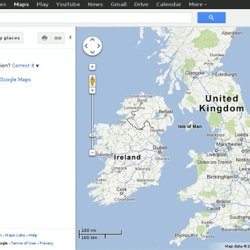
Sky. Maps. Earth Gallery. Maps. MapData Services. Raviii added: Google Maps. Screen reader users: click here for plain HTML +You Search Images.
Raviii added: Google Earth: Pro free or not Pro free? Ohmslibrary added: The Science of Disney Imagineering: Roller Coaster Ride Builder. Maps and GPS.