
Promenade à Nemausus. La démocratie à Athènes avec les réformes de Clisthène et le siècle de Périclès. Acropolis Virtual Tour. The Virtual Tour of the Acropolis is a web application based on HTML5 technologies (webGL and CSS3D) to display effectively panoramic photographic images in desktop and mobile browsers.
The production of panoramic photomosaics at resolutions of several gigapixels was realised between 2010 and 2014 by employing established practices of digital image acquisition and processing. In order to achieve the best possible mapping of natural lighting on the monuments together with the display of shaded details, High Dynamic Range (HDR) imaging techniques were used for capturing and combining different exposure levels of the same theme. Starting from the RAW photos all the way up to the combined and color-corrected finalised panoramas, all intermediate outputs were maintained in order to be able to reproduce and control the entire manufacturing process for future reference.
The krpano viewer and revelant tools are used for the display of the panoramic images within the application. Visite. Timgad. Timgad Timgad lies on the northern slopes of the Aurès mountains and was created ex nihilo as a military colony by the Emperor Trajan in AD 100.
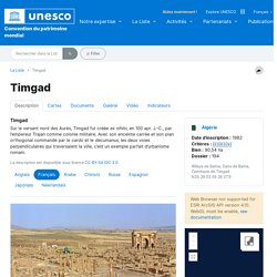
With its square enclosure and orthogonal design based on the cardo and decumanus, the two perpendicular routes running through the city, it is an excellent example of Roman town planning. La description est disponible sous licence CC-BY-SA IGO 3.0 Sur le versant nord des Aurès, Timgad fut créée ex nihilo, en 100 apr. J. تيمجاد على المنحدر الشمالي من جبال أوراس، نشأت تيمجاد من لا شيء عام 100 بعد الميلاد على يد الأمبراطور تراجان كمستوطنة عسكرية. Source: UNESCO/ERI La description est disponible sous licence CC-BY-SA IGO 3.0 提姆加德 蒂姆加德位于奥雷斯山(the Aurès mountains)北麓,是公元100年古罗马皇帝图拉真(the Emperor Trajan)建立的军事殖民地。
Древний город Тимгад Тимгад, расположенный на северных склонах гор Орес, был основан в 100 г. н.э. императором Траяном как военная колония на пустовавшем до того месте. Timgad ティムガッド アルジェリア北東部の山麓に、AD100年頃、ローマの退役軍人の植民市として建設。 La bataille d'Actium (-31) vue par le cinéma américain. La bataille d'Alésia. Virtual Roman House 2. De la naissance à la chute de l'empire romain. Cette carte fait partie d’un ensemble de 8 cartes animées portant sur Rome et son empire Rome, à l’origine modeste cité d’Italie, finit par dominer l’ensemble de la Méditerranée.
La ville a d'abord connu la royauté, puis la République et enfin l'Empire. De -753 à -509 Rome est gouvernée par des rois. Après Romulus le fondateur légendaire, viennent des rois d'origine sabine, puis des rois étrusques dont le dernier est Tarquin le Superbe. Sous la République la ville est gouvernée par le sénat, aux mains des patriciens*, et par deux consuls* élus chaque année. Rome s’agrandit peu à peu en luttant contre ses voisins, les Latins* et les Étrusques*, puis en occupant le sud de la péninsule où les Grecs ont fondé de nombreuses colonies. Au cours des Guerres puniques, Rome combat Carthage, et s’approprie progressivement ses territoires en Méditerranée occidentale. À l’ouest, Rome pénètre en Gaule méridionale et s’empare d’une large partie de l’Espagne. Le plus célèbre d’entre eux est Jules César.
A Day in Pompeii - Full-length animation. A Tour through Ancient Rome in 320 C.E. A Tour through Ancient Rome in 320 C.E. British Museum video - A Parthenon Metope: history and reconstruction. Atene Athens. Musique de la Grèce antique.
Animation d'un vase grec / Greec vase animation. Au nom d'Athènes - Episode 2 - Divine Salamine. Au nom d'Athènes - Episode 1 - Vaincre à Marathon. La démocratie athénienne. Citoyenneté - sommaire. A glimpse of teenage life in ancient Rome - Ray Laurence. Autour de la table claudienne - Reportages. Paris, ville antique.