
City Population. Earth album alpha. Geografi.nu. Globalis. Google Maps. Indien.nu. Panoramas.dk - Photo Panoramiques. Perry-Castañeda Library Map Collection. Photos of the World. TimeTicker. Timeanddate.com.
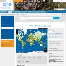
World Heritage List. #: As for 19 Natural and Mixed Properties inscribed for geological values before 1994, criteria numbering of this property has changed.
See Decision 30.COM 8D.1. Worldatlas.com. World Sunlight Map. Watch the sun rise and set all over the world on this real-time, computer-generated illustration of the earth's patterns of sunlight and darkness.
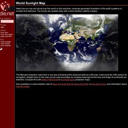
The clouds are updated daily with current weather satellite imagery. The Mercator projection used here is one way of looking at the spherical earth as a flat map. Used since the 16th century for navigation, straight lines on this map can be used accurately as compass bearings but the size and shape of continents are distorted. Compare this with Peters, Mollweide or equirectangular projection maps.