
Hypogeum of Ħal-Saflieni. The Hypogeum of Paola, Malta, (Ipoġew in Maltese) literally meaning "underground" in Greek, is a subterranean structure dating to the Saflieni phase (3000-2500 BC) in Maltese prehistory.

Thought to have been originally a sanctuary, it became a necropolis in prehistoric times and the remains of more than 7,000 individuals have been found. It is the only known prehistoric underground temple in the world. The Hypogeum was depicted on a 2 cents 5 mils stamp issued in the Maltese Islands in 1980 to commemorate the acceptance by UNESCO of this unique structure in the World Heritage Site list. It was closed to visitors between 1992 and 1996 for restoration works; since it reopened only 60 people per day are allowed entry. It was discovered by accident in 1902 when workers cutting cisterns for a new housing development broke through its roof. First Level[edit] The first level is very similar to tombs found in Xemxija in Malta.
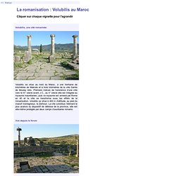
Second Level[edit] Hal Saflieni The Main Chamber[edit] La romanisation : Volubilis au Maroc. Volubilis, une cité romanisée.
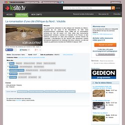
La romanisation d'une cité d'Afrique du Nord : Volubilis. Résumé.
Site archéologique de Volubilis. Archaeological Site of Volubilis The Mauritanian capital, founded in the 3rd century B.C., became an important outpost of the Roman Empire and was graced with many fine buildings.
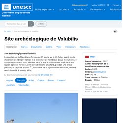
Extensive remains of these survive in the archaeological site, located in a fertile agricultural area. Volubilis was later briefly to become the capital of Idris I, founder of the Idrisid dynasty, who is buried at nearby Moulay Idris. HomePage / Page D'Accueil. The Other Mystery of Easter Island. Moai statues Easter Island is branded into popular consciousness as the home of the mysterious and towering moai statues, but these are not the only curiosity the South Pacific island holds.
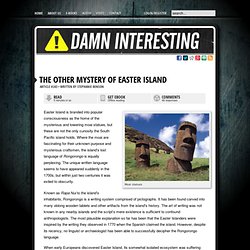
Where the moai are fascinating for their unknown purpose and mysterious craftsmen, the island's lost language of Rongorongo is equally perplexing. The unique written language seems to have appeared suddenly in the 1700s, but within just two centuries it was exiled to obscurity. Known as Rapa Nui to the island's inhabitants, Rongorongo is a writing system comprised of pictographs. It has been found carved into many oblong wooden tablets and other artifacts from the island's history. In 1864, Father Joseph Eyraud became the first non-islander to record Rongorongo. Some time later, Bishop Florentin Jaussen of Tahiti attempted to translate the texts. Thompson was determined, however, and decided that Ure Va'e Iko might be more forthcoming under the influence of alcohol. An Indus valley connection? 2011 Starchild Skull Preliminary DNA Report. Starchild Skull DNA Analysis Report—2011 A Layman's summary of this report is available HERE SUMMARY: Early in 2011, a geneticist attempting to recover Starchild Skull DNA identified four fragments that matched with human mitochondrial DNA (mtDNA).
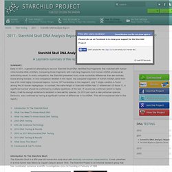
Comparing those fragments with matching fragments from human mtDNA produced an astonishing result. In every comparison, the Starchild presented many more nucleotide differences than are normally found among humans. Eisp. Atlantis Rising Magazine. UNDERWATER PYRAMIDS: JAPAN. The Incredible Mystery Of Coral Castle. Ancient Egypt for Kids. Tombs of Ancient Egypt. Greek and Roman Materials. History: Ancient History in-depth. Show me - prehistory games, activities and resources for kids from UK museums and galleries. Science & Nature - Caveman challenge. Mysteries of Çatalhöyük. Creswell Crags Museum and Visitor Centre - Inspiring and educational guided cave tours.
Prehistoric Humans - World History For Kids. Web Chronology Project. Handy Man - Tools - Early Humans for Kids. Early man did not have sharp claws or strong sharp teeth.
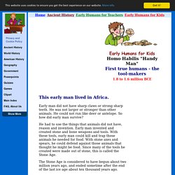
He was not larger or stronger than other animals. He could not run like deer or antelope. So how did early man survive? He had to use the things that animals did not have, reason and invention. Early man invented and created stone and bone weapons and tools. The Stone Age is considered to have begun about two million years ago, and ended sometime after the end of the last ice age about ten thousand years ago. During the Stone Age, Homo Habilis appeared. Some scientists believe that Homo Habilis did not know how to start a fire. Campfires were very useful to Homo Habilis since fire keeps most animals away, so a campfire would be watched carefully to keep it going. Livius. Articles on Ancient History. Map Collections. The Library of Congress Search by Keyword | Browse by Geographic Location Index | Subject Index | Creator Index | Title Index The Geography and Map Division of the Library of Congress holds more than 4.5 million items, of which Map Collections represents only a small fraction, those that have been converted to digital form.

The focus of Map Collections is Americana and Cartographic Treasures of the Library of Congress. These images were created from maps and atlases and, in general, are restricted to items that are not covered by copyright protection. Map Collections is organized according to seven major categories. Searching Map Collections The mission of the Library of Congress is to make its resources available and useful to Congress and the American people and to sustain and preserve a universal collection of knowledge and creativity for future generations.
The Library of Congress presents these documents as part of the record of the past. Special Presentations: Ancient Maps Cover Page. Collapse: Why do civilisations fall? Hundreds of years ago in what is now modern Honduras, Copán was a thriving civilization, a center of the cultural life of the Maya.

Tens of thousands of people made their home in the Copán Valley. Yet despite its importance, Copán went into decline. Across the vast territory of the ancient Maya, other important sites were sharing a similar fate. Classic Maya civilization was collapsing.
FR - Klaus Dona : L'Histoire cachée du genre humain. La révélation des pyramides : l'enquête qui change le monde. Elmi, merci d’avoir mis ce lien sur l’hypothèse astrologique des représentations pariéatles.
Cela sert le propos que je souhaite vous livrer. Déjà, j’ai été particulièrement intéressé par cette vidéo. Je la trouve trop sincère pour en balayer les arguments d’un simple coup de plume, d’une boutade ou d’une raillerie. Et je suis totalement d’accord pour considérer qu’il ne faut pas sous-estimer les connaissances de nos ancêtres. L’astronomie nous semble une science ultime : on ne s’intéresse au ciel que quand on a réglé les affaires terrestres. Il est beaucoup plus probable que ce soit la première. D’abord, parce que l’homme le plus préhistorique est peut-être très occupé en journée, mais qu’il n’a pas grand-chose à faire de ses nuits que regarder le ciel.
Et rien d’autre à faire, les nuits d’insomnie, qu’à contempler cet ordre. On nous annonce comme une grande nouvelle que l’homme, du temps des bâtisseurs, connaissait déjà l’astronomie. Pareil pour Pi. The Edge of Science - Pyramides Bosniaques (vostfr) La Révélation des Pyramides (VOSTFR) L'Homme ancien est de moins en moins ce qu'il était! Nos apparentes certitudes sur l’évolution humaine, et notamment le moment du passage à un niveau de développement compatible avec l’utilisation de symboles, d’outils et le feu domestique, semblent devoir être remises en cause.
On place habituellement l’avènement de l’écriture, en tant que méthode de communication non verbale utilisant des symboles, à l’établissement de sociétés agraires voici environ 6 000 ans. Bien avant cela les “hommes des cavernes” peignaient les murs de leurs cavernes mais n’y laissaient point de textes. Vraiment? Une “revisitation” minutieuse des grottes de Rouffignac, Chauvet et Lascaux a permit un inventaire de signes, autres que les classiques dessins figuratifs, qui pourraient bien constituer une forme d’alphabet utilisé par ces humains voici… 30 000 ans! Le message prémonitoire des Indiens d'Amérique. "Nous avons toujours eu beaucoup; nos enfants n'ont jamais pleuré de faim, notre peuple n'a jamais manqué de rien...
Les rapides de Rock River nous fournissaient un excellent poisson, et la terre très fertile a toujours porté de bonnes récoltes de maïs, de haricots, ce citrouilles, de courges... Ici était notre village depuis plus de 100 ans pendant lesquels nous avons tenu la vallée sans qu'elle nous fût jamais disputée. Si un prophète était venu à notre village en ce temps-là nous prédire ce qui allait advenir, et ce qui est advenu, personne dans le village ne l'aurait cru. " Black Hawk, chef indien. Égypte - la revelation des pyramides. Légende de l'Atlantide - La Fraternité Secrète FR 1/6. Quand l'Amérique détruit les vestiges de Sumer...Pourquoi...? Chronologie éronée 1-2. L'Arche de Noé et le Déluge: Preuves Historiques et Scientifiques. The Edge of Science - Pyramides Bosniaques (vostfr) The truth of the tunel Ravne in Bosna & Herzegovina.
Forum Orandia - ****COMPLÉMENT SURPRENANT. Par gilles surprenant, mardi 08 mai 2012, 15:47 (il y a 709 jours) @ KIWANédité par gilles surprenant, mercredi 09 mai 2012, 13:57. La confrérie du Serpent, c'est quoi...? Les tablettes Mésopotamiennes indiquent que " EA " Enki , Prince extra-terrestre de la terre, créateur de l'homo sapiens, se rebella, n'acceptant pas les cruautés que ses congénères infligeaient aux hommes, et fonda la " Confrérie du Serpent ".
Alignement des sites sacrés de la terre sur des lignes énergétiques telluriques. Alignement des sites sacrés de la terre sur des lignes énergétiques telluriques Depuis l'espace, la Terre nous apparait comme une boule ronde et lisse très légèrement aplatie aux pôles. Nous distinguons facilement les mers et les continents, mais à première vue aucune structure régulière, aucun réseau, aucun treillis n'y sont apparents.
Si un réseau de lignes structurées existe, il faut chercher d'autres indices. On peut tout d'abord noter que puisque la Terre tourne autour d'un axe qui traverse les pôles, ces points se distinguent des autres parce qu'ils ne bougent pas. Ils auront donc un statut particulier dans un réseau. A partir de ces 2 pôles, on peut également construire l'équateur, comme cercle équidistant des 2 pôles.
Ce sont ces coordonnées, par exemple, qui sont utilisées par les satellites géostationnaires GPS (Global Positioning System – ou système mondial de localisation). Quest for the Lost Civilization - Graham Hancock (5 of 14) Quest for the Lost Civilization - Graham Hancock (2 of 14) Quest for the Lost Civilization - Graham Hancock (7 of 14) Quest for the Lost Civilization - Graham Hancock (6 of 14) Graham Hancock - Quest for the Lost Civilization (14 of 14) Quest for the Lost Civilization - Graham Hancock (13 of 14)
Quest for the Lost Civilization - Graham Hancock (12 of 14) Quest for the Lost Civilization - Graham Hancock (4 of 14) Quest for the Lost Civilization - Graham Hancock (3 of 14) Quest for the Lost Civilization - Graham Hancock (1 of 14) Quest for the Lost Civilization - Graham Hancock (11 of 14) Quest for the Lost Civilization - Graham Hancock (10 of 14) Quest for the Lost Civilization - Graham Hancock (9 of 14) Quest for the Lost Civilization - Graham Hancock (8 of 14)