
Digital Maps by State. Old Maps Online. WardMaps. Historic Map Works. David Rumsey Historical Map Collection. BPL: Norman B. Leventhal Map Center. Harvard Map Collection. The Harvard Map Collection is one of the oldest and largest collections of cartographic materials in the United States with over 500,000 items.
Resources range from 16th century globes to modern maps and geographic information systems (GIS) layers. A selection of our materials has been digitally imaged and is offered both as true picture images and georeferenced copies. This Virtual Collection includes those maps and atlases that are available through the Harvard Image Delivery Service. Those maps that have been georeferenced are available through the Harvard Geospatial Library. Therefore, many of the maps listed will have two records, one for the image that is true to the original and the other a georeferenced image. Only a small portion of the Map Collection has been cataloged and included in Hollis and an even smaller selection are included in this virtual collection as digital images. LoC: Maps. The Library of Congress Search by Keyword | Browse by Geographic Location Index | Subject Index | Creator Index | Title Index The Geography and Map Division of the Library of Congress holds more than 4.5 million items, of which Map Collections represents only a small fraction, those that have been converted to digital form.

The focus of Map Collections is Americana and Cartographic Treasures of the Library of Congress. These images were created from maps and atlases and, in general, are restricted to items that are not covered by copyright protection. Map Collections is organized according to seven major categories. LOC: Maps Search. ↓ Refine your search Map of the Iowa Central Air Line Rail Road and its connections.
Scale ca. 1:1,550,000. Entered according to act of Congress in the year 1857. LC Railroad maps, 435 Description derived from published bibliography. Detailed township map of the north-central states indicating drainage, cities ... The seige [sic] of Petersburg, Va. LoC: Maps of America List v.2. LoC: Railroad Maps Collection. The Library of Congress Map Collections | Transportation and Communication Geography and Map Division, Library of Congress The Railroad Maps 1828 to 1900 collection has been migrated to an improved presentation.
Please visit the new presentation. Search by Keyword | Browse by Geographic Location | Subject Index | Creator Index | Title Index | Railroad Lines The Railroad maps represent an important historical record, illustrating the growth of travel and settlement as well as the development of industry and agriculture in the United States. All of the items presented here are documented in RAILROAD MAPS of the United States compiled by Andrew M.
The mission of the Library of Congress is to make its resources available and useful to Congress and the American people and to sustain and preserve a universal collection of knowledge and creativity for future generations. The Library of Congress presents these documents as part of the record of the past. Atlas of Historical County Boundaries Project. National Data Click on the national map to see all of the Atlas' content related to the nation at one view.
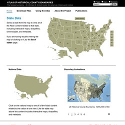
Like the state map above this content includes interactive maps, shapefiles, and metadata. Boundary Animations US Historical State & Territorial Boundaries, 1783-2000 (3:00) US Historical County Boundaries, 1629-2000 (0:30) US Historical County Boundaries, 1629-2000 (3:00) US Historical County Boundaries (1629-2000), with State/Territorial boundaries (1783-2000) (0:30) US Historical County Boundaries (1629-2000), with State/Territorial boundaries (1783-2000) (3:00) US Historical State & Territorial Boundaries, 1783-2000 (0:30) US Historical State & Territorial Boundaries, 1783-2000 (3:00) Historic Land Ownership Maps & Atlases Online. Historic land ownership maps and county atlases show who owned land in a given area at a given time.
Also displayed are towns, churches, cemeteries, schools, railroads, businesses, and natural land features. Land ownership maps make it easy to view the location and shape of an ancestor's land or farm at a particular point of time, plus its relationship to the land and locations of relatives, friends, and neighbors. Land ownership maps are available online from a variety of resources, including subscription genealogy sites, University map collections, sources for digitized historic books, and locality-based websites hosted by individuals, genealogical and historical societies, and local libraries.
Below you'll find a selected list of online resources for locating historic landowner and cadastral maps online, but you'll find even more by using search terms such as county atlas, cadastral map, landowner map, the name of a map publisher (i.e. F. 1. David Lees/Digital Vision/Getty Images 2. NYPL: Maps. Broer Map Library. OSU: eHistory Maps.