
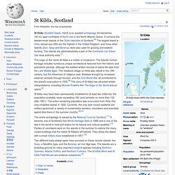
St Kilda, Scotland. Coordinates: Overview of Village Bay St Kilda (Scottish Gaelic: Hiort) is an isolated archipelago 64 kilometres (40 mi) west-northwest of North Uist in the North Atlantic Ocean.
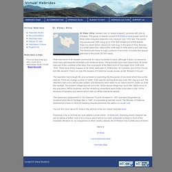
St Kilda - National Trust for Scotland World Heritage Site. St Kilda - National Trust for Scotland World Heritage Site. Christian Lassure - THE CLEITEAN OF THE SAINT-KILDA ARCHIPELAGO IN THE OUTER HEBRIDES, SCOTLAND. By Christian Lassure french version The St.
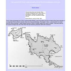
Kilda archipelago lies 180 km off the North-Western coast of Scotland and 64 km West of the Outer Hebrides. It is comprised of four volcanic islands: Hirta, Dun, Soay and Boreray. The largest - Hirta - is renowned for its myriad small dry stone buildings - called cleitean (plural of cleit) in Scottish Gaelic and cleits in English - that were used as all-purpose storage huts until 1930 when the last remaining islanders left for the mainland. Hirta. Hirta (Scottish Gaelic: Hiort) is the largest island in the St Kilda archipelago, on the western edge of Scotland.
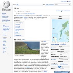
The names "Hiort" (in Scottish Gaelic) and "Hirta" (historically in English) have also been applied to the entire archipelago. Geography[edit] St Kilda (Hirta) National Nature Reserve, United Kingdom. Introduction The St.
Kilda archipelago (57°54'36"N - 57°46'N) is a World Heritage Site which has preserved ecosystems intact for thousands of years virtually unchanged by man; also a well preserved well documented primitive settlement. St Kilda World Heritage Site. All Photos are provided by Panoramio.
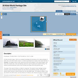
Photos are under the copyright of their owners. Description Coordinates: 57°49′N 8°35′W / 57.817°N 8.583°W / 57.817; -8.583. St. Kilda / Hirta. St.
Kilda / Hirta ('western isle' or 'shield shaped'), (pictured left, click to enlarge), The group of islands consist of St Kilda or Hirta proper, which is three miles long and extremely hilly, rising to over 1400 feet. The island has spectacular cliffs rising up to 1000 feet straight out of the Atlantic. Soay is a small island, about one mile long, to the west of Hirta. Boreray is a small island four miles to the north east of Hirta, and is one mile long.
The islands are home to huge numbers of sea birds, including the largest gannetry in the world (60,000 pairs). Hirta was home to an isolated community for many hundreds of years, although it does not appear to have been permanently inhabited until medieval times. The islanders had a tough life, and survived by exploiting the thousands of sea birds which live on the islands. The island was bequeathed to The National Trust for Scotland in 1957 and was designated as Scotland's first World Heritage Site in 1987. Back to. St Kilda, Hirta - A WALK ALONG MAIN STREET .mpg. St Kilda Britains lonliest island (1928) St. Kilda, Its People and Birds (1908) - extract. St Kilda: A Wildlife Mystery. Scottish Screen Archive - Search - Results. 1930 - Evacuation of St Kilda. Life on the little Atlantic island of St Kilda was always tough for its inhabitants.
As the new luxuries of 20th-century life improved conditions on the mainland of Scotland, little improvement seemed to trickle out to their shores. Conditions of life remained basic and worse than basic. The hard winter of 1929 led to the St Kildans needing to seek aid yet again from the mainland. Finally they decided they had had enough. The islanders petitioned for evacuation. Death of a Island Republic. St Kilda. On 10 May 1930 the people of St Kilda sent a collective letter to William Adamson, the Secretary of State for Scotland, requesting that they should be evacuated from their home.
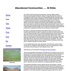
By the end of August that year the evacuation was completed and the process of resettlement on the Scottish mainland had begun. The abandonment of St Kilda is sometimes described as one of the few occasions when the ending of a community has taken place in a voluntary fashion. We will see, however, that while the adult members of the St Kilda community came to a unanimous decision that it would be right to leave many of them were in fact reluctant to sign the letter. Behind the decision, moreover, lay a complex pattern of social changes over a long period of time that had transformed a stable and contented community into one that saw no future for itself. St Kilda abandonment remembered. St Kilda Archipeligo, Hirta and Boreray 19th June 2005 Photo Gallery by Steve Goldthorp at pbase. St. Kilda St. Kilda Islands, Hirta, Soay, Boreray Photo Gallery.
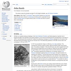
St Kilda Soay Sheep Project. John Sands. Da Voe, the main anchorage of Foula John Sands (1826–1900)[1] of Ormiston[2] was a Scottish freelance journalist and artist who also had an interest in archaeology and folk customs, especially the way of life on Scottish islands.
He spent almost a year on St Kilda and lived on several other remote islands. St Kilda[edit] St Kilda is an isolated outlying archipelago in the Outer Hebrides of Scotland, and Sands played an important role in bringing the plight of the islanders to the world's attention. On his second visit Sands became stranded there in the winter of 1876–7, and during that time invented the "mailboat" by attaching a message to a lifebuoy salvaged from the wreck of the Peti Dubrovacki and throwing it into the sea.