
Lingam
How to Be Agile With Business Analytics. Already have a Gartner account?
Sign in to view this research document. Forgot username or password? New to Gartner? Register with us for FREE access to this research document. Summary As the demands of IT service delivery shift toward bimodal capabilities, analytics and business intelligence leaders must introduce increased agility into the business analytics delivery process, in order to increase the agility of the business decision-making process and maximize business value.
Table of Contents © 2015 Gartner, Inc. and/or its Affiliates. Not a Gartner Client? Want more research like this? Contact us online Research More Webinars More 18 June 2015 Leveraging Roadmaps as Tools for Communicating ChangeLeading enterprise architects use a variety of roadmaps to guide and... 18 June 2015 Top Security Trends for 2015 - 2016During 2014 we've seen profound changes in cybersecurity, altering planning... Why Gartner Find out more.
BI, Big Data & Analytic. Downloads GEOFabriks. Our download server Our download server at has excerpts and derived data from the OpenStreetMap dataset available for free download.
Most of these files are updated every day – any change you upload to OpenStreetMap should be on our download server the next day. Geographic Regions Data on the download server is organised by region. The /openstreetmap directory contains files that have a whole continent's data in them, and for some continents there are subdirectories in which you find individual files for various countries. Please let us know if you are interested in other regional excerpts that we do not offer right now – we might be able to add them with little effort. Raw data (OSM source data) Files ending in ".osm.bz2" are bzip2 comressed OpenStreetMap raw data files.
Processing OSM raw data requires software. Shape Files Files ending in ".shp.zip" are shape files that you can process with almost any GIS software. License. Free GIS mapping, ArcGIS shapefiles, tools, news, geography maps and resources. Sponsors Welcome - We've been online since 1996 providing free and open source GIS software applications and programs, city, state and national level maps, geospatial data and shapefiles, GIS tutorials, GPS programs and tools, Satellite - aerial - remote sensing programs and maps, TOPO maps, and other resources for students, educators, home schoolers, cartographers, geographers, GIS professionals, GIS beginners, Community GIS participants, neogeographers and neocartographers.
We also create custom GIS shapefiles, GIS and web based mapping projects to your specifications. Check here for more information and examples. Geodata Eurostat. The top 20 data visualisation tools. The top 20 data visualisation tools. Explore Data Visualizations. Explore Data Visualizations. A Carefully Selected List of Recommended Tools on Datavisualization. When I meet with people and talk about our work, I get asked a lot what technology we use to create interactive and dynamic data visualizations.
At Interactive Things, we have a set of preferred libraries, applications and services that we use regularly in our work. We will select the most fitting tool for the job depending on the requirements of the project. Sometimes a really simple tool is all you need to create something meaningful. On other occasions, a more multifaceted repertoire is needed.
But how does one choose the right thing to use? That’s why we have put together a selection of tools that we use the most and that we enjoy working with. Let me answer the most likely questions right away: No, not everything find its’ way into this list, so you might not find your personal favorite. Download data by country. Select and download free geographic (GIS) data for any country in the world Sources Formats The files have been compressed and grouped in ZIP files.
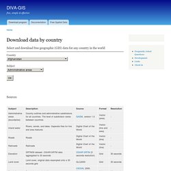
You can use programs such as 7-zip, PKZIP or StuffIt to decompress the files. Vector data are stored as ESRI shapefiles Grid (raster) data are stored as DIVA gridfiles. Free GIS Datasets - Categorised List.
Test Prepare. Strategy. Proposal Support. Public Speaking. Daily News. Tech News. Others.