Seven Volcanoes In Six Different Countries All Start Erupting Within Hours Of Each Other. Seven Volcanoes In Six Different Countries All Start Erupting Within Hours Of Each OtherA new island has appeared in the Pacific. A submarine eruption just off Nishino-Shima Island Japan has erupted for the first time in 40 years. The Japanese Navy noticed the explosions as boiling lava met sea water giving rise to plumes of steam and ash. Almost 7,000 miles away in Mexico, the Colima volcano blew its top after a period of relative calm. A steam and ash cloud rose two miles into the sky and the grumbling of the mountain could be heard in towns a few miles away. In Guatemala the ‘Fire Mountain’ belched out lava and sent up a moderate ash cloud causing an ash fall over nearby towns.
In Vanuatu the Yasur volcano is giving some cause for concern. Over to Italy, Mount Etna is putting on quite a display. The Etna eruption (Nov 17th) In Indonesia a four mile high ash cloud is making life hard for residents. Mount Sinabung ash cloud So, we have eruptions big enough to prompt evacuations. Colima. ALERT! - The whole earth is SHAKING as we speak!! Pulsating Beam Hits the Sun/The Images are being Removed. TSUNAMI EN ANTOFAGASTA!!! Magnitude-8.0 quake strikes northern Chile. IQUIQUE, Chile (AP) — Coastal residents of Chile's far north spent a second sleepless night outside their homes as major aftershocks continued Thursday following a magnitude-8.2 earthquake that damaged several thousand homes and caused six deaths.
No new major damage or casualties were reported, and a heavy police and military presence kept order. Raw: Big Aftershock Hits Chile Photos: Chile earthquake triggers tsunami alerts The infrastructure in the area is nearly entirely intact, but with aftershocks continuing, life has been anything but normal. After a magnitude-7.6 aftershock struck just before midnight Wednesday, Chile's Emergency Office and navy issued a tsunami alert, and for two hours ordered everyone living in low-lying areas along the country's entire 2,500-mile (4,000-kilometer) Pacific coastline to evacuate.
Among those moved inland was President Michelle Bachelet, who was in the city of Arica assessing damage in the north from Tuesday night's powerful quake. Monitoring the world. Global Maps. H.A.A.R.P. Earth_as_seen_in_Wall-e.jpg (JPEG Image, 3508 × 2480 pixels) - Scaled (33%) GOES-R: Benefits of Next-Generation Environmental Monitoring: Print Version. Learning Objectives Upon completion of this module, you should be able to: List several environmental hazards and phenomena where GOES–R satellite observations are expected to benefit users.
Describe some of the key anticipated benefits as they relate to GOES–R monitoring of those same environmental hazards and phenomena. Describe the main GOES–R mission objectives. State the fundamental difference between geostationary and polar–orbiting satellites and briefly describe the advantages of each. Top Introduction The Geostationary Operational Environmental Satellite series (GOES) is essential to continuous observation of Earth's environment and plays a key role for weather monitoring, warning, and forecast operations in the United States and Western Hemisphere. The GOES–R mission is expected to improve the quality and timeliness of information, enhancing public safety, protecting lives, property and the environment, improving economic security, and promoting science education and research.
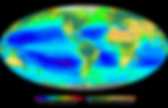
Satellites_earth_browse.jpg (JPEG Image, 560 × 448 pixels) TheWeatherSpace.com. Emergency and Disaster Information Service. Live Earthquakes Map. Earthquake Hazards Program. Gheorghe Marmureanu: “Something is wrong! There are too many strong earthquakes” The Earth is shaking! Scientists find no explanation to the 39 earthquakes that rocked the planet in just two days. “Something is wrong! There are too many strong earthquakes” believes Romania’s top seismologist, Gheorghe Marmureanu, who finds the latest Indonesian quake very unusual.The series of tremors debuted with the two big quakes (8.6 and 8.2 on the Richter scale) that rocked Indonesia these days. Just hours later, three more earthquakes panicked Mexico (7, 6.9 and 6.2 on the Richter scale). “A surprise that cannot be explained by science”According to Marmureanu, there is no relation between the quakes that shook the planet during the last two days, but what happened in Indonesia came as a surprise that cannot be explained by science.
Gheorghe Mărmureanu: «Ceva nu e în regulă! Pământul se zguduie rău! Startul acestui “lanţ” de seisme a fost dat de cele două cutremure de 8,6 şi 8,2 grade pe scara Richter care au zguduit miercuri zona Indoneziei. Is the New Madrid Mega Quake Being Engineered? The Powers-That-Be seem to be making a continuous effort to drive a stake right into America's heart(land). Natural disasters are on the rise, and an increasing amount of evidence is leading to the conclusion that these natural disasters might not be completely natural. Louisiana Sink Hole - Will This Trigger the Big One? As you peruse the points below and the accompanying illustrations, you'll see a very clear, seriously dangerous weak spot. If someone wanted to deal a disastrous blow to this nation, where would you trigger a "natural disaster" if you could?
The recent developments with the growing Louisiana sinkhole caving into a potentially massively explosive gas repository also used for nuclear waste storage is something to keep a close eye on and take very seriously. Will A New Madrid Quake Be Natural, Manipulated, or Both? The Evidence of a Plan Predictive Programming -- This is where the groundwork is laid for directing people toward an imagined future. Disaster Making in the Making. Earth Quakes & Fault Lines.
EarthQuake.
Seismic Monitor. Breathingearth - CO2, birth & death rates by country, simulated real-time. Poodwaddle. Your mind is your weapon. Mapas para Monitoreo / Informacion. Live Ships Map - AIS - Vessel Traffic and Positions. Maps That Explain The World. Top 25 Informative Maps That You'll Never Forget. Population of Southeast Asia Compared to the Rest of the World Maps can be great guides for more than just finding routes for traveling.
They often provide insight on the rest of the world. Taking a look at certain maps can be incredibly informative, especially when comparing the standing of countries in relation to one another. In fact, many passionate cartographers take pride in creating maps that present relevant knowledge through a visual medium. Whether they're on topics concerning population density, educational level, or even a gauge of internet usage across the world, each serves a purpose of sharing data to enlighten minds.
An ever-growing collection of informative maps are available through ChartsBin, Target Map, and the MapPorn subreddit. Top map: reddit Countries That Do Not Officially Use the Metric System Wikimedia Frequency of Lightning Strikes Around the World Citynoise Worldwide Driving Orientation by Country Benjamin D. All That is Interesting reddit Vlad III Tepes Carna Botnet. Six decades of U.S. tornadoes visualized in one stunning map. I think it would be more terrain.
Wind patterns are "disrupted" by mountains, which does not lend itself to the circumstances that lead to a tornado. Or it could also be the way the jet streams "flow" along the mountains, as opposed to into them. Terrain, climate, and a lack of Gulf moisture. You'll notice a similar but far less-defined dead spot along the most rugged of the Appalachians.
The mountains just don't have enough warm moist air to create the conditions necessary for formation of tornadoes. You only get tornadoes forming in the most severe storm cells, where there is an excess of moist warm air forced into an updraft into cooler atmospheric air (causing instability); In the mountains you'll get Orographic thunderstorms caused by cool air that is forced up the mountain side by convection. Tornadoes typically only occur in air mass thunderstorm or frontal thunder storms. [skywarn.org] Ocean_currents_1943.jpg (JPEG Image, 2639 × 1406 pixels) - Scaled (43. Felixpharanddeschenesanthropocenemapping8.jpg (JPEG Image, 620 × 620 pixels) The Internet map. WORLD LIFE EXPECTANCY MAP. World Life Expectancy. Which fossil fuel companies are most responsible for climate change? – interactive | Environment. Turn autoplay off Edition: <span><a href=" Beta About us Today's paper Subscribe This site uses cookies.
Custom Search Which fossil fuel companies are most responsible for climate change? All but seven of the 90 companies found to have caused the climate crisis deal in oil, gas and coal – and half of the estimated emissions were produced just in the past 25 years. Hot topics © 2015 Guardian News and Media Limited or its affiliated companies. Send to a friend Your IP address will be logged Share Short link for this page: Contact us Meet the Environment team Report errors or inaccuracies: userhelp@theguardian.com Letters for publication should be sent to: guardian.letters@theguardian.com Close. Global Carbon Footprint. Air pollution monitoring stations face closure as government looks to cut costs | Environment.
Up to 600 stations for monitoring air pollution across England could be shut down under new government plans to save money by cutting regulations. Ministers want to remove obligations on local authorities to assess air quality in their areas, resulting in less monitoring. But environmental campaigners are accusing them of trying to hide one of the country's biggest public health problems. Government advisers have estimated that one type of pollutant – miniscule particles from diesel engines, fossil fuel power stations and other sources – is killing 29,000 people a year in the UK, and costing health services about £16bn. But European air pollution limits meant to protect health are being breached in urban areas across the country, with the highest levels in London. But now Defra has launched a six-week consultation, due to close on 30 August, proposing a radical overhaul of the local air quality management regime that has been in place since 1997.
Chemical Weapons Stockpile and Destruction Sites Map and Photos. The following map and photos depict the locations of what remains of the U.S. chemical weapons stockpile and the facilities being constructed to complete the destruction of remaining chemical agents. According to a press release from the Department of Defense’s Assembled Chemical Weapons Alternatives program office, the U.S. had destroyed “nearly 90 percent of the chemical weapons stockpile” in advance of the extended Chemical Weapons Convention deadline of April 29, 2012. Though chemical weapons were originally stored at eight continental U.S. Army military installations, only two facilities remain active. One site is located at the Blue Grass Army Depot in Richmond, Kentucky and the other is at the Pueblo Chemical Depot just north of Avondale, Colorado.
The current stockpile includes projectiles, cartridges, and rockets. Original Locations and Compositions of Continental U.S. Pueblo Chemical Agent-Destruction Pilot Plant (PCAPP) Emissions | Global Carbon Atlas. USA Life Expectancy. Wind Map. An invisible, ancient source of energy surrounds us—energy that powered the first explorations of the world, and that may be a key to the future. This map shows you the delicate tracery of wind flowing over the US. The wind map is a personal art project, not associated with any company. We've done our best to make this as accurate as possible, but can't make any guarantees about the correctness of the data or our software. Please do not use the map or its data to fly a plane, sail a boat, or fight wildfires :-) If the map is missing or seems slow, we recommend the latest Chrome browser. Surface wind data comes from the National Digital Forecast Database. These are near-term forecasts, revised once per hour.
If you're looking for a weather map, or just want more detail on the weather today, see these more traditional maps of temperature and wind. Live flight tracker! In order to save data consumption Flightradar24 web page times out after 30 minutes. Please reload the web page to get another 30 minutes. or get a Flightradar24 Premium subscription and Flightradar24.com will not time-out again!
International Ground to Air Signal Codes. International Ground-to-Air Signal Codes You can lay out these symbols using strips of fabric, pieces of wood, stone, or any other available material. Try to make as big a color contrast as possible between your symbol(s) and the surrounding terrain. Symbols should be at least 8 feet in height or longer. Take care when constructing these symbols so that they can't be confused.
In addition, you should use any means possible to try and attract an aircraft's attention: radio, flames, smoke, flares etc. Aircraft Acknowledgements Message Understood: An aircraft will indicate that ground signals have been understood by rocking from side to side or by making green flashes with a signal lamp. Message Not Understood: An aircraft will indicate that ground signals are not understood by making a complete right-hand circuit or by making red flashes with a signal lamp. Return to Camping Corner Becky's Guiding Resource Centre Main Menu. Blast it or paint it: Asteroid to threaten Earth in 2013. Meteorite hits Russian Urals: Fireball explosion wreaks havoc, over 900 injured (PHOTOS, VIDEO)
Russian meteor blast injures at least 1,000 people, authorities say. Described as once-in-100-years event, the meteor released a 300-kiloton blastlt had been moving faster than normal because of its close proximity to the EarthDeep Space Industries said countries should be proactive in establishing "a sentry line"A bright white flash appeared in the sky for a few seconds, followed by a heavy bang Did you see the meteor? Share your images with CNN iReport. Moscow (CNN) -- A meteor streaked through the skies above Russia's Urals region Friday morning before exploding with a flash and boom that shattered glass in buildings and left about 1,000 people hurt, authorities said. Described by NASA as a "tiny asteroid," the meteor's explosion created a blast in central Russia equivalent to 300,000 tons of TNT, the space agency's officials said Friday, adding that the incident was a once-in-100-years event.
The injured included more than 200 children. A large chunk of a meteor that exploded over Russia is found in a lake on Friday, February 15. __i18n_ovi.service.map.
News24.it. Residenti di una località' nella regione centrale di Cuba hanno dichiarato aver visto un oggetto che cadeva dal cielo e che è esploso con un grande fragore, che ha fatto tremare le case del posto: lo si apprende da testimonianze raccolte dalla televisione locale. Vota: Votata: 46volte, Media voti: 4.17 Per le strade di Santa Isabel de Las Lajas (Cuba) Www.pccwglobal.com/images/stories/brochures/PCCW_Global_Infrastructure_Map.pdf.