
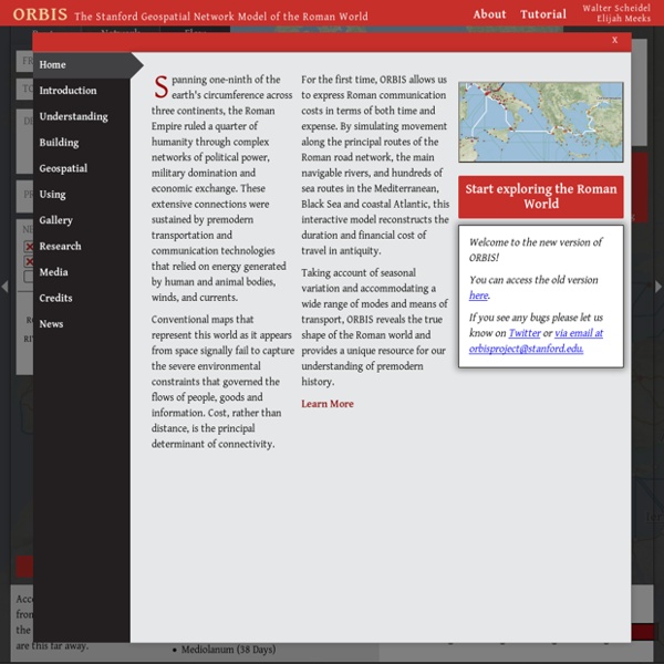
Play Caesar: Travel Ancient Rome with Stanford's Interactive Map Scholars of ancient history and IT experts at Stanford University have collaborated to create a novel way to study Ancient Rome. ORBIS, a geospatial network model, allows visitors to experience the strategy behind travel in antiquity. (Find a handy tutorial for using the system on the Web and YouTube). The ORBIS map includes about 750 mostly urban settlements of the Roman period. What Historians Want from GIS By J. B. "Jack" Owens Watch the Destruction of Pompeii by Mount Vesuvius, Re-Created with Computer Animation (79 AD) A good disaster story never fails to fascinate — and, given that it actually happened, the story of Pompeii especially so. Buried and thus frozen in time by the eruption of Mount Vesuvius in 79 AD, the ancient Roman town of 11,000 has provided an object of great historical interest ever since its rediscovery in 1599. Baths, houses, tools and other possessions (including plenty of wine bottles), frescoes, graffiti, an ampitheater, an aqueduct, the “Villa of the Mysteries“: Pompeii has it all, as far as the stuff of first-century Roman life goes.
Retrotechtacular: Examining Music in 1950’s Russia If you had told 12-year-old me that one day I would be able to listen to pretty much any song I wanted to on demand and also pull up the lyrics as fast as I could type the artist’s name and part of the title into a text box, I would have a) really hoped you weren’t kidding and b) would have wanted to grow up even faster than I already did. The availability of music today, especially in any place with first world Internet access is really kind of astounding. While the technology to make this possible has come about only recently, the freedom of music listening has been fairly wide open in the US. The closest we’ve come to governmental censorship is the parental advisory sticker, and those are just warnings. The only thing that really stands between kids’ ears and the music they want to listen to is parental awareness and/or consent.
Microwave Kiln Review — HackSpace magazine There’s a small central section where you can put the glass you want to heat, then the lid goes on, and the whole lot goes in the microwave. We bought a 12 cm kiln from July Tool’s Store on AliExpress for £15.92, including shipping to the UK. We also got 50 sheets of kiln paper (£5.10), which is needed to stop the glass from sticking to the bottom of the kiln when it’s melted. 12cm is the outer diameter; there’s actually only 7.5 cm of space to work with, and as you don’t want your object too close to the edge, there’s about a 6 cm diameter of workable space, but as the heat isn’t evenly distributed, you’ll get better results if you stick to 3–4 cm diameter objects. Our biggest concern was whether the kiln would get up to temperature for melting glass, and it managed this in our 900 W microwave.
An Interactive Map of Odysseus' 10-Year Journey in Homer's Odyssey The Odyssey, one of Homer’s two great epics, narrates Odysseus’ long, strange trip home after the Trojan war. During their ten-year journey, Odysseus and his men had to overcome divine and natural forces, from battering storms and winds to difficult encounters with the Cyclops Polyphemus, the cannibalistic Laestrygones, the witch-goddess Circe and the rest. And they took a most circuitous route, bouncing all over the Mediterranean, moving first down to Crete and Tunisia. Next over to Sicily, then off toward Spain, and back to Greece again. If you’re looking for an easy way to visualize all of the twists and turns in The Odyssey, then we’d recommend spending some time with the interactive map created by Gisèle Mounzer. “Odysseus’ Journey” breaks down Odysseus’ voyage into 14 key scenes and locates them on a modern map designed by Esri, a company that creates GIS mapping software.
Great Britain Historical Geographical Information System (GBHGIS) The Great Britain Historical Geographical Information System is a unique digital collection of information about Britain's localities as they have changed over time. Information comes from census reports, historical gazetteers, travellers' tales and historic maps assembled into a whole that is much more than the sum of its parts. This site tells you more about the project itself and about historical GIS. The Invention of Murder: How the Ancient Romans Codified Their Bizarre Views on Murder ‹ CrimeReads Way back in the semi-mythical mists of Roman time, for the first three hundred years of Rome’s existence, there was no written law. What was and wasn’t legal was up to the king, and then, when kings were booted to the kerb, to the priests. In 451 BCE, however, it was decided, for whatever reason, that this situation was not a sustainable or useful way forward for Rome. Romans being Romans, a fundamentally pragmatic people, they decided to set up a committee to deal with the situation. This committee, of ten men with consular imperium, put together ten tablets of laws and then bolted on another two tablets the following year.
Architectures As mentioned a while back, I’ve been trying to find a way to classify the numerous ‘Design with Intent’ and architectures of control examples that have been examined on this site, and suggested by readers. Since that post, my approach has shifted slightly to look at what the intent is behind each example, and hence develop a kind of ‘method’ for suggesting ‘solutions’ to ‘problems’, based on analysing hundreds of examples. I’d hesitate to call it a suggestion algorithm quite yet, but it does, in a very very rudimentary way, borrow certain ideas from TRIZ*. Below is a tentative, v.0.1 example of the kind of thought process that a ‘designer’ might be led through by using the DwI Method. I’ve deliberately chosen an common example where the usual architectures of control-type ‘solutions’ are pretty objectionable.
100 STEAM Projects for Teachers AdWords We use AdWords to deploy digital advertising on sites supported by AdWords. Ads are based on both AdWords data and behavioral data that we collect while you’re on our sites. "Rome in 3D" reboot - detailed reconstruction of the City center - History in 3D After a relatively long pause, we’re returning to the “Rome in 3D” project. During the last months, as we all know, not everything went as we initially planned. But we did not abandon the project despite the difficulties. Today, I want to share a first intro to the Rome project in a new form. To a certain degree, it is the reboot of the project, since many objects were replaced and remodelled completely, and the whole project has been moved to the new game engine.
Historical GIS The AAG Historical GIS Forum provides a digital exchange center for historians, geographers, and other humanities scholars to network with each other and discuss pressing research needs and topics, such as: Challenges facing historical GIS work Best practices in GIS-based historical research Key technical issues and how to resolve them Data consistency and comparability issues Theoretical and conceptual issues in approaches to incorporating geographical data into historical research projects AAG members and non-members alike are encouraged to participate in the Forum.
Hear an Ancient Chinese Historian Describe The Roman Empire (and Other Voices of the Past) Those who see the world from only one narrow point of view get called a number of things–parochial, provincial, and worse–and are encouraged to seek out other perspectives and broaden their view. Not everyone can travel the world, but the world comes to us through immigration and the internet, restaurants and recipes. Most of us, if we are inclined, can learn about and appreciate the cultures, cuisines, and histories of others.