
Flash Earth - Zoom into satellite and aerial imagery of the Earth in Flash. Your Sky. By John Walker Welcome to Your Sky, the interactive planetarium of the Web.

You can produce maps in the forms described below for any time and date, viewpoint, and observing location. If you enter the orbital elements of an asteroid or comet, Your Sky will compute its current position and plot it on the map. Each map is accompanied by an ephemeris for the Sun, Moon, planets, and any tracked asteroid or comet. A control panel permits customisation of which objects are plotted, limiting magnitudes, colour scheme, image size, and other parameters; each control is linked to its description in the help file. Your Sky provides three ways to view the sky with links, where appropriate, among the various presentations.
Sky Map The sky map shows the entire sky as viewed from a given location at a specified time and date. Horizon Views Horizon Views, showing the stars above the horizon as seen from a specified observing site at a given date and time. The Virtual Telescope Your Sky help Related Software. View from Satellite. UK Active Map of Universities and HE Institutions. Uk aerial photography: aerial maps, digital aerial photos, aerial photo prints. Portable GPS car navigation systems. The Simpsons: Interactive Map of Springfield. Discover Springfield, where live the Simpsons family; Homer, Bart, Marge, Lisa and Maggie.

Roll over the places to discover a picture of it. The map of Springfield is based on the Guide to Springfield USA . I made this interactive, the job is not finished, there are allways framegrabs to add and add some functions to the map. If you want to know more about the show or Springfield in particular, check out these links: » Zoom-out opening sequence (animated gif) (in GABF05 & FABF08) » Where is The Simpsons' Springfield? » Official site of "The Simpsons" animated series on FOX » All Intros (Runs To Couch) of the 16th/17th Season (including zoom-out couch to space) » All the Simpsons on DVD via Amazon.com » The screencaps » Everything about The Simpsons Movie Source: Wikipedia Like The Map of Springfield?
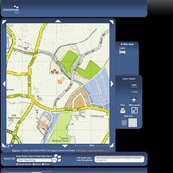
How building materials have changed. LGBCE - Home. The Leader In Online Imagery - Aerial Photos & Satellite Images. Streetmap.co.uk- search results for 618250,216750. Skip to navigation Map key | Location is at 618020,216678 | Click here to convert coordinates. | Click here to toggle map adverts Search Tips © All Technology Copyright Streetmap EU Ltd 2012 | This data may not be reproduced in any form without permission.This site includes mapping data licenced from Open Street Map, Ordnance Survey & Collins Bartholomew.
Cartes ViaMichelin : Plans de ville, Cartes France et Cartes d'Europe, Cartes routières et Atlas routier. ViaMichelin Cartes et Itinéraires.

Online vector map creation. OS_Explore_main.JPG. OpenStreetMap. OOo.HG pour OpenOffice 3 avec Cart'OOo, Atlas'OOo,Chron'OOo, Diap'OOo. Libre et gratuit. Old-Maps - the online repository of historic maps - home page. Ogle Earth Headlines. MAPCO : Map And Plan Collection Online.
Mappy - plans, itinéraires, guide d'adresses en Europe. NAVTEQ Map24 – Route planner and maps for UK, Europe and USA. MAGIC. Maps. IGN.FR - Portail. Home. Great Britain Map. Google Maps. Google Image Result for. Fun stuff for Google Earth. Google Earth Community - Forums powered by UBB.threads™ Get-a-map from Ordnance Survey, Britain's national mapping agency. Site du GEIPAN - Groupe d'Information et d'Etudes sur les Phénomènes Aérospatiaux Non Identifiés.
Election Maps. An Imagery and Information Company. Did British Intelligence Orchestrate Princess Diana's Death? Dark Government conspiracies,ufo technology, discussion. Country and Regional Map Sites. Skip to Content Libraries Home | Mobile | My Account | Renew Items | Sitemap | Help | University of Texas Libraries Home > Finding Information > PCL Map Collection > Country and Regional Map Sites Maps Maps FAQ Map Room Guide World Africa Americas Asia Australia/Pacific Europe Middle East Polar/Oceans Russia/Republics Texas Historical Thematic.
La France, Carte, Plan et Photo Satellite. Animated Manhattan. Amazon Mechanical Turk - All HITs.