

AlasCT - Atlas Cartographic Technologies. Политерм: Геоинформационная система Zulu. Python for ArcGIS. Lepton Software Export & Research Pvt. Ltd. Базовая геоинформационная платформа ОАО «НПК «РЕКОД» О компании. С 1990 года ИВЦ «Поток» работает на рынке специализированного программного обеспечения для инженерных коммуникаций, разрабатывая и внедряя в производство комплексные компьютерные информационные системы предприятий, эксплуатирующих трубопроводные и кабельные сети.
Более 10 лет понадобилось отечественным энергетике и коммунальному хозяйству, чтобы шаг за шагом понять и оценить место информатизации, как одного из наиболее эффективных стратегических направлений инвестирования. Это неудивительно: трудно понять, сколько сэкономлено средств и ресурсов, если НЕ произошли возможные аварии, если НЕ разрушались при раскопках смежные коммуникации, если НЕ применялись неээфективные режимные мероприятия, НЕ имели место ошибочные действия диспетчеров. Чтобы понять и оценить все эти "НЕ", и потребовалось время, много времени. Секрет первый: Если Вы думаете, что все, что мы разработали и внедрили, мы же сами и придумали – Вы ошибаетесь.
Секрет второй: Мы – профессионалы. Создание геоинформационных систем (ГИС) различного назначения. Разработана ГИС - географическая часть Единой Информационно-Аналитической Системы Фонда РЖС В настоящее время ФГУП «ГОСГИСЦЕНТР» выполнил работы по заказу Федерального фонда содействия развитию жилищного строительства по разработке, внедрению и наполнению первой промышленной версии географической информационной системы в составе единой информационно-аналитической системы Федерального фонда содействия развитию жилищного строительства для нужд Федерального фонда содействия развитию жилищного строительства.
Разработанная ГИС является частью Единой Информационно-Аналитической Системы Фонда РЖС , она предназначена для: обеспечения геоинформационной поддержки принятия управленческих решений руководством Фонда РЖС ; NextGIS: NextGIS. Understanding GIS: An ArcGIS Project Workbook. Building Models for GIS Analysis Using ArcGIS 10. Introduction to models and ModelBuilder What is a model?
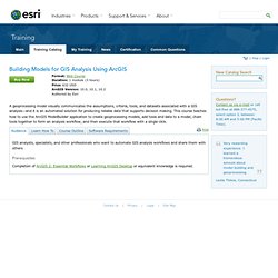
What is ModelBuilder and why use it? Model elements Model states Model environment settings Explore an existing model. GDAL: GDAL - Geospatial Data Abstraction Library. Wxgis - wxGIS is GIS developed using wxWidgets on top of GDAL. The project move to github ( wxGIS is following ArcGIS ideology in developing GIS.
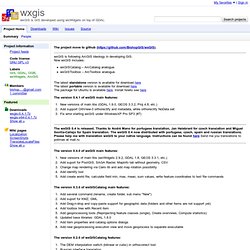
Now wxGIS includes: wxGISCatalog – ArcCatalog analogue. wxGISToolbox – ArcToolbox analogue. The latest standalone version is available for download here The latest portable version is available for download here The package for Ubuntu is available here. Install howto see here. Smart Grids Projects in Europe - Interactive Map. IBM Maximo Spatial Asset Management. For Local Government. ОАО "Сибгеоинформ" - Новости. Сообщение о проведении внеочередного собрания акционеров.
GeoIQ. Гео информационные системы для энергосбережения. В наиболее общем смысле, геоинформационные системы это инструменты для обработки пространственной информации, обычно явно привязанной к некоторой части земной поверхности и используемые для управления ею.
Это рабочее определение не является ни полным, ни точным. Как и в случае с географией, термин трудноопределим и представляет собой объединение многих предметных областей. В результате, нет общепринятого определения ГИС. Inform ++ Community > Community Investment Index. Print The Community Investment Index (CI2) maps the concentrations of recent place-based investments and on-the-ground features that contribute to sustainable communities across southeastern Pennsylvania.
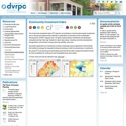
DVRPC mapped nearly 100 types of place-based investments and developed composite scoring "heat map" datasets for seven topic areas, including economic development, transportation, environment, housing, planning activities, and more. Smiswww.iki.rssi.ru/default.aspx?page=316. Технология GEOSMIS Технология GEOSMIS - универсальная технология построения интерфейсов работы c пространственной информацией в системах дистанционного мониторинга.
Данная технология рассчитана на создание интерфейсов работы с большими распределенными многомерными архивами спутниковых данных и результатов их обработки. НИЦ Планета. Untitled. РЕЗИДЕНТ - геоинформационные системы, векторизаторы, цифровые векторные карты. Autodesk MapGuide R6. 3D Moscow Model Map - карта Модель Москвы - mom.exe. ГИС - портал. Онлайн ГИС сервисы. ИНЖЕНЕРНЫЕ ИЗЫСКАНИЯ ДЛЯ СТРОИТЕЛЬСТВА. Геодезия, геология. GRASS GIS - The World Leading Free Software GIS. ФГУП ГОСГИСЦЕНТР. Land Surveying Software and Surveying Data Collection Software. Inform ++: Виртуальная планета учится петь. Впечатлился видео.
Делюсь мыслями. 1. Первые геосистемы учились понимать плоскую географическую привязку. Много приколов возникало в связи с тем что Земля круглая а "бумага" плоская. 2. В базовом KML отсутствуют пока теги, отвечающие за прямую работу с пространственно таргетированным ближайшим звуком. TechNavio - Market Intelligence Reports for your Industry. Компания «Совзонд» - ведущий российский интегратор в области технологий космического дистанционного зондирования Земли (ДЗЗ). Поставка и обработк данных ДЗЗ. Создание ГИС и геопорталов.
Map Software Products. Maptitude Geographic Information System (GIS) and mapping software. Mapping made easy Answer a few simple questions and Create-a-Map Wizard™ makes a map at any scale, from all of the countries of the world, to streets around an address, landmark, or intersection.
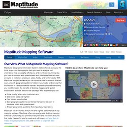
With a few clicks of the mouse, MapWizard® automatic mapping technology helps you create color and pattern maps, dot-density maps, scaled-symbol maps, and maps with integrated pie or bar charts. You can customize the colors, styles, and labels in your map. Once you understand the patterns hidden in the numbers, share your maps to tell your stories. Manifold® System - GIS and Mapping. Geospatial Product Details: GeoMedia. Spatial Reference. GeoTools The Open Source Java GIS Toolkit — GeoTools.
Your Open Source Compass. OnEarth, JPL WMS Server. Welcome. This free "self-service" testing facility can be used by any developer as often as they like to test their implementations of OGC standards. You don't need to be an OGC member, and you will always have unlimited access to this testing facility. There are more than 40 adopted OGC standards, but we currently can only certify implementations for the tests listed bellow.
New tests currently under development can be seen and tried out at our beta testing facility. We encourage you to try them out and provide feedback, so that we may finalize them and make them oficial. GeoWebCache. About Mapnik · mapnik/mapnik Wiki. Mapnik is a Free Toolkit for developing mapping applications. It is written in modern C++ and has Python bindings that support fast-paced agile development. It can comfortably be used for both desktop map design and web development. Mapnik is about making beautiful maps.
INSPIRE > WELCOME TO INSPIRE. Welcome - GeoServer. Service Providers - Search. OSGeo Foundation OSGeo Community Language User login Home Service Providers - Search. Open Source GIS: GRASS Book downloads. Дистанционное зондирование Земли (ДЗЗ), космические снимки и спутниковый мониторинг, карты. MapsWithMe - детальные оффлайн карты мира для iPhone, iPad, iPod, Android и Amazon Kindle Fire. USA Topo Maps. List of OSM based Services. Available languages — Alphabetically sorted complete list of projects using especially data from OpenStreetMap. For any page using just the OSM Map see OSM Internet Links. For smaller user favourites lists see: The term free materials is what you would colloquially refer to as "open".
A project which makes its building blocks - be that software, algorithms, works of art - available to a degree that allows everyone to duplicate it should be labelled "yes", and a project where relevant bits - data processing scripts, rendering stylesheets, or CSS files - are hidden in a black box should be labelled "no". See also Free and Open License. General Art. Карта работы уборочной техники - Официальный портал Екатеринбурга. Общественный транспорт онлайн. Город Астрахань. ОАО "АстраханьПассажирТранс" About us. The management team. Geofabrik Tools. CGIAR-CSI. OSM Buildings - A leightweight JavaScript library for visualizing 3D OSM building data on interactive maps. OSRM Website. MapQuest Maps - Driving Directions - Map. RU:Заглавная страница. OpenMapSurfer. Bing Maps.
Bing Maps. Сделаем Вместе! Карта координации уборок. Blog — All the maps that are fit to blog. Nottingham Sprint, Wednesday 18th Sept September 11th, 2013 by Tim Schaub · 5 Comments. OpenLayers: Home. 1.11 now official part of the standard software portfolio in the City of Munich! GvSIG 1.11 now official part of the standard software portfolio in the City of Munich! Your Open Source Compass. OpenLayers: Home. Let's describe the whole world! Google Maps API: теперь за деньги. 27 октября 2011 в 14:36 Приветствую. Сегодня изменились условия использования Google Maps API.
В случае, если нагрузка, приходящая с сайта в API составляет больше 25000 хитов в день (для использующих стилизированные карты — 2500 хитов) — каждая следующая тысяча хитов отныне будет стоить 4$. В Google Geo Developers Blog сказано, что для очень популярных сайтов вероятно, будет выгодней использование лицензии Premier. Google также говорит, что некоммерческие приложения и приложения, которые считаются полезными для общества (по мнению Google), не подпадают под эти ограничения использования.
API for Silverlight - ArcGIS API for Silverlight overview. GeoSciML. GeoSciML or Geoscience Markup Language is a GML Application Schema that can be used to transfer information about geology, with an emphasis on the "interpreted geology" that is conventionally portrayed on geologic maps. Its feature-type catalogue includes Geologic Unit, Mapped Feature, Earth Material, Geologic Structure, and specializations of these, as well as Borehole and other observational artefacts.
It was created by, and is governed by, the Commission for the Management and Application of Geoscience Information (CGI) to support interoperability of information served from Geologic Surveys and other data custodians. It will be used in the OneGeology project, an effort to create a geological map of the entire Earth, served live by merging data from many national geological surveys. The GeoSciML project was initiated in 2003, under the auspices of the Commission for Geoscience Information (CGI) working group on Data Model Collaboration.
Version 3.1 was released in December, 2012. Technical Collaboration. What is GeoSciML GeoSciML is an XML–based data transfer standard for the exchange of digital geoscientific information. It accommodates the representation and description of features typically found on geological maps, as well as being extensible to other geoscience data such as drilling, sampling, and analytical data. GeoSciML provides a standard data structure for a suite of common geologic features (eg, geologic units, structures, earth materials) and artefacts of geological investigations (eg, boreholes, specimens, measurements).
WV IJDC GIS Data Portal. The electronic Geophysical Year. RouteSmart Technologies — Route Optimization Software & Routing Management Solutions. Spatial and Graph - Spatial Features. The industry’s most advanced database for scalable, performant spatial applications and massively scalable, secure graph applications. uDig : Home. Refractions Research : Home. PostGIS : Home. Welcome.
Немного OSM и OpenLayers для корпоративных систем. Привет Хабр, сегодня я расскажу немного про использование osm для предприятий и b2b. А именно, как и зачем перейти от google maps api к osm, openlayers и счастью. Первый вопрос, который непременно возникнет: зачем? Начнем с того, что использование google maps api для непубличных сервисов ограничено условиями предоставления сервиса.
Второе: апи карт гугл — это именно апи карт гугл, а не апи для отображения всего, что напоминает карту. Т.е. если вам захотелось отображать другую подложку или добавить растровый слой, отрисовываемый сервером в локальной сети предприятия, готовтесь лепить костыли. Предположим, я вас убедил. Maps API licensing - Google Maps API. TopoGrafix - GPS Software, Waypoints, and Maps for your Garmin, Magellan, or Lowrance GPS. GPX: the GPS Exchange Format. Untitled. Серийное изготовление геопространственной продукции. (Руководитель направления - Гомозов Олег Анатольевич (телефон: +7 (495) 231-38-25)) Производство геопространственной информации: электронных топографических и тематических карт, высокоточных ортопланов, цифровых моделей рельефа, трехмерных моделей местности и других данных. Untitled. Sxf. ГИС Карта 2011. Иннотер - геоинновационное агентство.