Table-top Models. ...to simulate what the Kepler Mission does.

The Kepler Mission Education team has produced table top models demonstrating the principle of how Kepler will find extrasolar planets by the transit method. Components include: Orrery† (model planet system), Light (model star), Light sensor†† (model Kepler photometer), Computer interface (model Deep Space Network), and Computer graphic software (model Kepler Science Office) † The 1st orrery we created was one made of LEGO parts, described on this page.
Later, an orrery was created for one of the investigations in the middle school Planetary Science course from the Full Option Science System (FOSS). Planet Orrery with Lego. Lego Orrery Earth-Moon-Sun (Planétaire) LEGO Planet Orrery. Lego Orrery. Eppur si muove! Un modello del Sistema Solare con Scratch. Classe: dalla quinta primaria alla seconda della secondaria di primo grado, ma proponibile anche in altre classi modificando obiettivi e approfondimentiObiettivi: come si può realizzare un modello di un fenomeno?

Se si utilizza un particolare strumento di modellazione ci saranno limitazioni al modello? Bisognerà sacrificare qualcosa? Fare ipotesi e avere intuizioni. Questo progetto si propone di aiutare i ragazzi a rispondere a queste domande e a trovare connessioni tra le materie e riuscire a tradurre in istruzioni le forze in gioco dei fenomeni.Materie: scienze, tecnologia, matematica, storia, lettere,… Descrizione Una simulazione con alcuni limiti dovuti allo strumento e alle dimensioni del fenomeno da analizzare. Inizio presentando il titolo “Eppur si muove!” Dopo il titolo apro Scratch per far intuire le forze in gioco nel moto dei pianeti, semplifico in base alla classe e, in ogni caso, anche perchè il moto circolare è abbastanza complesso di suo.
La Luna? Et voilà! Il sistema solare - Lezione in JClic.
La nascita del sistema solare. Terra 1di3. Terra 2di3. Terra 3di3. Home. Viaggio virtuale nel sistema solare. Astronomy Picture of the Day. NASA - galleria di immagini. Your Weight on Other Worlds.
Ever wonder what you might weigh on Mars or The Moon?
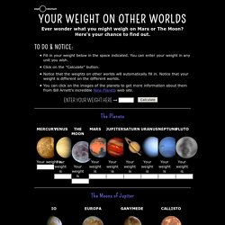
Here's your chance to find out. <div class="js-required"><hr> This Page requires a Javascript capable browser <hr></div> Fill in your weight below in the space indicated. You can enter your weight in any unit you wish. Click on the "Calculate" button. Mass and Weight Before we get into the subject of gravity and how it acts, it's important to understand the difference between weight and mass. We often use the terms "mass" and "weight" interchangeably in our daily speech, but to an astronomer or a physicist they are completely different things. Weight is an entirely different thing. If you are in a spaceship far between the stars and you put a scale underneath you, the scale would read zero. The Relationship Between Gravity and Mass and Distance As stated above, your weight is a measure of the pull of gravity between you and the body you are standing on. The two "M's" on top are your mass and the planet's mass.
Isaac Newton. Trading Card Top of Game - in inglese. Attività didattiche di esplorazione e gioco. Ufotto Leprotto - Alla scoperta dell'universo. Your Sky. By John Walker Welcome to Your Sky, the interactive planetarium of the Web.
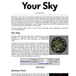
You can produce maps in the forms described below for any time and date, viewpoint, and observing location. If you enter the orbital elements of an asteroid or comet, Your Sky will compute its current position and plot it on the map. Each map is accompanied by an ephemeris for the Sun, Moon, planets, and any tracked asteroid or comet. A control panel permits customisation of which objects are plotted, limiting magnitudes, colour scheme, image size, and other parameters; each control is linked to its description in the help file. Your Sky provides three ways to view the sky with links, where appropriate, among the various presentations.
Sky Map The sky map shows the entire sky as viewed from a given location at a specified time and date. Horizon Views Horizon Views, showing the stars above the horizon as seen from a specified observing site at a given date and time. Solar System Scope.